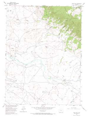
Eagle Hill Topo Map Colorado
To zoom in, hover over the map of Eagle Hill
USGS Topo Quad 40106g2 - 1:24,000 scale
| Topo Map Name: | Eagle Hill |
| USGS Topo Quad ID: | 40106g2 |
| Print Size: | ca. 21 1/4" wide x 27" high |
| Southeast Coordinates: | 40.75° N latitude / 106.125° W longitude |
| Map Center Coordinates: | 40.8125° N latitude / 106.1875° W longitude |
| U.S. State: | CO |
| Filename: | o40106g2.jpg |
| Download Map JPG Image: | Eagle Hill topo map 1:24,000 scale |
| Map Type: | Topographic |
| Topo Series: | 7.5´ |
| Map Scale: | 1:24,000 |
| Source of Map Images: | United States Geological Survey (USGS) |
| Alternate Map Versions: |
Eagle Hill CO 1955, updated 1957 Download PDF Buy paper map Eagle Hill CO 1955, updated 1957 Download PDF Buy paper map Eagle Hill CO 1955, updated 1967 Download PDF Buy paper map Eagle Hill CO 1955, updated 1967 Download PDF Buy paper map Eagle Hill CO 2000, updated 2004 Download PDF Buy paper map Eagle Hill CO 2011 Download PDF Buy paper map Eagle Hill CO 2013 Download PDF Buy paper map Eagle Hill CO 2016 Download PDF Buy paper map |
| FStopo: | US Forest Service topo Eagle Hill is available: Download FStopo PDF Download FStopo TIF |
1:24,000 Topo Quads surrounding Eagle Hill
> Back to 40106e1 at 1:100,000 scale
> Back to 40106a1 at 1:250,000 scale
> Back to U.S. Topo Maps home
Eagle Hill topo map: Gazetteer
Eagle Hill: Canals
Coon Creek Ditch elevation 2450m 8038′Dwinell Ditch elevation 2436m 7992′
Government Creek Supply Ditch elevation 2665m 8743′
North Park Ditch Number 2 elevation 2501m 8205′
North Park Ditch Number 3 elevation 2513m 8244′
Sanborn Ditch elevation 2421m 7942′
Sand Creek Ditch elevation 2444m 8018′
Stillwater Ditch elevation 2429m 7969′
Eagle Hill: Mines
Ballinger Prospect elevation 2447m 8028′Bourg Strip Mine elevation 2453m 8047′
Case Mine elevation 2491m 8172′
Manning Prospect elevation 2477m 8126′
McCallum Mine elevation 2477m 8126′
Eagle Hill: Oilfields
Battleship Oil Field elevation 2442m 8011′North Mc Callum Oil Field elevation 2493m 8179′
Eagle Hill: Ranges
North Sand Hills elevation 2620m 8595′Eagle Hill: Springs
Crystal Spring elevation 2458m 8064′Eagle Hill: Streams
Coon Creek elevation 2423m 7949′Mendenhall Creek elevation 2493m 8179′
Saint Francis Creek elevation 2441m 8008′
Sherman Creek elevation 2434m 7985′
Spring Creek elevation 2477m 8126′
Stony Creek elevation 2461m 8074′
Yockum Creek elevation 2440m 8005′
Eagle Hill: Summits
Eagle Hill elevation 2544m 8346′Eagle Hill: Trails
Mendenhall Trail elevation 2877m 9438′Eagle Hill: Valleys
Mann Draw elevation 2444m 8018′Sudduth Draw elevation 2451m 8041′
Eagle Hill digital topo map on disk
Buy this Eagle Hill topo map showing relief, roads, GPS coordinates and other geographical features, as a high-resolution digital map file on DVD:


