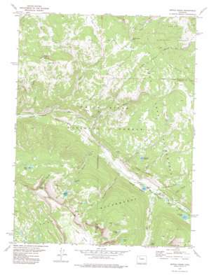
Ripple Creek Topo Map Colorado
To zoom in, hover over the map of Ripple Creek
USGS Topo Quad 40107a3 - 1:24,000 scale
| Topo Map Name: | Ripple Creek |
| USGS Topo Quad ID: | 40107a3 |
| Print Size: | ca. 21 1/4" wide x 27" high |
| Southeast Coordinates: | 40° N latitude / 107.25° W longitude |
| Map Center Coordinates: | 40.0625° N latitude / 107.3125° W longitude |
| U.S. State: | CO |
| Filename: | o40107a3.jpg |
| Download Map JPG Image: | Ripple Creek topo map 1:24,000 scale |
| Map Type: | Topographic |
| Topo Series: | 7.5´ |
| Map Scale: | 1:24,000 |
| Source of Map Images: | United States Geological Survey (USGS) |
| Alternate Map Versions: |
Ripple Creek CO 1977, updated 1978 Download PDF Buy paper map Ripple Creek CO 2011 Download PDF Buy paper map Ripple Creek CO 2013 Download PDF Buy paper map Ripple Creek CO 2016 Download PDF Buy paper map |
| FStopo: | US Forest Service topo Ripple Creek is available: Download FStopo PDF Download FStopo TIF |
1:24,000 Topo Quads surrounding Ripple Creek
> Back to 40107a1 at 1:100,000 scale
> Back to 40106a1 at 1:250,000 scale
> Back to U.S. Topo Maps home
Ripple Creek topo map: Gazetteer
Ripple Creek: Cliffs
Sable Point elevation 3438m 11279′Ripple Creek: Dams
Lake of the Woods Dam elevation 2890m 9481′Ripple Creek: Falls
Bessies Falls elevation 2829m 9281′Ripple Creek: Flats
Lily Pond Park elevation 3109m 10200′Picket Pin Park elevation 3155m 10351′
Ripple Creek: Gaps
Ripple Creek Pass elevation 3157m 10357′Ripple Creek: Lakes
Boulder Lake elevation 2982m 9783′Doris Lake elevation 3055m 10022′
Lake of the Woods elevation 2748m 9015′
Lily Pond elevation 3104m 10183′
Mirror Lake elevation 3053m 10016′
Paradise Lake elevation 3067m 10062′
Rainbow Lake elevation 2634m 8641′
Sable Lake elevation 3014m 9888′
Shamrock Lake elevation 2994m 9822′
Ripple Creek: Parks
Snell Park elevation 3103m 10180′Ripple Creek: Reservoirs
Anderson Reservoir elevation 2853m 9360′Lake of the Woods elevation 2747m 9012′
Lake of the Woods elevation 2890m 9481′
Ripple Creek: Streams
Bear Creek elevation 2597m 8520′Big Fish Creek elevation 2646m 8681′
Deadhorse Creek elevation 2439m 8001′
Hauskins Creek elevation 2643m 8671′
Lynx Creek elevation 2683m 8802′
Mirror Creek elevation 2557m 8389′
Paradise Creek elevation 2596m 8517′
Picket Pin Creek elevation 2622m 8602′
Ripple Creek elevation 2506m 8221′
Snell Creek elevation 2475m 8120′
Ripple Creek: Summits
Himes Peak elevation 3388m 11115′Snell Mountain elevation 3197m 10488′
Ripple Creek digital topo map on disk
Buy this Ripple Creek topo map showing relief, roads, GPS coordinates and other geographical features, as a high-resolution digital map file on DVD:


