Hooker Mountain Topo Map Colorado
To zoom in, hover over the map of Hooker Mountain
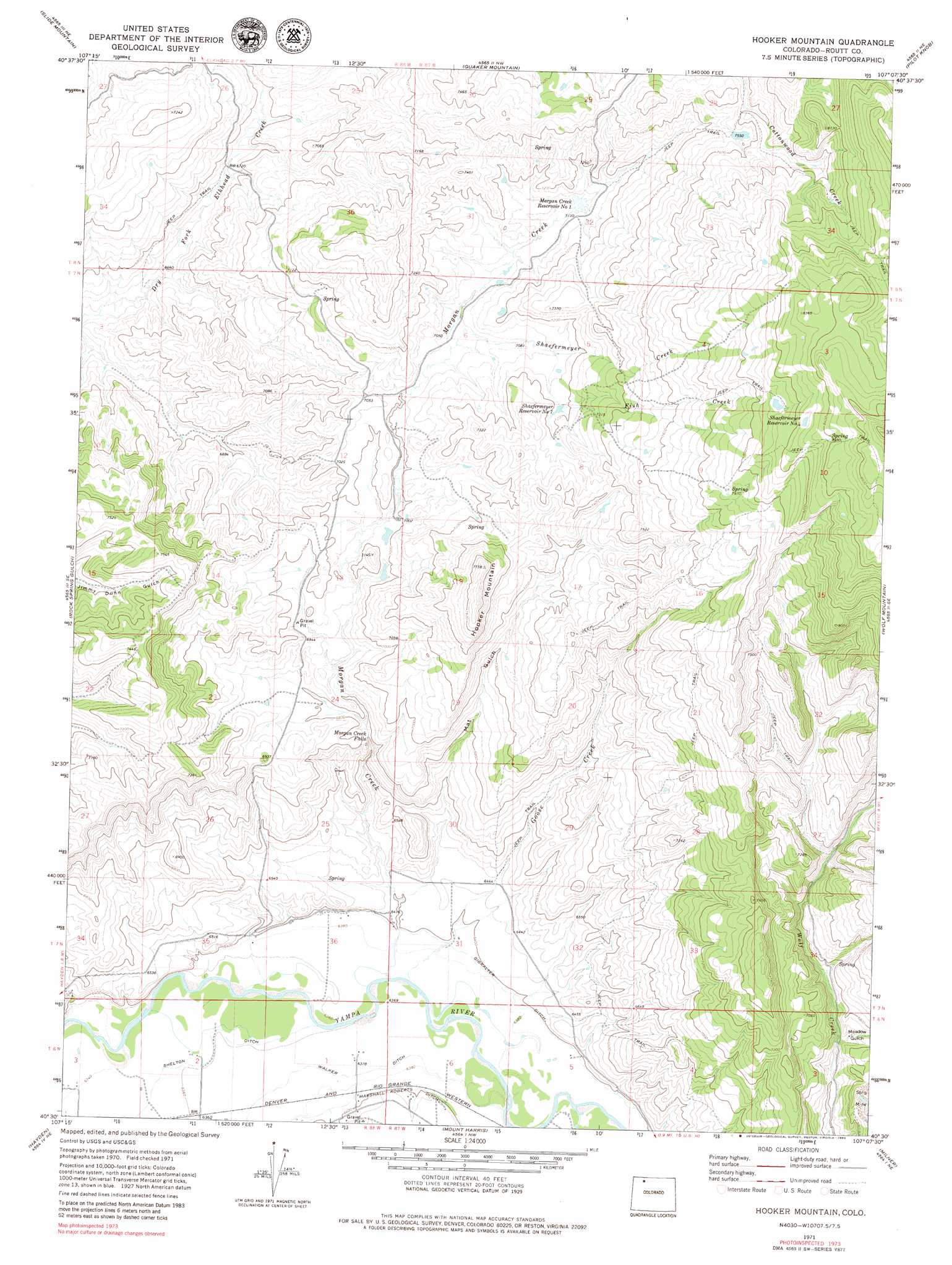
USGS Topo Quad 40107e2 - 1:24,000 scale
| Topo Map Name: | Hooker Mountain |
| USGS Topo Quad ID: | 40107e2 |
| Print Size: | ca. 21 1/4" wide x 27" high |
| Southeast Coordinates: | 40.5° N latitude / 107.125° W longitude |
| Map Center Coordinates: | 40.5625° N latitude / 107.1875° W longitude |
| U.S. State: | CO |
| Filename: | o40107e2.jpg |
| Download Map JPG Image: | Hooker Mountain topo map 1:24,000 scale |
| Map Type: | Topographic |
| Topo Series: | 7.5´ |
| Map Scale: | 1:24,000 |
| Source of Map Images: | United States Geological Survey (USGS) |
| Alternate Map Versions: |
Hooker Mountain CO 1971, updated 1974 Download PDF Buy paper map Hooker Mountain CO 1971, updated 1974 Download PDF Buy paper map Hooker Mountain CO 2010 Download PDF Buy paper map Hooker Mountain CO 2013 Download PDF Buy paper map Hooker Mountain CO 2016 Download PDF Buy paper map |
1:24,000 Topo Quads surrounding Hooker Mountain
Freeman Reservoir |
Buck Point |
Bears Ears Peaks |
Meaden Peak |
Hahns Peak |
Mcinturf Mesa |
Slide Mountain |
Quaker Mountain |
Pilot Knob |
Clark |
Ralph White Lake |
Rock Spring Gulch |
Hooker Mountain |
Wolf Mountain |
Mad Creek |
Breeze Mountain |
Hayden |
Mount Harris |
Milner |
Cow Creek |
Pagoda |
Hayden Gulch |
Dunckley |
Rattlesnake Butte |
Oak Creek |
> Back to 40107e1 at 1:100,000 scale
> Back to 40106a1 at 1:250,000 scale
> Back to U.S. Topo Maps home
Hooker Mountain topo map: Gazetteer
Hooker Mountain: Canals
Gibralter Ditch elevation 1951m 6400′Hooker Mountain: Dams
Morgan Creek Number 1 Dam elevation 2165m 7103′Hooker Mountain: Mines
Champion Mine elevation 2051m 6729′Hooker Mountain: Reservoirs
Morgan Creek Reservoir Number 1 elevation 2165m 7103′Shaefermeyer Reservoir Number 1 elevation 2190m 7185′
Shaefermeyer Reservoir Number 4 elevation 2519m 8264′
Hooker Mountain: Streams
Fish Creek elevation 2171m 7122′Goose Creek elevation 1943m 6374′
Morgan Creek elevation 1943m 6374′
Shaefermeyer Creek elevation 2193m 7194′
Hooker Mountain: Summits
Hooker Mountain elevation 2359m 7739′Hooker Mountain: Valleys
Mat Gulch elevation 1969m 6459′Meadow Gulch elevation 2024m 6640′
Hooker Mountain digital topo map on disk
Buy this Hooker Mountain topo map showing relief, roads, GPS coordinates and other geographical features, as a high-resolution digital map file on DVD: