Pine Ridge Topo Map Colorado
To zoom in, hover over the map of Pine Ridge
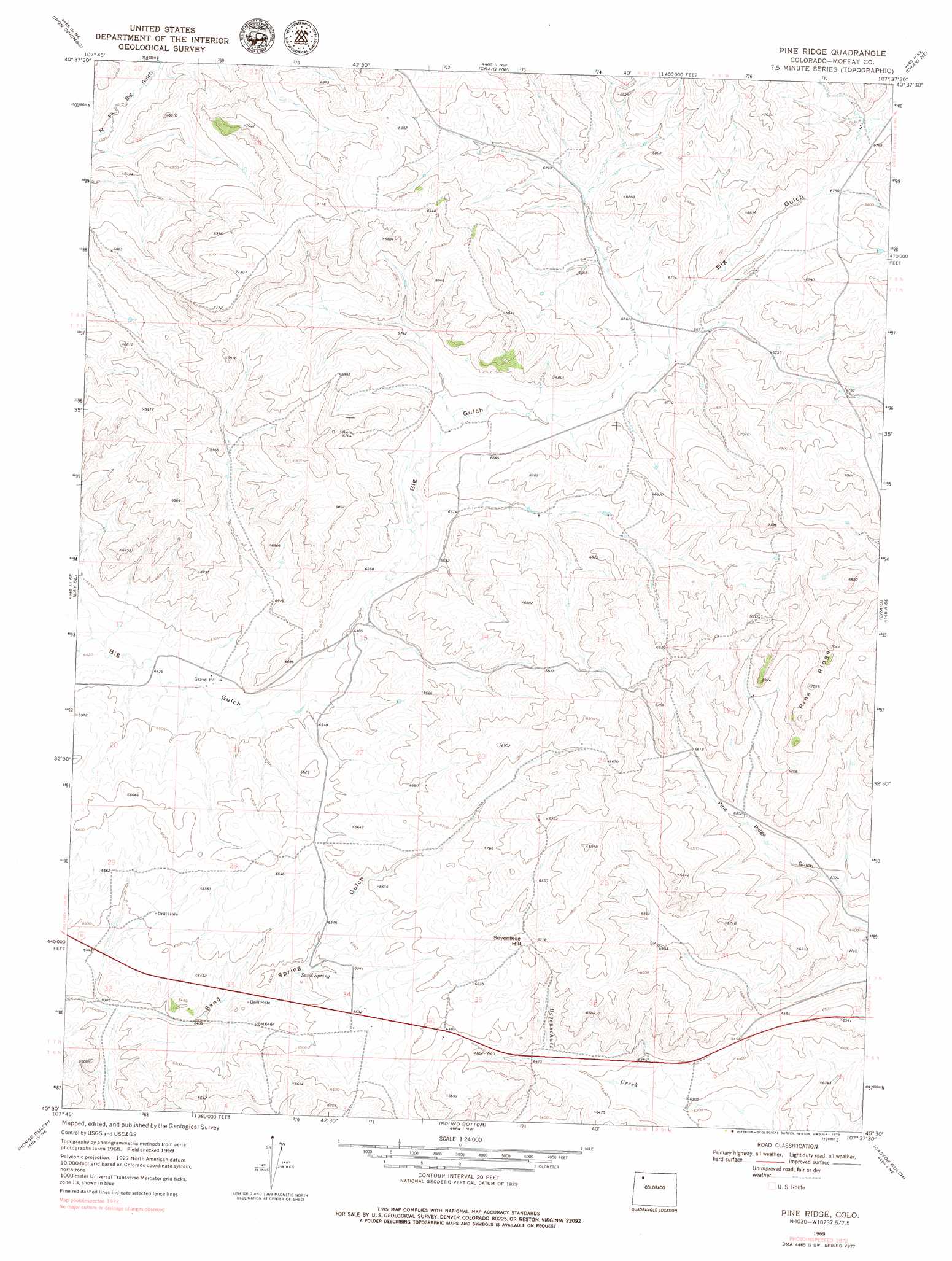
USGS Topo Quad 40107e6 - 1:24,000 scale
| Topo Map Name: | Pine Ridge |
| USGS Topo Quad ID: | 40107e6 |
| Print Size: | ca. 21 1/4" wide x 27" high |
| Southeast Coordinates: | 40.5° N latitude / 107.625° W longitude |
| Map Center Coordinates: | 40.5625° N latitude / 107.6875° W longitude |
| U.S. State: | CO |
| Filename: | o40107e6.jpg |
| Download Map JPG Image: | Pine Ridge topo map 1:24,000 scale |
| Map Type: | Topographic |
| Topo Series: | 7.5´ |
| Map Scale: | 1:24,000 |
| Source of Map Images: | United States Geological Survey (USGS) |
| Alternate Map Versions: |
Pine Ridge CO 1969, updated 1973 Download PDF Buy paper map Pine Ridge CO 1969, updated 1973 Download PDF Buy paper map Pine Ridge CO 2010 Download PDF Buy paper map Pine Ridge CO 2013 Download PDF Buy paper map Pine Ridge CO 2016 Download PDF Buy paper map |
1:24,000 Topo Quads surrounding Pine Ridge
Mayberry Spring |
Great Divide |
East Timberlake Creek |
Fortification |
Freeman Reservoir |
Adobe Springs |
Iron Springs |
Craig Nw |
Craig Ne |
Mcinturf Mesa |
Lay |
Lay Se |
Pine Ridge |
Craig |
Ralph White Lake |
Juniper Hot Springs |
Horse Gulch |
Round Bottom |
Castor Gulch |
Breeze Mountain |
Easton Gulch |
Axial |
Monument Butte |
Hamilton |
Pagoda |
> Back to 40107e1 at 1:100,000 scale
> Back to 40106a1 at 1:250,000 scale
> Back to U.S. Topo Maps home
Pine Ridge topo map: Gazetteer
Pine Ridge: Mines
Golden Grain Claims elevation 2104m 6902′Pine Ridge: Ridges
Pine Ridge elevation 2138m 7014′Pine Ridge: Springs
Sand Spring elevation 1976m 6482′Pine Ridge: Summits
Sevenmile Hill elevation 2046m 6712′Pine Ridge digital topo map on disk
Buy this Pine Ridge topo map showing relief, roads, GPS coordinates and other geographical features, as a high-resolution digital map file on DVD: