Adobe Springs Topo Map Colorado
To zoom in, hover over the map of Adobe Springs
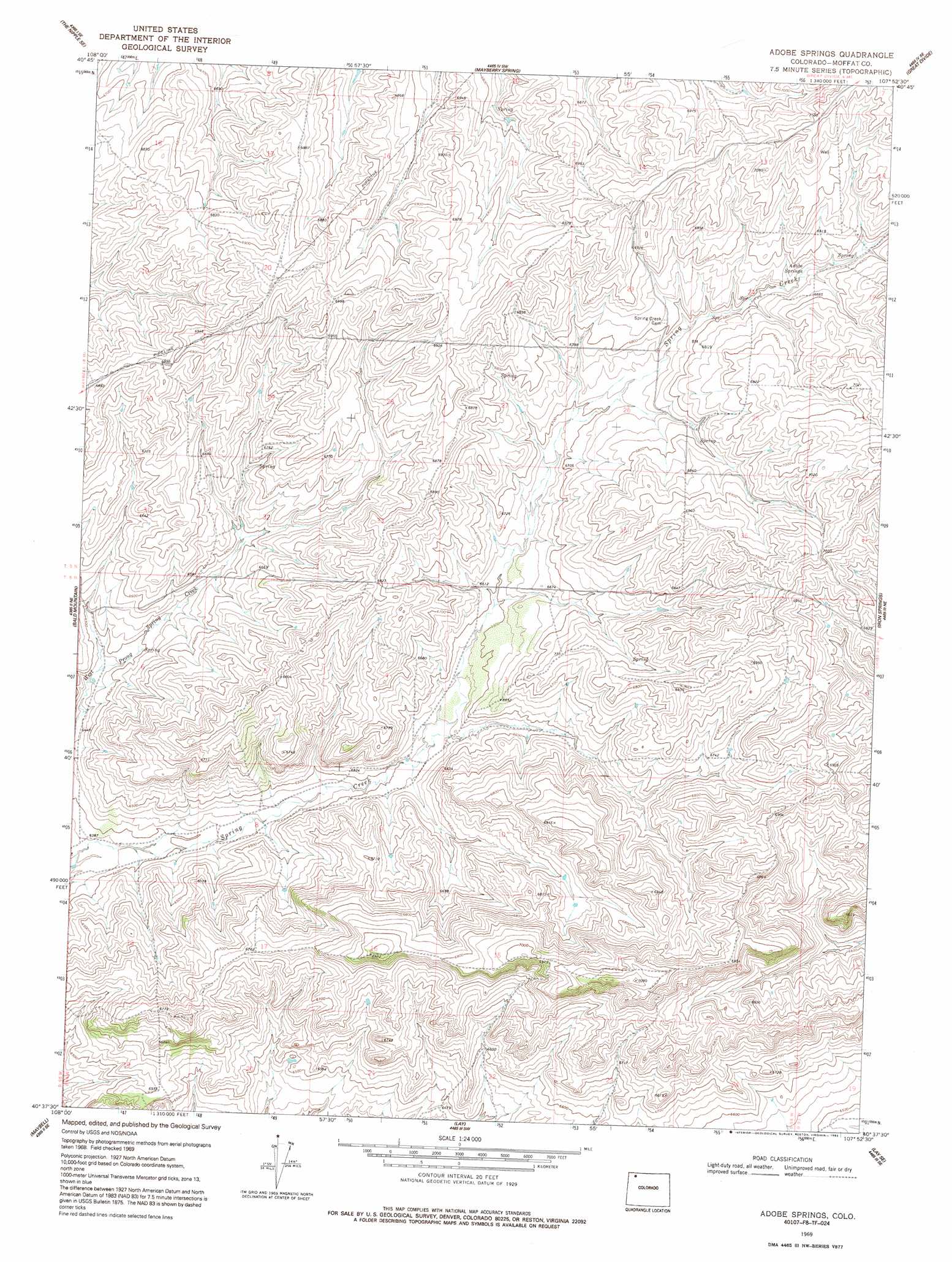
USGS Topo Quad 40107f8 - 1:24,000 scale
| Topo Map Name: | Adobe Springs |
| USGS Topo Quad ID: | 40107f8 |
| Print Size: | ca. 21 1/4" wide x 27" high |
| Southeast Coordinates: | 40.625° N latitude / 107.875° W longitude |
| Map Center Coordinates: | 40.6875° N latitude / 107.9375° W longitude |
| U.S. State: | CO |
| Filename: | o40107f8.jpg |
| Download Map JPG Image: | Adobe Springs topo map 1:24,000 scale |
| Map Type: | Topographic |
| Topo Series: | 7.5´ |
| Map Scale: | 1:24,000 |
| Source of Map Images: | United States Geological Survey (USGS) |
| Alternate Map Versions: |
Adobe Springs CO 1969, updated 1972 Download PDF Buy paper map Adobe Springs CO 1969, updated 1972 Download PDF Buy paper map Adobe Springs CO 1969, updated 1985 Download PDF Buy paper map Adobe Springs CO 1969, updated 1992 Download PDF Buy paper map Adobe Springs CO 2010 Download PDF Buy paper map Adobe Springs CO 2013 Download PDF Buy paper map Adobe Springs CO 2016 Download PDF Buy paper map |
1:24,000 Topo Quads surrounding Adobe Springs
Reservoir Draw |
The Nipple Ne |
Bighole Butte |
Thornburgh Gulch |
Pole Gulch |
The Nipple |
The Nipple Se |
Mayberry Spring |
Great Divide |
East Timberlake Creek |
Ninemile Hill |
Bald Mountain |
Adobe Springs |
Iron Springs |
Craig Nw |
Sunbeam |
Maybell |
Lay |
Lay Se |
Pine Ridge |
Cedar Knob |
Juniper Mountain |
Juniper Hot Springs |
Horse Gulch |
Round Bottom |
> Back to 40107e1 at 1:100,000 scale
> Back to 40106a1 at 1:250,000 scale
> Back to U.S. Topo Maps home
Adobe Springs topo map: Gazetteer
Adobe Springs: Springs
Adobe Springs elevation 2083m 6833′Adobe Springs: Streams
Rock Creek elevation 2096m 6876′Adobe Springs digital topo map on disk
Buy this Adobe Springs topo map showing relief, roads, GPS coordinates and other geographical features, as a high-resolution digital map file on DVD: