Fortification Topo Map Colorado
To zoom in, hover over the map of Fortification
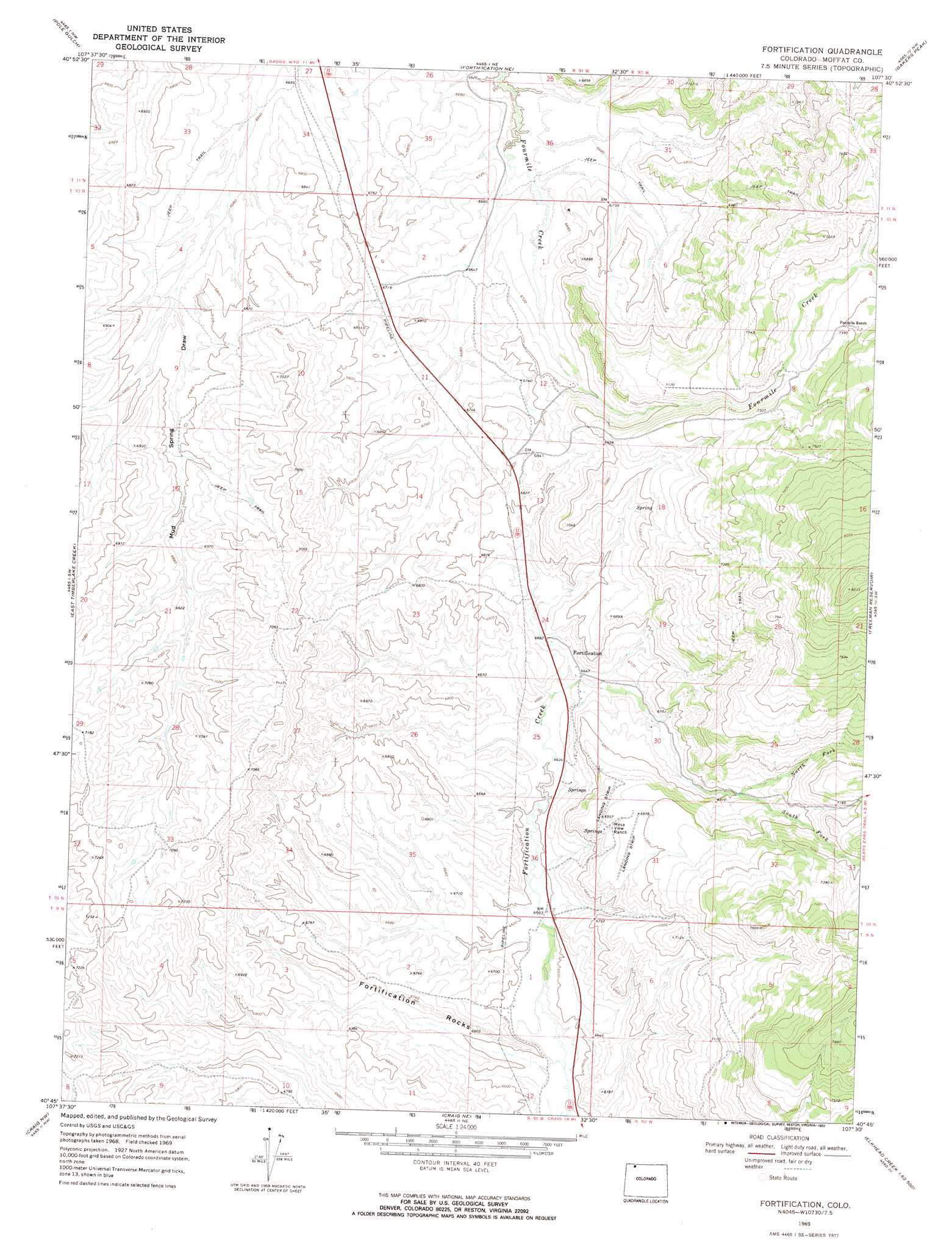
USGS Topo Quad 40107g5 - 1:24,000 scale
| Topo Map Name: | Fortification |
| USGS Topo Quad ID: | 40107g5 |
| Print Size: | ca. 21 1/4" wide x 27" high |
| Southeast Coordinates: | 40.75° N latitude / 107.5° W longitude |
| Map Center Coordinates: | 40.8125° N latitude / 107.5625° W longitude |
| U.S. State: | CO |
| Filename: | o40107g5.jpg |
| Download Map JPG Image: | Fortification topo map 1:24,000 scale |
| Map Type: | Topographic |
| Topo Series: | 7.5´ |
| Map Scale: | 1:24,000 |
| Source of Map Images: | United States Geological Survey (USGS) |
| Alternate Map Versions: |
Fortification CO 1969, updated 1972 Download PDF Buy paper map Fortification NE CO 1969, updated 1972 Download PDF Buy paper map Fortification CO 2010 Download PDF Buy paper map Fortification CO 2013 Download PDF Buy paper map Fortification CO 2016 Download PDF Buy paper map |
1:24,000 Topo Quads surrounding Fortification
Poison Basin |
Baggs |
Dixon |
Savery |
Grieve Reservoir |
Thornburgh Gulch |
Pole Gulch |
Fortification Ne |
Bakers Peak |
Fly Creek |
Great Divide |
East Timberlake Creek |
Fortification |
Freeman Reservoir |
Buck Point |
Iron Springs |
Craig Nw |
Craig Ne |
Mcinturf Mesa |
Slide Mountain |
Lay Se |
Pine Ridge |
Craig |
Ralph White Lake |
Rock Spring Gulch |
> Back to 40107e1 at 1:100,000 scale
> Back to 40106a1 at 1:250,000 scale
> Back to U.S. Topo Maps home
Fortification topo map: Gazetteer
Fortification: Airports
Mesa View Ranch Airport elevation 2104m 6902′Fortification: Pillars
Fortification Rocks elevation 2053m 6735′Fortification: Ranges
Elkhead Mountains elevation 2273m 7457′Fortification: Streams
North Fork Fortification Creek elevation 2079m 6820′South Fork Fortification Creek elevation 2079m 6820′
West Prong South Fork Slater Creek elevation 2352m 7716′
Fortification digital topo map on disk
Buy this Fortification topo map showing relief, roads, GPS coordinates and other geographical features, as a high-resolution digital map file on DVD: