Barcus Creek Topo Map Colorado
To zoom in, hover over the map of Barcus Creek
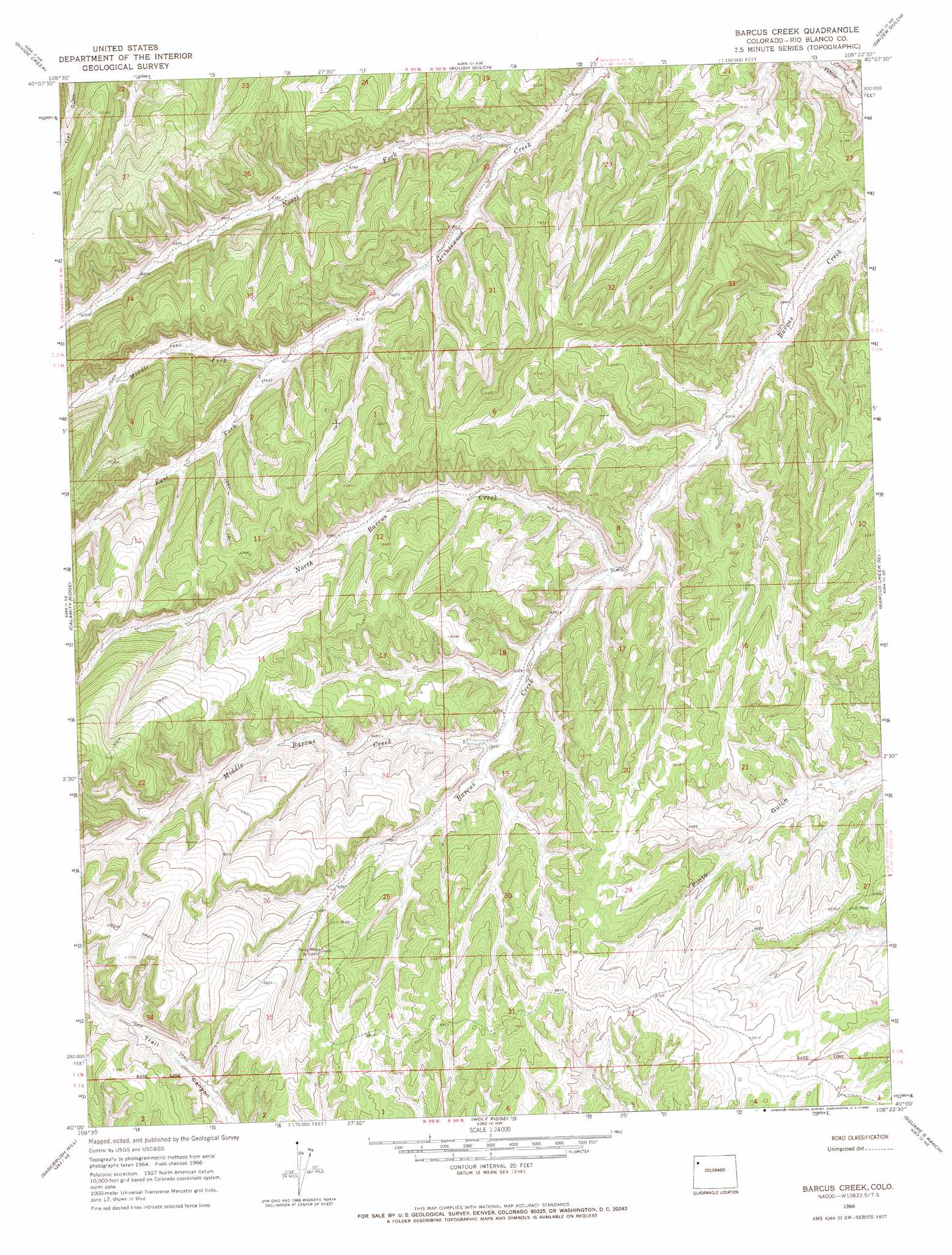
USGS Topo Quad 40108a4 - 1:24,000 scale
| Topo Map Name: | Barcus Creek |
| USGS Topo Quad ID: | 40108a4 |
| Print Size: | ca. 21 1/4" wide x 27" high |
| Southeast Coordinates: | 40° N latitude / 108.375° W longitude |
| Map Center Coordinates: | 40.0625° N latitude / 108.4375° W longitude |
| U.S. State: | CO |
| Filename: | o40108a4.jpg |
| Download Map JPG Image: | Barcus Creek topo map 1:24,000 scale |
| Map Type: | Topographic |
| Topo Series: | 7.5´ |
| Map Scale: | 1:24,000 |
| Source of Map Images: | United States Geological Survey (USGS) |
| Alternate Map Versions: |
Barcus Creek CO 1966, updated 1969 Download PDF Buy paper map Barcus Creek CO 2010 Download PDF Buy paper map Barcus Creek CO 2013 Download PDF Buy paper map Barcus Creek CO 2016 Download PDF Buy paper map |
1:24,000 Topo Quads surrounding Barcus Creek
Skull Creek |
M F Mountain |
Elk Springs |
Wapiti Peak |
Citadel Plateau |
Cactus Reservoir |
Divide Creek |
Rough Gulch |
Smizer Gulch |
Indian Valley |
Gillam Draw |
Calamity Ridge |
Barcus Creek |
Barcus Creek Se |
White River City |
Philadelphia Creek |
Sagebrush Hill |
Wolf Ridge |
Square S Ranch |
Greasewood Gulch |
White Coyote Draw |
Black Cabin Gulch |
Yankee Gulch |
Rock School |
Jessup Gulch |
> Back to 40108a1 at 1:100,000 scale
> Back to 40108a1 at 1:250,000 scale
> Back to U.S. Topo Maps home
Barcus Creek topo map: Gazetteer
Barcus Creek: Streams
East Fork Greasewood Creek elevation 1955m 6414′Middle Barcus Creek elevation 1934m 6345′
Middle Fork Greasewood Creek elevation 1955m 6414′
North Barcus Creek elevation 1892m 6207′
North Fork Greasewood Creek elevation 1841m 6040′
Barcus Creek digital topo map on disk
Buy this Barcus Creek topo map showing relief, roads, GPS coordinates and other geographical features, as a high-resolution digital map file on DVD: