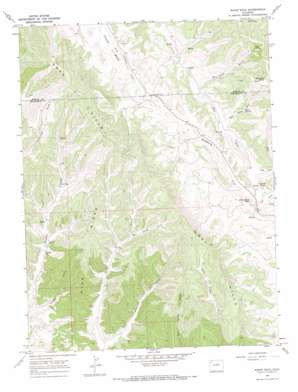
White Rock Topo Map Colorado
To zoom in, hover over the map of White Rock
USGS Topo Quad 40108b1 - 1:24,000 scale
| Topo Map Name: | White Rock |
| USGS Topo Quad ID: | 40108b1 |
| Print Size: | ca. 21 1/4" wide x 27" high |
| Southeast Coordinates: | 40.125° N latitude / 108° W longitude |
| Map Center Coordinates: | 40.1875° N latitude / 108.0625° W longitude |
| U.S. State: | CO |
| Filename: | o40108b1.jpg |
| Download Map JPG Image: | White Rock topo map 1:24,000 scale |
| Map Type: | Topographic |
| Topo Series: | 7.5´ |
| Map Scale: | 1:24,000 |
| Source of Map Images: | United States Geological Survey (USGS) |
| Alternate Map Versions: |
White Rock CO 1966, updated 1969 Download PDF Buy paper map White Rock CO 1966, updated 1970 Download PDF Buy paper map White Rock CO 2010 Download PDF Buy paper map White Rock CO 2013 Download PDF Buy paper map White Rock CO 2016 Download PDF Buy paper map |
1:24,000 Topo Quads surrounding White Rock
> Back to 40108a1 at 1:100,000 scale
> Back to 40108a1 at 1:250,000 scale
> Back to U.S. Topo Maps home
White Rock topo map: Gazetteer
White Rock: Cliffs
White Rock elevation 2101m 6893′White Rock: Ranges
Danforth Hills elevation 2541m 8336′Gray Hills elevation 2465m 8087′
White Rock: Ridges
Dick Ridge elevation 2254m 7395′White Rock: Springs
Bitter Spring elevation 2260m 7414′Coal Spring elevation 2397m 7864′
Moonshine Spring elevation 2523m 8277′
White Rock: Summits
Strawberry Peak elevation 2085m 6840′White Rock: Valleys
Bitter Spring Gulch elevation 2115m 6938′Cave Gulch elevation 2025m 6643′
East Fork Strawberry Creek elevation 2014m 6607′
Goff Camp Gulch elevation 2061m 6761′
Gower Gulch elevation 2145m 7037′
Hidden Valley elevation 1908m 6259′
Jordan Draw elevation 2135m 7004′
White Rock digital topo map on disk
Buy this White Rock topo map showing relief, roads, GPS coordinates and other geographical features, as a high-resolution digital map file on DVD:


