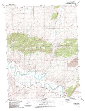
Maybell Topo Map Colorado
To zoom in, hover over the map of Maybell
USGS Topo Quad 40108e1 - 1:24,000 scale
| Topo Map Name: | Maybell |
| USGS Topo Quad ID: | 40108e1 |
| Print Size: | ca. 21 1/4" wide x 27" high |
| Southeast Coordinates: | 40.5° N latitude / 108° W longitude |
| Map Center Coordinates: | 40.5625° N latitude / 108.0625° W longitude |
| U.S. State: | CO |
| Filename: | o40108e1.jpg |
| Download Map JPG Image: | Maybell topo map 1:24,000 scale |
| Map Type: | Topographic |
| Topo Series: | 7.5´ |
| Map Scale: | 1:24,000 |
| Source of Map Images: | United States Geological Survey (USGS) |
| Alternate Map Versions: |
Maybell CO 1986, updated 1986 Download PDF Buy paper map Maybell CO 1986, updated 1986 Download PDF Buy paper map Maybell CO 2010 Download PDF Buy paper map Maybell CO 2013 Download PDF Buy paper map Maybell CO 2016 Download PDF Buy paper map |
1:24,000 Topo Quads surrounding Maybell
> Back to 40108e1 at 1:100,000 scale
> Back to 40108a1 at 1:250,000 scale
> Back to U.S. Topo Maps home
Maybell topo map: Gazetteer
Maybell: Flats
Eagle Park elevation 1922m 6305′Maybell: Mines
Hudson Claim Group Mine elevation 1946m 6384′Lucky Claim elevation 1861m 6105′
Maybell Pit elevation 1921m 6302′
Trevenen Claims elevation 1849m 6066′
Maybell: Pillars
Eagle Rock elevation 1994m 6541′Maybell: Populated Places
Maybell elevation 1805m 5921′Maybell: Springs
Barber Spring elevation 1867m 6125′Omstead Spring elevation 1880m 6167′
Maybell: Streams
Deception Creek elevation 1799m 5902′Spring Creek elevation 1800m 5905′
Maybell: Summits
Hat Hill elevation 2018m 6620′Maybell: Valleys
Mud Spring Gulch elevation 1867m 6125′Wildcat Draw elevation 1844m 6049′
Maybell digital topo map on disk
Buy this Maybell topo map showing relief, roads, GPS coordinates and other geographical features, as a high-resolution digital map file on DVD:


