The Nipple Ne Topo Map Colorado
To zoom in, hover over the map of The Nipple Ne
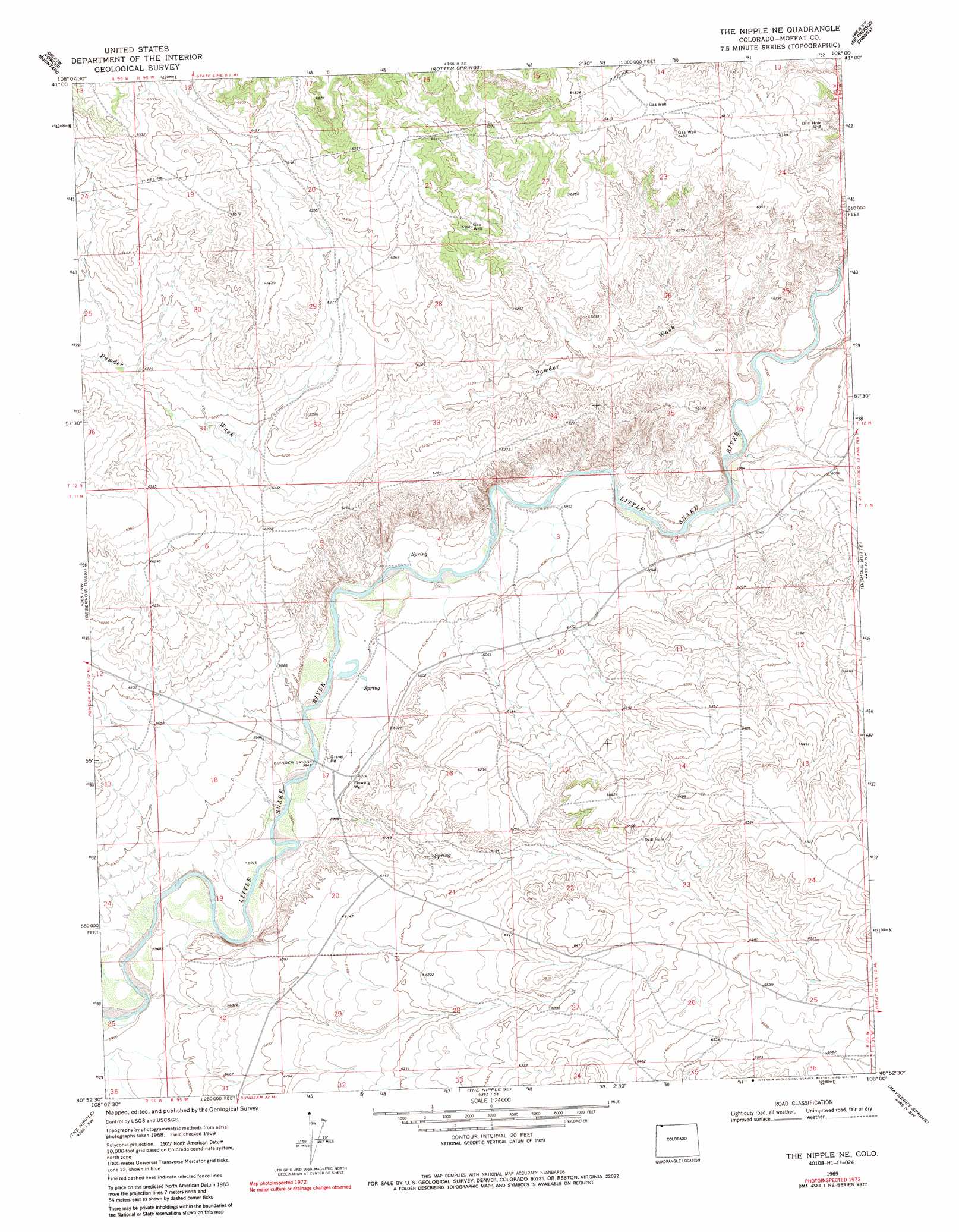
USGS Topo Quad 40108h1 - 1:24,000 scale
| Topo Map Name: | The Nipple Ne |
| USGS Topo Quad ID: | 40108h1 |
| Print Size: | ca. 21 1/4" wide x 27" high |
| Southeast Coordinates: | 40.875° N latitude / 108° W longitude |
| Map Center Coordinates: | 40.9375° N latitude / 108.0625° W longitude |
| U.S. State: | CO |
| Filename: | o40108h1.jpg |
| Download Map JPG Image: | The Nipple Ne topo map 1:24,000 scale |
| Map Type: | Topographic |
| Topo Series: | 7.5´ |
| Map Scale: | 1:24,000 |
| Source of Map Images: | United States Geological Survey (USGS) |
| Alternate Map Versions: |
The Nipple NE CO 1969, updated 1973 Download PDF Buy paper map The Nipple NE CO 1969, updated 1973 Download PDF Buy paper map The Nipple NE CO 1969, updated 1986 Download PDF Buy paper map The Nipple NE CO 2010 Download PDF Buy paper map The Nipple NE CO 2013 Download PDF Buy paper map The Nipple NE CO 2016 Download PDF Buy paper map |
1:24,000 Topo Quads surrounding The Nipple Ne
Monument Valley |
Prehistoric Rim |
Powder Mountain Ne |
Dripping Rock Spring |
Flat Top Mountain |
Upper Powder Spring |
Powder Mountain |
Rotten Springs |
Mcpherson Springs |
Poison Basin |
Powder Wash |
Reservoir Draw |
The Nipple Ne |
Bighole Butte |
Thornburgh Gulch |
Lang Spring |
The Nipple |
The Nipple Se |
Mayberry Spring |
Great Divide |
Sevenmile Draw |
Ninemile Hill |
Bald Mountain |
Adobe Springs |
Iron Springs |
> Back to 40108e1 at 1:100,000 scale
> Back to 40108a1 at 1:250,000 scale
> Back to U.S. Topo Maps home
The Nipple Ne topo map: Gazetteer
The Nipple Ne: Bridges
Edinger Bridge elevation 1812m 5944′The Nipple Ne: Mines
Little Snake One Mine elevation 1881m 6171′The Nipple Ne: Streams
Powder Wash elevation 1827m 5994′The Nipple Ne digital topo map on disk
Buy this The Nipple Ne topo map showing relief, roads, GPS coordinates and other geographical features, as a high-resolution digital map file on DVD: