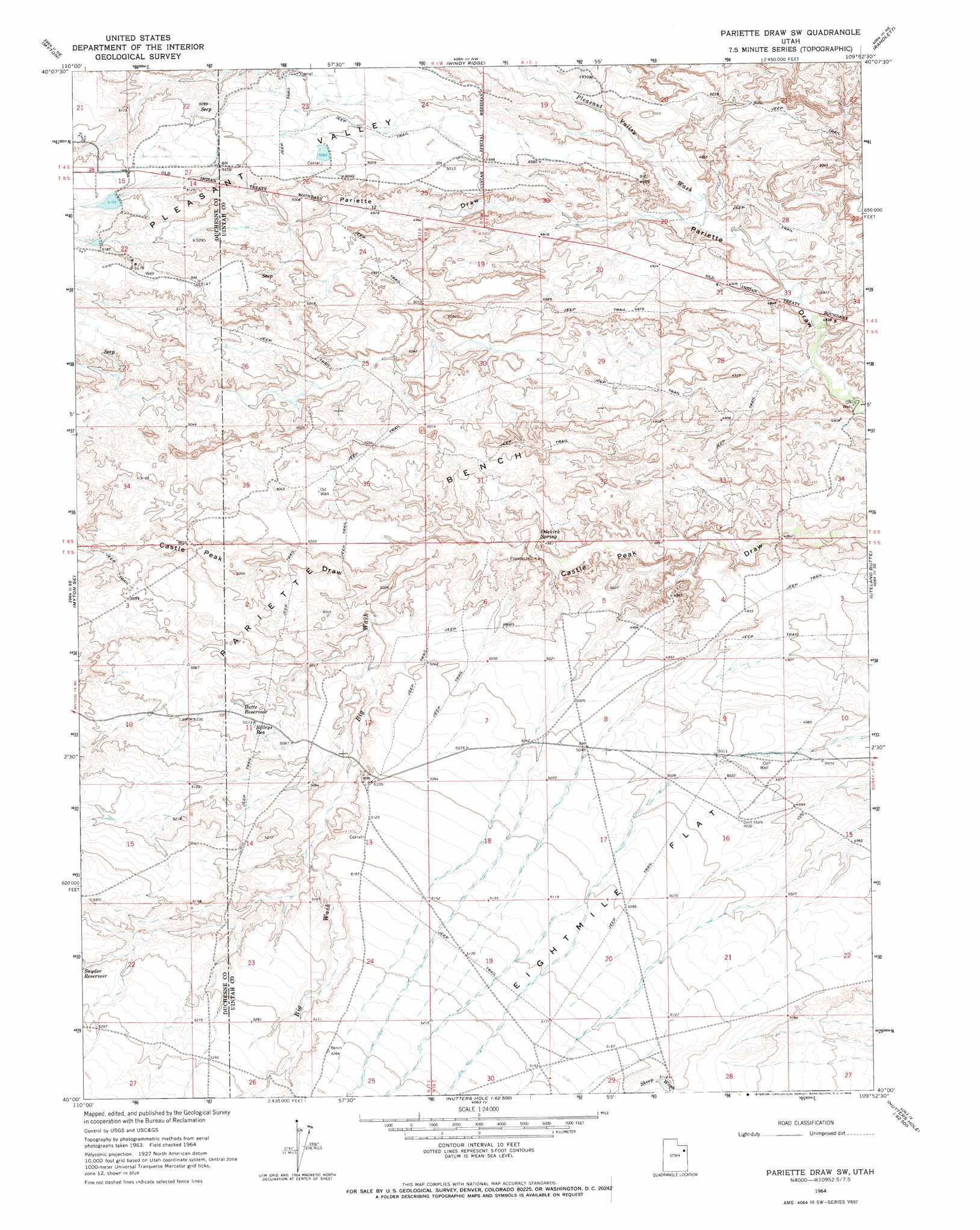
Pariette Draw Sw Topo Map Utah
To zoom in, hover over the map of Pariette Draw Sw
USGS Topo Quad 40109a8 - 1:24,000 scale
| Topo Map Name: | Pariette Draw Sw |
| USGS Topo Quad ID: | 40109a8 |
| Print Size: | ca. 21 1/4" wide x 27" high |
| Southeast Coordinates: | 40° N latitude / 109.875° W longitude |
| Map Center Coordinates: | 40.0625° N latitude / 109.9375° W longitude |
| U.S. State: | UT |
| Filename: | o40109a8.jpg |
| Download Map JPG Image: | Pariette Draw Sw topo map 1:24,000 scale |
| Map Type: | Topographic |
| Topo Series: | 7.5´ |
| Map Scale: | 1:24,000 |
| Source of Map Images: | United States Geological Survey (USGS) |
| Alternate Map Versions: |
Pariette Draw SW UT 1964, updated 1966 Download PDF Buy paper map Pariette Draw SW UT 2011 Download PDF Buy paper map Pariette Draw SW UT 2014 Download PDF Buy paper map |
1:24,000 Topo Quads surrounding Pariette Draw Sw
Bluebell |
Hancock Cove |
Roosevelt |
Fort Duchesne |
Vernal Sw |
Bridgeland |
Myton |
Windy Ridge |
Randlett |
Pelican Lake |
Myton Sw |
Myton Se |
Pariette Draw Sw |
Uteland Butte |
Ouray |
Gilsonite Draw |
Wilkin Ridge |
Crow Knoll |
Moon Bottom |
Big Pack Mountain Nw |
Cowboy Bench |
Pinnacle Canyon |
Duches Hole |
Nutters Hole |
Big Pack Mountain |
> Back to 40109a1 at 1:100,000 scale
> Back to 40108a1 at 1:250,000 scale
> Back to U.S. Topo Maps home
Pariette Draw Sw topo map: Gazetteer
Pariette Draw Sw: Benches
Pariette Bench elevation 1554m 5098′Pariette Draw Sw: Flats
Eightmile Flat elevation 1538m 5045′Pariette Draw Sw: Reservoirs
Billeys Reservoir elevation 1546m 5072′Butte Reservoir elevation 1540m 5052′
Pariette Draw Sw: Springs
Odekirk Spring elevation 1492m 4895′Pariette Draw Sw: Valleys
Big Wash elevation 1503m 4931′Pleasant Valley elevation 1489m 4885′
Pleasant Valley Wash elevation 1483m 4865′
Pariette Draw Sw digital topo map on disk
Buy this Pariette Draw Sw topo map showing relief, roads, GPS coordinates and other geographical features, as a high-resolution digital map file on DVD: