Lapoint Topo Map Utah
To zoom in, hover over the map of Lapoint
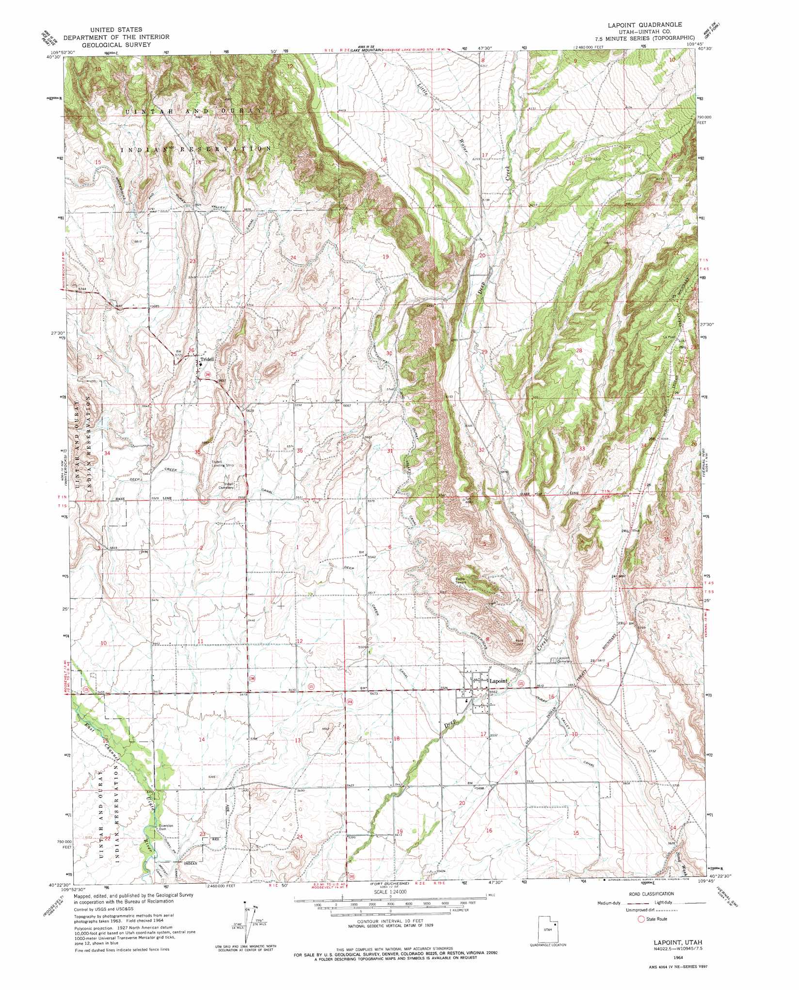
USGS Topo Quad 40109d7 - 1:24,000 scale
| Topo Map Name: | Lapoint |
| USGS Topo Quad ID: | 40109d7 |
| Print Size: | ca. 21 1/4" wide x 27" high |
| Southeast Coordinates: | 40.375° N latitude / 109.75° W longitude |
| Map Center Coordinates: | 40.4375° N latitude / 109.8125° W longitude |
| U.S. State: | UT |
| Filename: | o40109d7.jpg |
| Download Map JPG Image: | Lapoint topo map 1:24,000 scale |
| Map Type: | Topographic |
| Topo Series: | 7.5´ |
| Map Scale: | 1:24,000 |
| Source of Map Images: | United States Geological Survey (USGS) |
| Alternate Map Versions: |
Lapoint UT 1964, updated 1965 Download PDF Buy paper map Lapoint UT 1964, updated 1978 Download PDF Buy paper map Lapoint UT 2011 Download PDF Buy paper map Lapoint UT 2014 Download PDF Buy paper map |
1:24,000 Topo Quads surrounding Lapoint
Rasmussen Lakes |
Paradise Park |
Marsh Peak |
Taylor Mountain |
Dyer Mountain |
Pole Creek Cave |
Ice Cave Peak |
Lake Mountain |
Dry Fork |
Steinaker Reservoir |
Neola |
Whiterocks |
Lapoint |
Vernal Nw |
Vernal Ne |
Hancock Cove |
Roosevelt |
Fort Duchesne |
Vernal Sw |
Vernal Se |
Myton |
Windy Ridge |
Randlett |
Pelican Lake |
Brennan Basin |
> Back to 40109a1 at 1:100,000 scale
> Back to 40108a1 at 1:250,000 scale
> Back to U.S. Topo Maps home
Lapoint topo map: Gazetteer
Lapoint: Canals
Deep Creek Canal elevation 1686m 5531′Whiterocks and Ouray Valley Canal elevation 1770m 5807′
Lapoint: Dams
Diversion Dam elevation 1626m 5334′Lapoint: Populated Places
Lapoint elevation 1697m 5567′Tridell elevation 1718m 5636′
Lapoint: Streams
Little Water elevation 1867m 6125′Lapoint digital topo map on disk
Buy this Lapoint topo map showing relief, roads, GPS coordinates and other geographical features, as a high-resolution digital map file on DVD: