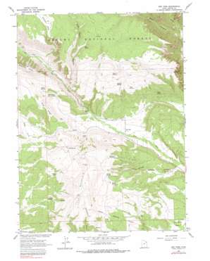
Dry Fork Topo Map Utah
To zoom in, hover over the map of Dry Fork
USGS Topo Quad 40109e6 - 1:24,000 scale
| Topo Map Name: | Dry Fork |
| USGS Topo Quad ID: | 40109e6 |
| Print Size: | ca. 21 1/4" wide x 27" high |
| Southeast Coordinates: | 40.5° N latitude / 109.625° W longitude |
| Map Center Coordinates: | 40.5625° N latitude / 109.6875° W longitude |
| U.S. State: | UT |
| Filename: | o40109e6.jpg |
| Download Map JPG Image: | Dry Fork topo map 1:24,000 scale |
| Map Type: | Topographic |
| Topo Series: | 7.5´ |
| Map Scale: | 1:24,000 |
| Source of Map Images: | United States Geological Survey (USGS) |
| Alternate Map Versions: |
Dry Fork UT 1966, updated 1967 Download PDF Buy paper map Dry Fork UT 1966, updated 1978 Download PDF Buy paper map Dry Fork UT 1996, updated 1999 Download PDF Buy paper map Dry Fork UT 2011 Download PDF Buy paper map Dry Fork UT 2014 Download PDF Buy paper map |
| FStopo: | US Forest Service topo Dry Fork is available: Download FStopo PDF Download FStopo TIF |
1:24,000 Topo Quads surrounding Dry Fork
> Back to 40109e1 at 1:100,000 scale
> Back to 40108a1 at 1:250,000 scale
> Back to U.S. Topo Maps home
Dry Fork topo map: Gazetteer
Dry Fork: Basins
Castle Cove elevation 2117m 6945′Dry Fork: Flats
Charleys Park elevation 2679m 8789′Dry Fork: Parks
Shindy Hollow Picnic Site elevation 2218m 7276′Dry Fork: Populated Places
Dry Fork elevation 1967m 6453′Dry Fork: Ridges
Pine Ridge elevation 2418m 7933′Dry Fork: Springs
Beck Spring elevation 2509m 8231′Box Spring elevation 2373m 7785′
Burch Spring elevation 2275m 7463′
Charleys Park Spring elevation 2655m 8710′
Chicken Spring elevation 2304m 7559′
Chivers Spring elevation 2364m 7755′
Chokecherry Spring elevation 2203m 7227′
East End Spring elevation 2394m 7854′
Hawthorn Spring elevation 2388m 7834′
June Spring elevation 2330m 7644′
Lind Spring elevation 2072m 6797′
Middle Spring elevation 2379m 7805′
Mud Spring elevation 2661m 8730′
Shindy Spring elevation 2235m 7332′
Willow Springs elevation 2279m 7477′
Dry Fork: Summits
Little Mountain elevation 2618m 8589′Dry Fork: Valleys
Alma Taylor Hollow elevation 2133m 6998′Black Canyon elevation 2021m 6630′
Shindy Draw elevation 1841m 6040′
Dry Fork digital topo map on disk
Buy this Dry Fork topo map showing relief, roads, GPS coordinates and other geographical features, as a high-resolution digital map file on DVD:


