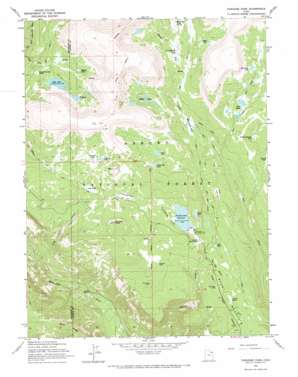
Paradise Park Topo Map Utah
To zoom in, hover over the map of Paradise Park
USGS Topo Quad 40109f8 - 1:24,000 scale
| Topo Map Name: | Paradise Park |
| USGS Topo Quad ID: | 40109f8 |
| Print Size: | ca. 21 1/4" wide x 27" high |
| Southeast Coordinates: | 40.625° N latitude / 109.875° W longitude |
| Map Center Coordinates: | 40.6875° N latitude / 109.9375° W longitude |
| U.S. State: | UT |
| Filename: | o40109f8.jpg |
| Download Map JPG Image: | Paradise Park topo map 1:24,000 scale |
| Map Type: | Topographic |
| Topo Series: | 7.5´ |
| Map Scale: | 1:24,000 |
| Source of Map Images: | United States Geological Survey (USGS) |
| Alternate Map Versions: |
Paradise Park UT 1965, updated 1967 Download PDF Buy paper map Paradise Park UT 1996, updated 1999 Download PDF Buy paper map Paradise Park UT 2011 Download PDF Buy paper map Paradise Park UT 2014 Download PDF Buy paper map |
| FStopo: | US Forest Service topo Paradise Park is available: Download FStopo PDF Download FStopo TIF |
1:24,000 Topo Quads surrounding Paradise Park
> Back to 40109e1 at 1:100,000 scale
> Back to 40108a1 at 1:250,000 scale
> Back to U.S. Topo Maps home
Paradise Park topo map: Gazetteer
Paradise Park: Benches
Hen Lee Bench elevation 3026m 9927′Paradise Park: Bridges
Dry Fork Bridge elevation 2986m 9796′Paradise Park: Canals
Mosby Canal elevation 3057m 10029′Paradise Park: Dams
Cliff Lake Dam elevation 3155m 10351′Julius Park Dam elevation 2970m 9744′
Paradise Park Dam elevation 3030m 9940′
Paradise Park: Flats
Blanchett Park elevation 3059m 10036′Dead Horse Park elevation 3146m 10321′
Hells Kitchen Park elevation 3118m 10229′
Johnson Park elevation 3273m 10738′
Julius Park elevation 2971m 9747′
Lightning Park elevation 3232m 10603′
Lonesome Park elevation 3171m 10403′
Lost Park elevation 3024m 9921′
Murray Park elevation 3027m 9931′
Paradise Park elevation 3058m 10032′
Summit Park elevation 3174m 10413′
Tool Box Park elevation 2995m 9826′
Paradise Park: Lakes
Dead Lake elevation 3068m 10065′Johnson Lake elevation 3287m 10784′
Kibah Lakes elevation 3216m 10551′
Lily Lake elevation 3145m 10318′
Little Elk Lake elevation 3218m 10557′
Mill Pond elevation 3067m 10062′
Moap Lake elevation 3277m 10751′
Mytoge Lake elevation 3231m 10600′
Paul Lake elevation 3238m 10623′
Red Belly Lake elevation 3215m 10547′
Twin Lakes elevation 3141m 10305′
Watkins Lake elevation 3158m 10360′
Paradise Park: Reservoirs
Cliff Lake elevation 3156m 10354′Julius Park Reservoir elevation 2970m 9744′
Paradise Park Reservoir elevation 3030m 9940′
Paradise Park: Streams
Lily Lake Creek elevation 2456m 8057′Reynolds Creek elevation 3173m 10410′
Paradise Park: Summits
Mesa elevation 3358m 11017′Paradise Peak elevation 3296m 10813′
Paradise Park: Trails
Dry Fork Trail elevation 2980m 9776′Paradise Park digital topo map on disk
Buy this Paradise Park topo map showing relief, roads, GPS coordinates and other geographical features, as a high-resolution digital map file on DVD:


