Rabbit Gulch Topo Map Utah
To zoom in, hover over the map of Rabbit Gulch
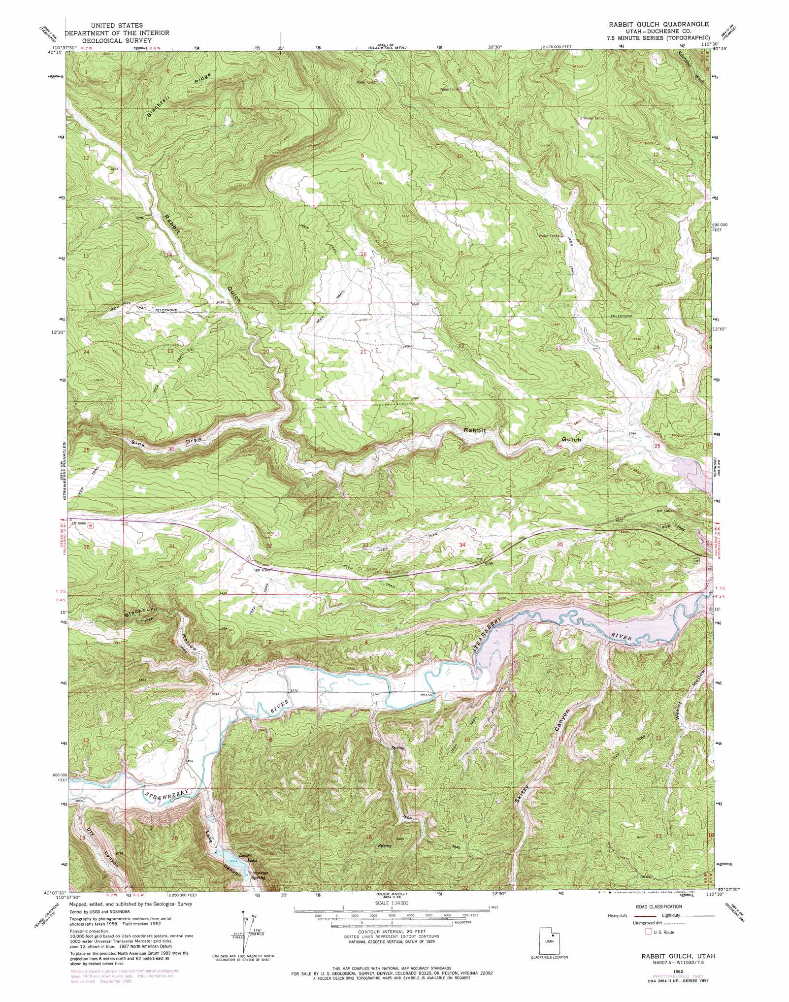
USGS Topo Quad 40110b5 - 1:24,000 scale
| Topo Map Name: | Rabbit Gulch |
| USGS Topo Quad ID: | 40110b5 |
| Print Size: | ca. 21 1/4" wide x 27" high |
| Southeast Coordinates: | 40.125° N latitude / 110.5° W longitude |
| Map Center Coordinates: | 40.1875° N latitude / 110.5625° W longitude |
| U.S. State: | UT |
| Filename: | o40110b5.jpg |
| Download Map JPG Image: | Rabbit Gulch topo map 1:24,000 scale |
| Map Type: | Topographic |
| Topo Series: | 7.5´ |
| Map Scale: | 1:24,000 |
| Source of Map Images: | United States Geological Survey (USGS) |
| Alternate Map Versions: |
Rabbit Gulch UT 1962, updated 1964 Download PDF Buy paper map Rabbit Gulch UT 1962, updated 1981 Download PDF Buy paper map Rabbit Gulch UT 2011 Download PDF Buy paper map Rabbit Gulch UT 2014 Download PDF Buy paper map |
1:24,000 Topo Quads surrounding Rabbit Gulch
Hanna |
Farm Creek Peak |
Dry Mountain |
Mountain Home |
Altonah |
Tabby Mountain |
Tabiona |
Blacktail Mountain |
Talmage |
Altamont |
Fruitland |
Strawberry Pinnacles |
Rabbit Gulch |
Duchesne |
Duchesne Ne |
Avintaquin Canyon |
Sams Canyon |
Buck Knoll |
Duchesne Sw |
Duchesne Se |
Gray Head Peak |
Jones Hollow |
Lance Canyon |
Anthro Mountain |
Anthro Mountain Ne |
> Back to 40110a1 at 1:100,000 scale
> Back to 40110a1 at 1:250,000 scale
> Back to U.S. Topo Maps home
Rabbit Gulch topo map: Gazetteer
Rabbit Gulch: Parks
Rabbit Gulch Wildlife Management Area elevation 1842m 6043′Rabbit Gulch: Reservoirs
Lower Lake elevation 1832m 6010′Rabbit Gulch: Valleys
Blackburn Hollow elevation 1785m 5856′Dry Canyon elevation 1791m 5875′
Lake Canyon elevation 1769m 5803′
Sink Draw elevation 1837m 6026′
Skitzy Canyon elevation 1741m 5711′
Weeint Hollow elevation 1740m 5708′
Rabbit Gulch digital topo map on disk
Buy this Rabbit Gulch topo map showing relief, roads, GPS coordinates and other geographical features, as a high-resolution digital map file on DVD: