Tworoose Pass Topo Map Utah
To zoom in, hover over the map of Tworoose Pass
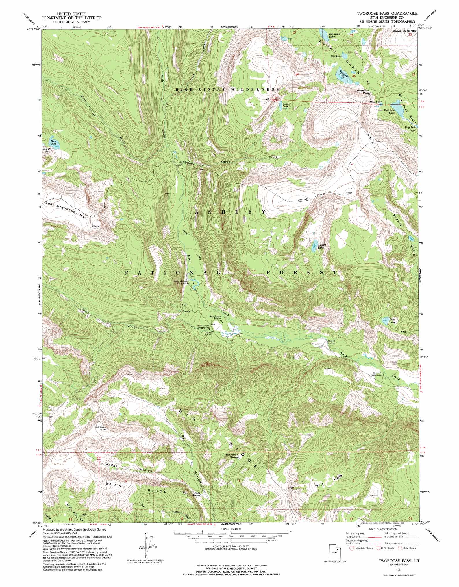
USGS Topo Quad 40110e6 - 1:24,000 scale
| Topo Map Name: | Tworoose Pass |
| USGS Topo Quad ID: | 40110e6 |
| Print Size: | ca. 21 1/4" wide x 27" high |
| Southeast Coordinates: | 40.5° N latitude / 110.625° W longitude |
| Map Center Coordinates: | 40.5625° N latitude / 110.6875° W longitude |
| U.S. State: | UT |
| Filename: | o40110e6.jpg |
| Download Map JPG Image: | Tworoose Pass topo map 1:24,000 scale |
| Map Type: | Topographic |
| Topo Series: | 7.5´ |
| Map Scale: | 1:24,000 |
| Source of Map Images: | United States Geological Survey (USGS) |
| Alternate Map Versions: |
Tworoose Pass UT 1967, updated 1968 Download PDF Buy paper map Tworoose Pass UT 1967, updated 1980 Download PDF Buy paper map Tworoose Pass UT 1967, updated 1995 Download PDF Buy paper map Tworoose Pass UT 2011 Download PDF Buy paper map Tworoose Pass UT 2014 Download PDF Buy paper map |
| FStopo: | US Forest Service topo Tworoose Pass is available: Download FStopo PDF Download FStopo TIF |
1:24,000 Topo Quads surrounding Tworoose Pass
Whitney Reservoir |
Christmas Meadows |
Red Knob |
Mount Lovenia |
Mount Powell |
Mirror Lake |
Hayden Peak |
Explorer Peak |
Oweep Creek |
Garfield Basin |
Iron Mine Mountain |
Grandaddy Lake |
Tworoose Pass |
Kidney Lake |
Lake Fork Mountain |
Wolf Creek |
Hanna |
Farm Creek Peak |
Dry Mountain |
Mountain Home |
Raspberry Knoll |
Tabby Mountain |
Tabiona |
Blacktail Mountain |
Talmage |
> Back to 40110e1 at 1:100,000 scale
> Back to 40110a1 at 1:250,000 scale
> Back to U.S. Topo Maps home
Tworoose Pass topo map: Gazetteer
Tworoose Pass: Airports
Stillwater Heliport elevation 2435m 7988′Tworoose Pass: Bends
Hell Hole elevation 3024m 9921′Tworoose Pass: Lakes
Audry Lake elevation 3056m 10026′Bear Lake elevation 2740m 8989′
Cabin Lake elevation 3191m 10469′
Diamond Lake elevation 3117m 10226′
Docs Lake elevation 3015m 9891′
Horseshoe Lake elevation 3079m 10101′
Lily Pad Lake elevation 3128m 10262′
Mid Lake elevation 3179m 10429′
Milk Lake elevation 3154m 10347′
Rudolph Lake elevation 3193m 10475′
Tworoose Lake elevation 3141m 10305′
Tworoose Pass: Ridges
Big Ridge elevation 3293m 10803′Burnt Ridge elevation 3006m 9862′
Tworoose Pass: Springs
Burnt Ridge Spring elevation 3100m 10170′Log Hollow Spring elevation 3032m 9947′
Pine Spring elevation 3236m 10616′
Rock Spring elevation 2856m 9370′
Tworoose Pass: Streams
Cabin Creek elevation 2499m 8198′East Fork Rock Creek elevation 2563m 8408′
Fish Creek elevation 2759m 9051′
South Fork Rock Creek elevation 2375m 7791′
West Fork Rock Creek elevation 2519m 8264′
Tworoose Pass: Valleys
Wedge Hollow elevation 2902m 9520′Tworoose Pass digital topo map on disk
Buy this Tworoose Pass topo map showing relief, roads, GPS coordinates and other geographical features, as a high-resolution digital map file on DVD: