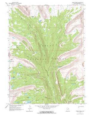
Oweep Creek Topo Map Utah
To zoom in, hover over the map of Oweep Creek
USGS Topo Quad 40110f5 - 1:24,000 scale
| Topo Map Name: | Oweep Creek |
| USGS Topo Quad ID: | 40110f5 |
| Print Size: | ca. 21 1/4" wide x 27" high |
| Southeast Coordinates: | 40.625° N latitude / 110.5° W longitude |
| Map Center Coordinates: | 40.6875° N latitude / 110.5625° W longitude |
| U.S. State: | UT |
| Filename: | o40110f5.jpg |
| Download Map JPG Image: | Oweep Creek topo map 1:24,000 scale |
| Map Type: | Topographic |
| Topo Series: | 7.5´ |
| Map Scale: | 1:24,000 |
| Source of Map Images: | United States Geological Survey (USGS) |
| Alternate Map Versions: |
Oweep Creek UT 1967, updated 1968 Download PDF Buy paper map Oweep Creek UT 1967, updated 1968 Download PDF Buy paper map Oweep Creek UT 2011 Download PDF Buy paper map Oweep Creek UT 2014 Download PDF Buy paper map |
| FStopo: | US Forest Service topo Oweep Creek is available: Download FStopo PDF Download FStopo TIF |
1:24,000 Topo Quads surrounding Oweep Creek
> Back to 40110e1 at 1:100,000 scale
> Back to 40110a1 at 1:250,000 scale
> Back to U.S. Topo Maps home
Oweep Creek topo map: Gazetteer
Oweep Creek: Areas
High Uintas Primitive Area elevation 3201m 10501′Oweep Creek: Basins
Brown Duck Basin elevation 3191m 10469′East Basin elevation 3204m 10511′
Ottoson Basin elevation 3318m 10885′
Oweep Creek: Dams
Clement Lake Dam elevation 3186m 10452′Oweep Creek: Flats
Lambert Meadow elevation 3336m 10944′West Park elevation 3246m 10649′
Oweep Creek: Gaps
Cleveland Pass elevation 3405m 11171′East Basin Pass elevation 3238m 10623′
Oweep Creek: Lakes
Clements Lake elevation 3185m 10449′Cleveland Lake elevation 3408m 11181′
East Slide Lake elevation 3145m 10318′
Horseshoe Lake elevation 3270m 10728′
Lambert Lake elevation 3348m 10984′
Picture Lake elevation 3272m 10734′
Stewart Lake elevation 3211m 10534′
Three Lakes elevation 3299m 10823′
Twin Lakes elevation 3231m 10600′
Oweep Creek: Reservoirs
Clement Lake elevation 3186m 10452′Oweep Creek: Streams
Clements Creek elevation 2613m 8572′East Basin Creek elevation 2710m 8891′
Ottoson Creek elevation 2821m 9255′
Oweep Creek elevation 2748m 9015′
Oweep Creek: Summits
Brown Duck Mountain elevation 3615m 11860′Oweep Creek digital topo map on disk
Buy this Oweep Creek topo map showing relief, roads, GPS coordinates and other geographical features, as a high-resolution digital map file on DVD:


