Gilbert Peak Ne Topo Map Utah
To zoom in, hover over the map of Gilbert Peak Ne
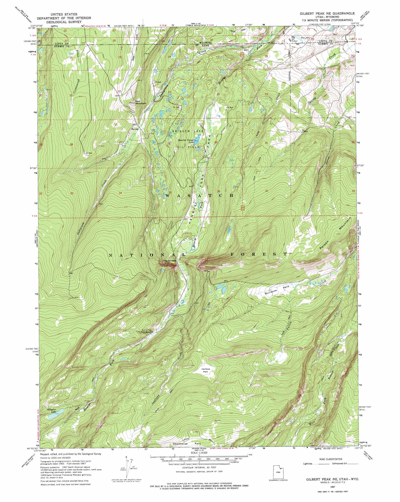
USGS Topo Quad 40110h3 - 1:24,000 scale
| Topo Map Name: | Gilbert Peak Ne |
| USGS Topo Quad ID: | 40110h3 |
| Print Size: | ca. 21 1/4" wide x 27" high |
| Southeast Coordinates: | 40.875° N latitude / 110.25° W longitude |
| Map Center Coordinates: | 40.9375° N latitude / 110.3125° W longitude |
| U.S. States: | UT, WY |
| Filename: | o40110h3.jpg |
| Download Map JPG Image: | Gilbert Peak Ne topo map 1:24,000 scale |
| Map Type: | Topographic |
| Topo Series: | 7.5´ |
| Map Scale: | 1:24,000 |
| Source of Map Images: | United States Geological Survey (USGS) |
| Alternate Map Versions: |
Gilbert Peak NE UT 1967, updated 1969 Download PDF Buy paper map Gilbert Peak NE UT 1967, updated 1977 Download PDF Buy paper map Gilbert Peak NE UT 1967, updated 1977 Download PDF Buy paper map Gilbert Peak NE UT 1998, updated 2001 Download PDF Buy paper map Gilbert Peak NE UT 2011 Download PDF Buy paper map Gilbert Peak NE UT 2014 Download PDF Buy paper map |
| FStopo: | US Forest Service topo Gilbert Peak NE is available: Download FStopo PDF Download FStopo TIF |
1:24,000 Topo Quads surrounding Gilbert Peak Ne
Hague Creek |
Robertson |
Leavitt Bench |
Reed Reservoir |
Soap Holes Reservoir |
Meeks Cabin Reservoir |
Buck Fever Ridge |
Table Mountain |
Lonetree |
Burntfork |
Lyman Lake |
Bridger Lake |
Gilbert Peak Ne |
Hole In The Rock |
Hoop Lake |
Mount Lovenia |
Mount Powell |
Kings Peak |
Fox Lake |
Chepeta Lake |
Oweep Creek |
Garfield Basin |
Mount Emmons |
Bollie Lake |
Rasmussen Lakes |
> Back to 40110e1 at 1:100,000 scale
> Back to 40110a1 at 1:250,000 scale
> Back to U.S. Topo Maps home
Gilbert Peak Ne topo map: Gazetteer
Gilbert Peak Ne: Bridges
Bridger Lake Oil Field elevation 2755m 9038′Gilbert Peak Ne: Flats
Deadhorse Park elevation 3303m 10836′Gilbert Peak Ne: Gaps
The Narrows elevation 2789m 9150′Gilbert Peak Ne: Lakes
Alligator Lake elevation 3060m 10039′Quarter Corner Lake elevation 2727m 8946′
Gilbert Peak Ne: Parks
Bullocks Park elevation 2890m 9481′Henrys Fork Park elevation 2721m 8927′
Joulious Park elevation 3089m 10134′
Gilbert Peak Ne: Streams
Dahlgreen Creek elevation 2610m 8562′Joulious Creek elevation 2839m 9314′
Lost Creek elevation 2593m 8507′
Gilbert Peak Ne: Summits
Poison Mountain elevation 3046m 9993′Red Mountain elevation 2900m 9514′
Gilbert Peak Ne digital topo map on disk
Buy this Gilbert Peak Ne topo map showing relief, roads, GPS coordinates and other geographical features, as a high-resolution digital map file on DVD: