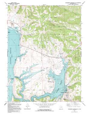
Strawberry Reservoir Ne Topo Map Utah
To zoom in, hover over the map of Strawberry Reservoir Ne
USGS Topo Quad 40111b1 - 1:24,000 scale
| Topo Map Name: | Strawberry Reservoir Ne |
| USGS Topo Quad ID: | 40111b1 |
| Print Size: | ca. 21 1/4" wide x 27" high |
| Southeast Coordinates: | 40.125° N latitude / 111° W longitude |
| Map Center Coordinates: | 40.1875° N latitude / 111.0625° W longitude |
| U.S. State: | UT |
| Filename: | o40111b1.jpg |
| Download Map JPG Image: | Strawberry Reservoir Ne topo map 1:24,000 scale |
| Map Type: | Topographic |
| Topo Series: | 7.5´ |
| Map Scale: | 1:24,000 |
| Source of Map Images: | United States Geological Survey (USGS) |
| Alternate Map Versions: |
Strawberry Reservoir NE UT 1966, updated 1968 Download PDF Buy paper map Strawberry Reservoir NE UT 1966, updated 1984 Download PDF Buy paper map Strawberry Reservoir NE UT 1994, updated 1994 Download PDF Buy paper map Strawberry Reservoir NE UT 1998, updated 2002 Download PDF Buy paper map Strawberry Reservoir NE UT 2011 Download PDF Buy paper map Strawberry Reservoir NE UT 2014 Download PDF Buy paper map |
| FStopo: | US Forest Service topo Strawberry Reservoir NE is available: Download FStopo PDF Download FStopo TIF |
1:24,000 Topo Quads surrounding Strawberry Reservoir Ne
> Back to 40111a1 at 1:100,000 scale
> Back to 40110a1 at 1:250,000 scale
> Back to U.S. Topo Maps home
Strawberry Reservoir Ne topo map: Gazetteer
Strawberry Reservoir Ne: Canals
Water Hollow Tunnel elevation 2745m 9005′Strawberry Reservoir Ne: Dams
Soldier Creek Dam elevation 2323m 7621′Strawberry Dam (historical) elevation 2309m 7575′
Strawberry Reservoir Ne: Parks
Soldier Creek Dam Day Use Area elevation 2321m 7614′Soldier Creek Recreation Complex elevation 2328m 7637′
Strawberry River Day Use Area elevation 2262m 7421′
Strawberry Reservoir Ne: Reservoirs
Soldier Creek Reservoir elevation 2309m 7575′Strawberry Reservoir elevation 2323m 7621′
Strawberry Reservoir Ne: Ridges
Windy Ridge elevation 2374m 7788′Strawberry Reservoir Ne: Springs
Chicken Spring elevation 2318m 7604′Soldier Springs elevation 2328m 7637′
Stinking Springs elevation 2309m 7575′
Strawberry Reservoir Ne: Streams
Chipman Creek elevation 2309m 7575′Sage Creek elevation 2309m 7575′
Soldier Creek elevation 2309m 7575′
Trout Creek elevation 2309m 7575′
Strawberry Reservoir Ne: Summits
Green Knoll elevation 2309m 7575′Island Mountain elevation 2480m 8136′
Square Top Mountain elevation 2797m 9176′
Strawberry Reservoir Ne: Trails
Soldier Creek Campground Loop Trail elevation 2442m 8011′Strawberry Reservoir Ne: Tunnels
West Portal Water Hollow Tunnel elevation 2315m 7595′Strawberry Reservoir Ne: Valleys
Badger Hollow elevation 2309m 7575′Coal Canyon elevation 2309m 7575′
Cow Hollow elevation 2309m 7575′
Pine Hollow elevation 2309m 7575′
Road Hollow elevation 2309m 7575′
The Narrows elevation 2309m 7575′
Strawberry Reservoir Ne digital topo map on disk
Buy this Strawberry Reservoir Ne topo map showing relief, roads, GPS coordinates and other geographical features, as a high-resolution digital map file on DVD:


