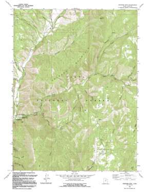
Granger Mountain Topo Map Utah
To zoom in, hover over the map of Granger Mountain
USGS Topo Quad 40111b4 - 1:24,000 scale
| Topo Map Name: | Granger Mountain |
| USGS Topo Quad ID: | 40111b4 |
| Print Size: | ca. 21 1/4" wide x 27" high |
| Southeast Coordinates: | 40.125° N latitude / 111.375° W longitude |
| Map Center Coordinates: | 40.1875° N latitude / 111.4375° W longitude |
| U.S. State: | UT |
| Filename: | o40111b4.jpg |
| Download Map JPG Image: | Granger Mountain topo map 1:24,000 scale |
| Map Type: | Topographic |
| Topo Series: | 7.5´ |
| Map Scale: | 1:24,000 |
| Source of Map Images: | United States Geological Survey (USGS) |
| Alternate Map Versions: |
Granger Mtn UT 1967, updated 1969 Download PDF Buy paper map Granger Mtn UT 1967, updated 1978 Download PDF Buy paper map Granger Mtn UT 1994, updated 1994 Download PDF Buy paper map Granger Mtn UT 1994, updated 1994 Download PDF Buy paper map Granger Mountain UT 1998, updated 2000 Download PDF Buy paper map Granger Mountain UT 2011 Download PDF Buy paper map Granger Mountain UT 2014 Download PDF Buy paper map |
| FStopo: | US Forest Service topo Granger Mountain is available: Download FStopo PDF Download FStopo TIF |
1:24,000 Topo Quads surrounding Granger Mountain
> Back to 40111a1 at 1:100,000 scale
> Back to 40110a1 at 1:250,000 scale
> Back to U.S. Topo Maps home
Granger Mountain topo map: Gazetteer
Granger Mountain: Basins
Wanrhodes Basin elevation 1886m 6187′Granger Mountain: Ridges
Grindstone Ridge elevation 2090m 6856′Granger Mountain: Streams
Packard Creek elevation 1882m 6174′Wardsworth Creek elevation 1923m 6309′
Granger Mountain: Summits
Granger Mountain elevation 2339m 7673′Red Pine Knoll elevation 2493m 8179′
Granger Mountain: Valleys
Bartholomew Canyon elevation 1660m 5446′Berryport Canyon elevation 1744m 5721′
Burnt Hollow elevation 1898m 6227′
Cedar Canyon elevation 1720m 5643′
Days Canyon elevation 1597m 5239′
Dry Canyon elevation 1754m 5754′
Granger Canyon elevation 1670m 5479′
Jux Canyon elevation 1900m 6233′
Kirkman Hollow elevation 1704m 5590′
Left Fork Days Canyon elevation 1782m 5846′
Pole Heaven elevation 1622m 5321′
Right Fork Days Canyon elevation 1780m 5839′
Right Fork Dry Canyon elevation 1795m 5889′
Whittemore Canyon elevation 1708m 5603′
Granger Mountain digital topo map on disk
Buy this Granger Mountain topo map showing relief, roads, GPS coordinates and other geographical features, as a high-resolution digital map file on DVD:


