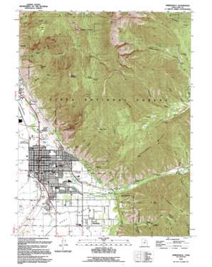
Springville Topo Map Utah
To zoom in, hover over the map of Springville
USGS Topo Quad 40111b5 - 1:24,000 scale
| Topo Map Name: | Springville |
| USGS Topo Quad ID: | 40111b5 |
| Print Size: | ca. 21 1/4" wide x 27" high |
| Southeast Coordinates: | 40.125° N latitude / 111.5° W longitude |
| Map Center Coordinates: | 40.1875° N latitude / 111.5625° W longitude |
| U.S. State: | UT |
| Filename: | o40111b5.jpg |
| Download Map JPG Image: | Springville topo map 1:24,000 scale |
| Map Type: | Topographic |
| Topo Series: | 7.5´ |
| Map Scale: | 1:24,000 |
| Source of Map Images: | United States Geological Survey (USGS) |
| Alternate Map Versions: |
Springville UT 1948, updated 1959 Download PDF Buy paper map Springville UT 1948, updated 1970 Download PDF Buy paper map Springville UT 1948, updated 1978 Download PDF Buy paper map Springville UT 1948, updated 1985 Download PDF Buy paper map Springville UT 1950 Download PDF Buy paper map Springville UT 1993, updated 1994 Download PDF Buy paper map Springville UT 1998, updated 2000 Download PDF Buy paper map Springville UT 2011 Download PDF Buy paper map Springville UT 2014 Download PDF Buy paper map |
| FStopo: | US Forest Service topo Springville is available: Download FStopo PDF Download FStopo TIF |
1:24,000 Topo Quads surrounding Springville
> Back to 40111a1 at 1:100,000 scale
> Back to 40110a1 at 1:250,000 scale
> Back to U.S. Topo Maps home
Springville topo map: Gazetteer
Springville: Basins
Kolob Basin elevation 2340m 7677′Springville: Flats
Maple Flat elevation 2366m 7762′Springville: Gaps
Camel Pass elevation 2375m 7791′Springville: Lakes
Burt Spring Pond elevation 1465m 4806′Springville: Populated Places
Ironton elevation 1391m 4563′Mapleton elevation 1442m 4730′
Springville elevation 1396m 4580′
Wagon Wheel Trailer Park elevation 1398m 4586′
Springville: Post Offices
Springville Post Office elevation 1398m 4586′Springville: Ridges
Grindstone Ridge elevation 2097m 6879′Twin Ridges elevation 1976m 6482′
Springville: Springs
Boardman Spring elevation 2170m 7119′Clyde Spring elevation 1427m 4681′
Cold Spring elevation 2476m 8123′
Fullmer Spring elevation 1426m 4678′
Hathenbrook Spring elevation 1596m 5236′
Knight Spring elevation 2392m 7847′
Konold Spring elevation 1473m 4832′
Osler Spring elevation 1463m 4799′
Wheeler Springs elevation 1427m 4681′
Springville: Streams
Left Fork Hobble Creek elevation 1538m 5045′Right Fork Hobble Creek elevation 1538m 5045′
Spring Creek elevation 1467m 4812′
Springville: Summits
Buckley Mountain elevation 2899m 9511′Corral Mountain elevation 3177m 10423′
Ether Peak elevation 2291m 7516′
Horse Mountain elevation 2636m 8648′
Powerhouse Mountain elevation 2426m 7959′
Provo Peak elevation 3355m 11007′
Rattlesnake Point elevation 1688m 5538′
Round Peak elevation 1687m 5534′
Three Sisters elevation 2047m 6715′
Toad Head elevation 2237m 7339′
Springville: Valleys
Buckley Draw elevation 1447m 4747′Deadmans Hollow elevation 1506m 4940′
Dibbles Canyon elevation 1870m 6135′
Ether Hollow elevation 1495m 4904′
Grindstone Canyon elevation 1537m 5042′
Jennings Hollow elevation 1766m 5793′
Lions Canyon elevation 1561m 5121′
Little Rock Canyon elevation 1381m 4530′
Magpie Hollow elevation 1591m 5219′
Maple Canyon elevation 1499m 4917′
Maple Slide Canyon elevation 1631m 5351′
Right Fork Maple Canyon elevation 1721m 5646′
Serviceberry Hollow elevation 1592m 5223′
Snowslide Canyon elevation 1718m 5636′
Spillway Hollow elevation 1536m 5039′
Water Hollow elevation 1681m 5515′
Springville digital topo map on disk
Buy this Springville topo map showing relief, roads, GPS coordinates and other geographical features, as a high-resolution digital map file on DVD:


