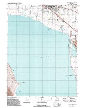
Pelican Point Topo Map Utah
To zoom in, hover over the map of Pelican Point
USGS Topo Quad 40111c7 - 1:24,000 scale
| Topo Map Name: | Pelican Point |
| USGS Topo Quad ID: | 40111c7 |
| Print Size: | ca. 21 1/4" wide x 27" high |
| Southeast Coordinates: | 40.25° N latitude / 111.75° W longitude |
| Map Center Coordinates: | 40.3125° N latitude / 111.8125° W longitude |
| U.S. State: | UT |
| Filename: | o40111c7.jpg |
| Download Map JPG Image: | Pelican Point topo map 1:24,000 scale |
| Map Type: | Topographic |
| Topo Series: | 7.5´ |
| Map Scale: | 1:24,000 |
| Source of Map Images: | United States Geological Survey (USGS) |
| Alternate Map Versions: |
Pelican Point UT 1950, updated 1958 Download PDF Buy paper map Pelican Point UT 1950, updated 1970 Download PDF Buy paper map Pelican Point UT 1950, updated 1978 Download PDF Buy paper map Pelican Point UT 1951 Download PDF Buy paper map Pelican Point UT 1992, updated 1992 Download PDF Buy paper map Pelican Point UT 1999, updated 2001 Download PDF Buy paper map Pelican Point UT 2011 Download PDF Buy paper map Pelican Point UT 2014 Download PDF Buy paper map |
1:24,000 Topo Quads surrounding Pelican Point
> Back to 40111a1 at 1:100,000 scale
> Back to 40110a1 at 1:250,000 scale
> Back to U.S. Topo Maps home
Pelican Point topo map: Gazetteer
Pelican Point: Canals
Utah Lake District Canal elevation 1370m 4494′Pelican Point: Capes
Goose Point elevation 1370m 4494′Jumbers Point elevation 1370m 4494′
Pelican Point elevation 1370m 4494′
Pelican Point: Crossings
Interchange 279 elevation 1389m 4557′Pelican Point: Dams
U S Steel Corporation Dam elevation 1380m 4527′Pelican Point: Populated Places
Wing elevation 1379m 4524′Pelican Point: Post Offices
Draper Post Office elevation 1370m 4494′Pelican Point: Reservoirs
U S Steel Corporation Reservoir elevation 1380m 4527′Pelican Point: Streams
American Fork elevation 1370m 4494′Spring Creek elevation 1370m 4494′
Pelican Point digital topo map on disk
Buy this Pelican Point topo map showing relief, roads, GPS coordinates and other geographical features, as a high-resolution digital map file on DVD:


