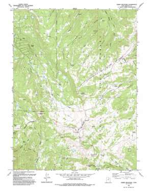
Heber Mountain Topo Map Utah
To zoom in, hover over the map of Heber Mountain
USGS Topo Quad 40111d2 - 1:24,000 scale
| Topo Map Name: | Heber Mountain |
| USGS Topo Quad ID: | 40111d2 |
| Print Size: | ca. 21 1/4" wide x 27" high |
| Southeast Coordinates: | 40.375° N latitude / 111.125° W longitude |
| Map Center Coordinates: | 40.4375° N latitude / 111.1875° W longitude |
| U.S. State: | UT |
| Filename: | o40111d2.jpg |
| Download Map JPG Image: | Heber Mountain topo map 1:24,000 scale |
| Map Type: | Topographic |
| Topo Series: | 7.5´ |
| Map Scale: | 1:24,000 |
| Source of Map Images: | United States Geological Survey (USGS) |
| Alternate Map Versions: |
Heber Mountain UT 1967, updated 1969 Download PDF Buy paper map Heber Mountain UT 1967, updated 1987 Download PDF Buy paper map Heber Mountain UT 1993, updated 1993 Download PDF Buy paper map Heber Mountain UT 1998, updated 2002 Download PDF Buy paper map Heber Mountain UT 2011 Download PDF Buy paper map Heber Mountain UT 2014 Download PDF Buy paper map |
| FStopo: | US Forest Service topo Heber Mountain is available: Download FStopo PDF Download FStopo TIF |
1:24,000 Topo Quads surrounding Heber Mountain
> Back to 40111a1 at 1:100,000 scale
> Back to 40110a1 at 1:250,000 scale
> Back to U.S. Topo Maps home
Heber Mountain topo map: Gazetteer
Heber Mountain: Basins
Buck Basin elevation 2834m 9297′Roundy Basin elevation 2994m 9822′
Heber Mountain: Dams
Center Creek Number Five Dam elevation 2833m 9294′Dee Mills Dam elevation 2823m 9261′
Heber Mountain: Flats
Harvey Meadow elevation 2854m 9363′Heber Mountain: Populated Places
Timber Lakes elevation 2352m 7716′Heber Mountain: Reservoirs
Center Creek Number Five Reservoir elevation 2833m 9294′Dee Mills Reservoir elevation 2823m 9261′
Heber Mountain: Ridges
Buck Hollow Ridge elevation 2784m 9133′Heber Mountain: Springs
Indian Spring elevation 2924m 9593′Mair Spring elevation 2831m 9288′
Heber Mountain: Streams
Lake Fork elevation 2686m 8812′Heber Mountain: Summits
Bald Knoll elevation 3075m 10088′Currant Creek Peak elevation 3177m 10423′
Heber Mountain elevation 3114m 10216′
Heber Mountain: Valleys
Bear Hollow elevation 2500m 8202′Bellows Hollow elevation 2608m 8556′
Dip Vat Hollow elevation 2497m 8192′
Trail Hollow elevation 2671m 8763′
Wide Hollow elevation 2622m 8602′
Heber Mountain digital topo map on disk
Buy this Heber Mountain topo map showing relief, roads, GPS coordinates and other geographical features, as a high-resolution digital map file on DVD:


