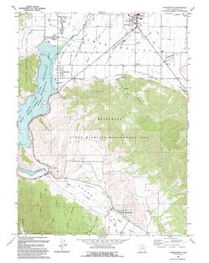
Charleston Topo Map Utah
To zoom in, hover over the map of Charleston
USGS Topo Quad 40111d4 - 1:24,000 scale
| Topo Map Name: | Charleston |
| USGS Topo Quad ID: | 40111d4 |
| Print Size: | ca. 21 1/4" wide x 27" high |
| Southeast Coordinates: | 40.375° N latitude / 111.375° W longitude |
| Map Center Coordinates: | 40.4375° N latitude / 111.4375° W longitude |
| U.S. State: | UT |
| Filename: | o40111d4.jpg |
| Download Map JPG Image: | Charleston topo map 1:24,000 scale |
| Map Type: | Topographic |
| Topo Series: | 7.5´ |
| Map Scale: | 1:24,000 |
| Source of Map Images: | United States Geological Survey (USGS) |
| Alternate Map Versions: |
Charleston UT 1966, updated 1969 Download PDF Buy paper map Charleston UT 1993, updated 1993 Download PDF Buy paper map Charleston UT 1998, updated 2000 Download PDF Buy paper map Charleston UT 2011 Download PDF Buy paper map Charleston UT 2014 Download PDF Buy paper map |
| FStopo: | US Forest Service topo Charleston is available: Download FStopo PDF Download FStopo TIF |
1:24,000 Topo Quads surrounding Charleston
> Back to 40111a1 at 1:100,000 scale
> Back to 40110a1 at 1:250,000 scale
> Back to U.S. Topo Maps home
Charleston topo map: Gazetteer
Charleston: Airports
Heber City Airport elevation 1711m 5613′Charleston: Canals
Humbug Canal elevation 1732m 5682′Lower Charleston Canal elevation 1660m 5446′
North Ditch elevation 1717m 5633′
Sagebrush and Spring Creek Canal elevation 1688m 5538′
Upper Charleston Canal elevation 1671m 5482′
Charleston: Parks
Wallsburg Wildlife Management Area elevation 1950m 6397′Charleston: Populated Places
Charleston elevation 1658m 5439′Daniel elevation 1742m 5715′
Wallsburg elevation 1730m 5675′
Charleston: Post Offices
Wallsburg Post Office elevation 1737m 5698′Charleston: Streams
Daniels Creek elevation 1653m 5423′Little Hobble Creek elevation 1713m 5620′
Main Creek elevation 1652m 5419′
Snake Creek elevation 1657m 5436′
Spring Creek elevation 1667m 5469′
Spring Creek elevation 1673m 5488′
Charleston: Valleys
Big Hollow elevation 1728m 5669′Billy Haws Canyon elevation 1710m 5610′
Hanks Canyon elevation 1687m 5534′
Heber Valley elevation 1663m 5456′
Owens Canyon elevation 1687m 5534′
Round Valley elevation 1672m 5485′
Sams Canyon elevation 1687m 5534′
Charleston digital topo map on disk
Buy this Charleston topo map showing relief, roads, GPS coordinates and other geographical features, as a high-resolution digital map file on DVD:


