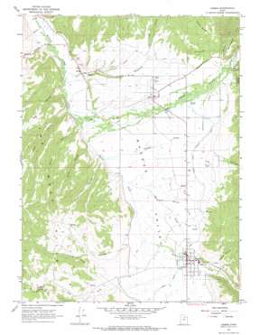
Kamas Topo Map Utah
To zoom in, hover over the map of Kamas
USGS Topo Quad 40111f3 - 1:24,000 scale
| Topo Map Name: | Kamas |
| USGS Topo Quad ID: | 40111f3 |
| Print Size: | ca. 21 1/4" wide x 27" high |
| Southeast Coordinates: | 40.625° N latitude / 111.25° W longitude |
| Map Center Coordinates: | 40.6875° N latitude / 111.3125° W longitude |
| U.S. State: | UT |
| Filename: | o40111f3.jpg |
| Download Map JPG Image: | Kamas topo map 1:24,000 scale |
| Map Type: | Topographic |
| Topo Series: | 7.5´ |
| Map Scale: | 1:24,000 |
| Source of Map Images: | United States Geological Survey (USGS) |
| Alternate Map Versions: |
Kamas UT 1967, updated 1969 Download PDF Buy paper map Kamas UT 1967, updated 1969 Download PDF Buy paper map Kamas UT 1998, updated 2001 Download PDF Buy paper map Kamas UT 2011 Download PDF Buy paper map Kamas UT 2014 Download PDF Buy paper map |
| FStopo: | US Forest Service topo Kamas is available: Download FStopo PDF Download FStopo TIF |
1:24,000 Topo Quads surrounding Kamas
> Back to 40111e1 at 1:100,000 scale
> Back to 40110a1 at 1:250,000 scale
> Back to U.S. Topo Maps home
Kamas topo map: Gazetteer
Kamas: Canals
Boulderville Ditch elevation 1983m 6505′Weber Provo Diversion Canal elevation 1977m 6486′
Kamas: Populated Places
Kamas elevation 1977m 6486′Marion elevation 1963m 6440′
Oakley elevation 1961m 6433′
Peoa elevation 1887m 6190′
Kamas: Post Offices
Kamas Post Office elevation 1973m 6473′Kamas: Ranges
The West Hills elevation 2313m 7588′Kamas: Ridges
Maple Ridge elevation 2315m 7595′Kamas: Streams
Beaver Creek elevation 1904m 6246′City Creek elevation 1936m 6351′
Crooked Creek elevation 1914m 6279′
Fort Creek elevation 1876m 6154′
Rasmussen Creek elevation 1917m 6289′
Spring Creek elevation 1933m 6341′
Thorn Creek elevation 1921m 6302′
Whites Creek elevation 2005m 6578′
Kamas: Valleys
Big Hollow elevation 1889m 6197′Browns Canyon elevation 1871m 6138′
Elder Hollow elevation 2013m 6604′
Hoyt Canyon elevation 2026m 6646′
Indian Hollow elevation 1946m 6384′
Jensen Hollow elevation 1905m 6250′
Kamas Valley elevation 1880m 6167′
Log Hollow elevation 2025m 6643′
Miles Hollow elevation 1922m 6305′
Neel Hollow elevation 1901m 6236′
Pinon Canyon elevation 2026m 6646′
Rock Hollow elevation 1924m 6312′
Seymour Canyon elevation 2023m 6637′
Kamas digital topo map on disk
Buy this Kamas topo map showing relief, roads, GPS coordinates and other geographical features, as a high-resolution digital map file on DVD:


