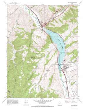
Coalville Topo Map Utah
To zoom in, hover over the map of Coalville
USGS Topo Quad 40111h4 - 1:24,000 scale
| Topo Map Name: | Coalville |
| USGS Topo Quad ID: | 40111h4 |
| Print Size: | ca. 21 1/4" wide x 27" high |
| Southeast Coordinates: | 40.875° N latitude / 111.375° W longitude |
| Map Center Coordinates: | 40.9375° N latitude / 111.4375° W longitude |
| U.S. State: | UT |
| Filename: | o40111h4.jpg |
| Download Map JPG Image: | Coalville topo map 1:24,000 scale |
| Map Type: | Topographic |
| Topo Series: | 7.5´ |
| Map Scale: | 1:24,000 |
| Source of Map Images: | United States Geological Survey (USGS) |
| Alternate Map Versions: |
Coalville UT 1967, updated 1970 Download PDF Buy paper map Coalville UT 1997, updated 2001 Download PDF Buy paper map Coalville UT 2011 Download PDF Buy paper map Coalville UT 2014 Download PDF Buy paper map |
1:24,000 Topo Quads surrounding Coalville
> Back to 40111e1 at 1:100,000 scale
> Back to 40110a1 at 1:250,000 scale
> Back to U.S. Topo Maps home
Coalville topo map: Gazetteer
Coalville: Airports
Knight Hawk Helicopter Service elevation 1800m 5905′Summit County Hospital Heliport elevation 1698m 5570′
Coalville: Cliffs
Witch Rocks elevation 1836m 6023′Coalville: Dams
Echo Dam elevation 1700m 5577′Coalville: Populated Places
Coalville elevation 1700m 5577′Echo elevation 1665m 5462′
Echo Resort elevation 1709m 5606′
Coalville: Post Offices
Coalville Post Office elevation 1702m 5583′Coalville: Reservoirs
Echo Reservoir elevation 1696m 5564′Coalville: Springs
Beckwith Spring elevation 1738m 5702′Hayes Spring elevation 1707m 5600′
Coalville: Streams
Chalk Creek elevation 1696m 5564′Echo Creek elevation 1665m 5462′
Grass Creek elevation 1696m 5564′
Spring Creek elevation 1754m 5754′
Coalville: Valleys
Allen Hollow elevation 1718m 5636′Bachelor Canyon elevation 1657m 5436′
Bell Hollow elevation 1780m 5839′
Bromleys Canyon elevation 1674m 5492′
Carruth Canyon elevation 1707m 5600′
Cedar Hollow elevation 1732m 5682′
Dexter Hollow elevation 1724m 5656′
Dry Fork Franklin Canyon elevation 1917m 6289′
Dry Hollow elevation 1713m 5620′
Echo Canyon elevation 1666m 5465′
Franklin Canyon elevation 1651m 5416′
Grass Valley Canyon elevation 1696m 5564′
Leonards Canyon elevation 1668m 5472′
Lewis Canyon elevation 1700m 5577′
Mill Canyon elevation 1941m 6368′
Narrows Canyon elevation 1751m 5744′
Narrows Hollow elevation 1767m 5797′
Red Rock Canyon elevation 1796m 5892′
Right Fork Franklin Canyon elevation 1803m 5915′
Spring Canyon elevation 1757m 5764′
Spring Hollow elevation 1735m 5692′
Tom Harris Hollow elevation 1763m 5784′
Coalville digital topo map on disk
Buy this Coalville topo map showing relief, roads, GPS coordinates and other geographical features, as a high-resolution digital map file on DVD:


