Vernon Ne Topo Map Utah
To zoom in, hover over the map of Vernon Ne
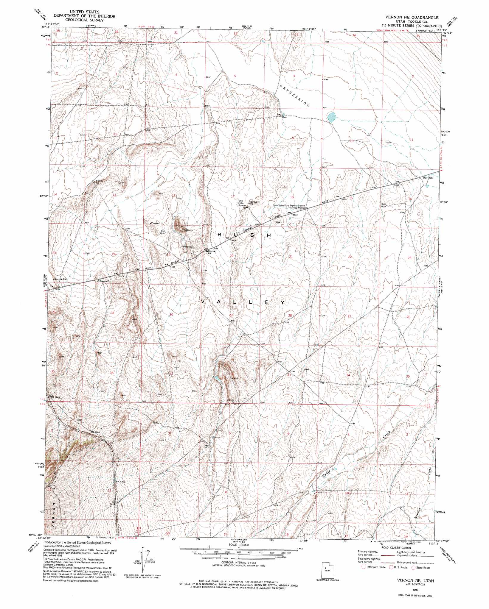
USGS Topo Quad 40112b3 - 1:24,000 scale
| Topo Map Name: | Vernon Ne |
| USGS Topo Quad ID: | 40112b3 |
| Print Size: | ca. 21 1/4" wide x 27" high |
| Southeast Coordinates: | 40.125° N latitude / 112.25° W longitude |
| Map Center Coordinates: | 40.1875° N latitude / 112.3125° W longitude |
| U.S. State: | UT |
| Filename: | o40112b3.jpg |
| Download Map JPG Image: | Vernon Ne topo map 1:24,000 scale |
| Map Type: | Topographic |
| Topo Series: | 7.5´ |
| Map Scale: | 1:24,000 |
| Source of Map Images: | United States Geological Survey (USGS) |
| Alternate Map Versions: |
Vernon NE UT 1971, updated 1974 Download PDF Buy paper map Vernon NE UT 1993, updated 1993 Download PDF Buy paper map Vernon NE UT 2011 Download PDF Buy paper map Vernon NE UT 2014 Download PDF Buy paper map |
1:24,000 Topo Quads surrounding Vernon Ne
Deseret Peak East |
South Mountain |
Stockton |
Lowe Peak |
Tickville Spring |
Johnson Pass |
Saint John |
Ophir |
Mercur |
Cedar Fort |
Onaqui Mountains South |
Faust |
Vernon Ne |
Fivemile Pass |
Goshen Pass |
Lookout Pass |
Vernon |
Lofgreen |
Boulter Peak |
Allens Ranch |
Erickson Knoll |
Dutch Peak |
Sabie Mountain |
Tintic Junction |
Eureka |
> Back to 40112a1 at 1:100,000 scale
> Back to 40112a1 at 1:250,000 scale
> Back to U.S. Topo Maps home
No gazetteer data is available for the Vernon Ne topo map sheet.
Vernon Ne digital topo map on disk
Buy this Vernon Ne topo map showing relief, roads, GPS coordinates and other geographical features, as a high-resolution digital map file on DVD: