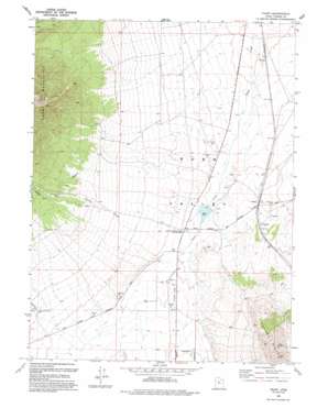
Faust Topo Map Utah
To zoom in, hover over the map of Faust
USGS Topo Quad 40112b4 - 1:24,000 scale
| Topo Map Name: | Faust |
| USGS Topo Quad ID: | 40112b4 |
| Print Size: | ca. 21 1/4" wide x 27" high |
| Southeast Coordinates: | 40.125° N latitude / 112.375° W longitude |
| Map Center Coordinates: | 40.1875° N latitude / 112.4375° W longitude |
| U.S. State: | UT |
| Filename: | o40112b4.jpg |
| Download Map JPG Image: | Faust topo map 1:24,000 scale |
| Map Type: | Topographic |
| Topo Series: | 7.5´ |
| Map Scale: | 1:24,000 |
| Source of Map Images: | United States Geological Survey (USGS) |
| Alternate Map Versions: |
Faust UT 1971, updated 1974 Download PDF Buy paper map Faust UT 1993, updated 1993 Download PDF Buy paper map Faust UT 2011 Download PDF Buy paper map Faust UT 2014 Download PDF Buy paper map |
1:24,000 Topo Quads surrounding Faust
> Back to 40112a1 at 1:100,000 scale
> Back to 40112a1 at 1:250,000 scale
> Back to U.S. Topo Maps home
Faust topo map: Gazetteer
Faust: Dams
Atherley Dam elevation 1589m 5213′Faust: Parks
Historical Marker Faust Pony Express Station elevation 1603m 5259′Faust: Populated Places
Faust elevation 1602m 5255′Faust: Ranges
Vernon Hills elevation 1793m 5882′Faust: Reservoirs
Atherley Reservoir elevation 1589m 5213′Faust: Streams
East Faust Creek elevation 1618m 5308′Faust: Valleys
Hellhole Canyon elevation 1733m 5685′Faust: Wells
Lookout Pass Trail elevation 1668m 5472′Faust digital topo map on disk
Buy this Faust topo map showing relief, roads, GPS coordinates and other geographical features, as a high-resolution digital map file on DVD:


