Cedar Fort Topo Map Utah
To zoom in, hover over the map of Cedar Fort
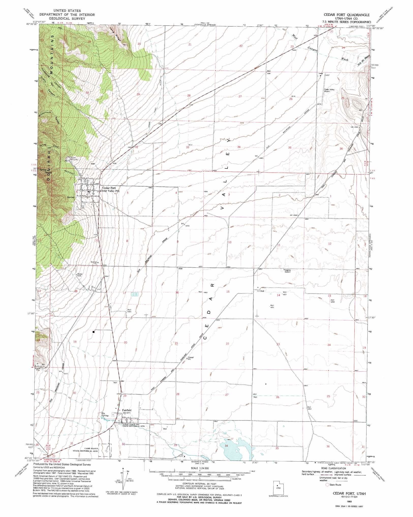
USGS Topo Quad 40112c1 - 1:24,000 scale
| Topo Map Name: | Cedar Fort |
| USGS Topo Quad ID: | 40112c1 |
| Print Size: | ca. 21 1/4" wide x 27" high |
| Southeast Coordinates: | 40.25° N latitude / 112° W longitude |
| Map Center Coordinates: | 40.3125° N latitude / 112.0625° W longitude |
| U.S. State: | UT |
| Filename: | o40112c1.jpg |
| Download Map JPG Image: | Cedar Fort topo map 1:24,000 scale |
| Map Type: | Topographic |
| Topo Series: | 7.5´ |
| Map Scale: | 1:24,000 |
| Source of Map Images: | United States Geological Survey (USGS) |
| Alternate Map Versions: |
Cedar Fort UT 1968, updated 1970 Download PDF Buy paper map Cedar Fort UT 1975, updated 1986 Download PDF Buy paper map Cedar Fort UT 1993, updated 1993 Download PDF Buy paper map Cedar Fort UT 1997, updated 2001 Download PDF Buy paper map Cedar Fort UT 2011 Download PDF Buy paper map Cedar Fort UT 2014 Download PDF Buy paper map |
1:24,000 Topo Quads surrounding Cedar Fort
Tooele |
Bingham Canyon |
Lark |
Midvale |
Draper |
Stockton |
Lowe Peak |
Tickville Spring |
Jordan Narrows |
Lehi |
Ophir |
Mercur |
Cedar Fort |
Saratoga Springs |
Pelican Point |
Vernon Ne |
Fivemile Pass |
Goshen Pass |
Soldiers Pass |
Lincoln Point |
Lofgreen |
Boulter Peak |
Allens Ranch |
Goshen Valley North |
West Mountain |
> Back to 40112a1 at 1:100,000 scale
> Back to 40112a1 at 1:250,000 scale
> Back to U.S. Topo Maps home
Cedar Fort topo map: Gazetteer
Cedar Fort: Airports
Cedar Valley Airport elevation 1527m 5009′Cedar Fort: Populated Places
Cedar Fort elevation 1550m 5085′Eagle Mountain elevation 1488m 4881′
Fairfield elevation 1487m 4878′
Cedar Fort: Post Offices
Cedar Valley Post Office elevation 1550m 5085′Cedar Fort: Springs
Big Spring elevation 1494m 4901′Cedar Fort: Streams
Spring Creek elevation 1583m 5193′Cedar Fort: Valleys
Broadmouth Canyon elevation 1555m 5101′Crafts Canyon elevation 1554m 5098′
Threemile Canyon elevation 1554m 5098′
Cedar Fort digital topo map on disk
Buy this Cedar Fort topo map showing relief, roads, GPS coordinates and other geographical features, as a high-resolution digital map file on DVD: