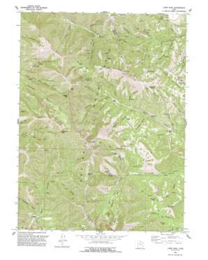
Lowe Peak Topo Map Utah
To zoom in, hover over the map of Lowe Peak
USGS Topo Quad 40112d2 - 1:24,000 scale
| Topo Map Name: | Lowe Peak |
| USGS Topo Quad ID: | 40112d2 |
| Print Size: | ca. 21 1/4" wide x 27" high |
| Southeast Coordinates: | 40.375° N latitude / 112.125° W longitude |
| Map Center Coordinates: | 40.4375° N latitude / 112.1875° W longitude |
| U.S. State: | UT |
| Filename: | o40112d2.jpg |
| Download Map JPG Image: | Lowe Peak topo map 1:24,000 scale |
| Map Type: | Topographic |
| Topo Series: | 7.5´ |
| Map Scale: | 1:24,000 |
| Source of Map Images: | United States Geological Survey (USGS) |
| Alternate Map Versions: |
Lowe Peak UT 1968, updated 1971 Download PDF Buy paper map Lowe Peak UT 1993, updated 1993 Download PDF Buy paper map Lowe Peak UT 1997, updated 2002 Download PDF Buy paper map Lowe Peak UT 2011 Download PDF Buy paper map Lowe Peak UT 2014 Download PDF Buy paper map |
1:24,000 Topo Quads surrounding Lowe Peak
> Back to 40112a1 at 1:100,000 scale
> Back to 40112a1 at 1:250,000 scale
> Back to U.S. Topo Maps home
Lowe Peak topo map: Gazetteer
Lowe Peak: Basins
Big Hole elevation 2672m 8766′Halls Basin elevation 2713m 8900′
Lowe Basin elevation 2755m 9038′
Lowe Peak: Flats
Farmers Flat elevation 1867m 6125′Maple Flat elevation 2137m 7011′
Mill Flat elevation 2098m 6883′
White Pine Flat elevation 2494m 8182′
Lowe Peak: Gaps
Dead Ox Pass elevation 2809m 9215′Piney Pass elevation 3013m 9885′
Lowe Peak: Mines
Old Mayflower Mine elevation 2165m 7103′Queen Mine elevation 2155m 7070′
Lowe Peak: Ridges
Sheep Ridge elevation 2276m 7467′Lowe Peak: Springs
Cold Spring elevation 2330m 7644′Cottonwood Spring elevation 1955m 6414′
Fourmile Spring elevation 2120m 6955′
Government Spring elevation 2415m 7923′
Iron Spring elevation 2295m 7529′
Lowe Spring elevation 2389m 7837′
Pollywog Spring elevation 2138m 7014′
Rattlesnake Spring elevation 2169m 7116′
Rock Spring elevation 2379m 7805′
Lowe Peak: Summits
Bald Knoll elevation 2284m 7493′Breccia Knob elevation 2206m 7237′
Butterfield Peaks elevation 2814m 9232′
Kelsey Peak elevation 3162m 10374′
Lowe Peak elevation 3216m 10551′
Rocky Peak elevation 3118m 10229′
The Jumpoff elevation 2455m 8054′
West Mountain elevation 2733m 8966′
Lowe Peak: Tunnels
Utah Metal Company Tunnel elevation 2154m 7066′Lowe Peak: Valleys
Bear Gulch elevation 2129m 6984′Bishop Fork elevation 2137m 7011′
Blackjack Gulch elevation 1885m 6184′
Bone Canyon elevation 1853m 6079′
Chandler Fork elevation 2129m 6984′
Cottonwood Canyon elevation 1941m 6368′
Crooked Canyon elevation 2024m 6640′
Fox Hollow elevation 2117m 6945′
Harkers Canyon elevation 1972m 6469′
Iron Canyon elevation 1865m 6118′
Jackson Hollow elevation 2118m 6948′
Left Hand Fork Butterfield Canyon elevation 1992m 6535′
Left Hand Fork Soldier Canyon elevation 2379m 7805′
Lowe Canyon elevation 2098m 6883′
Maple Canyon elevation 2020m 6627′
Mill Canyon elevation 2085m 6840′
Monkins Hollow elevation 1878m 6161′
Picnic Canyon elevation 2247m 7372′
Right Hand Fork Soldier Canyon elevation 2376m 7795′
Serviceberry Canyon elevation 2058m 6751′
Shingle Gulch elevation 2044m 6706′
South Fork Ophir Canyon elevation 2047m 6715′
Spring Gulch elevation 1986m 6515′
Stockings Fork elevation 1884m 6181′
Tie Fork elevation 2186m 7171′
Tooele Fork elevation 1984m 6509′
White Pine Canyon elevation 2079m 6820′
Lowe Peak digital topo map on disk
Buy this Lowe Peak topo map showing relief, roads, GPS coordinates and other geographical features, as a high-resolution digital map file on DVD:


