South Mountain Topo Map Utah
To zoom in, hover over the map of South Mountain
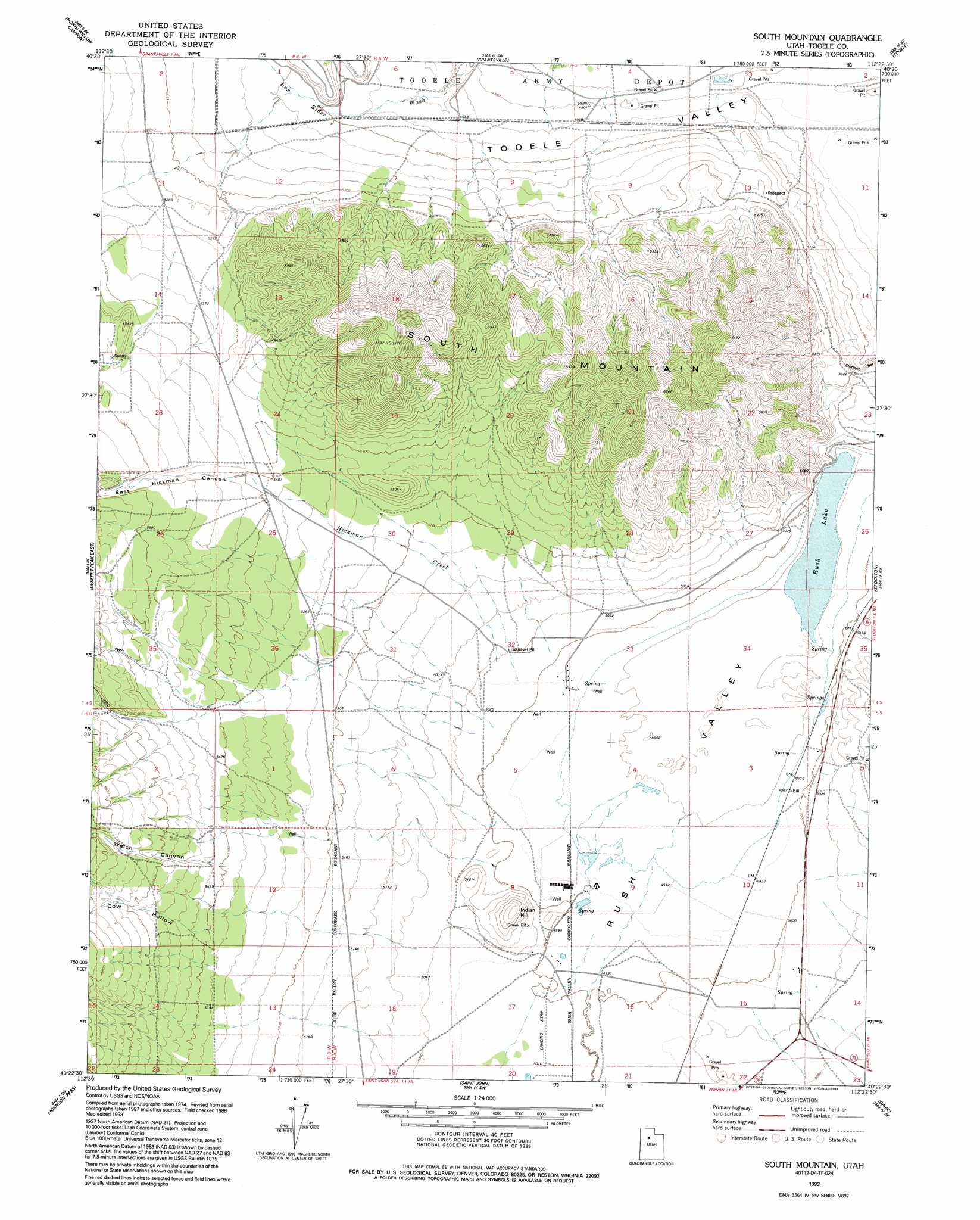
USGS Topo Quad 40112d4 - 1:24,000 scale
| Topo Map Name: | South Mountain |
| USGS Topo Quad ID: | 40112d4 |
| Print Size: | ca. 21 1/4" wide x 27" high |
| Southeast Coordinates: | 40.375° N latitude / 112.375° W longitude |
| Map Center Coordinates: | 40.4375° N latitude / 112.4375° W longitude |
| U.S. State: | UT |
| Filename: | o40112d4.jpg |
| Download Map JPG Image: | South Mountain topo map 1:24,000 scale |
| Map Type: | Topographic |
| Topo Series: | 7.5´ |
| Map Scale: | 1:24,000 |
| Source of Map Images: | United States Geological Survey (USGS) |
| Alternate Map Versions: |
South Mountain UT 1980, updated 1980 Download PDF Buy paper map South Mountain UT 1980, updated 1986 Download PDF Buy paper map South Mountain UT 1993, updated 1993 Download PDF Buy paper map South Mountain UT 2011 Download PDF Buy paper map South Mountain UT 2014 Download PDF Buy paper map |
1:24,000 Topo Quads surrounding South Mountain
Timpie |
Flux |
Burmester |
Mills Junction |
Farnsworth Peak |
Salt Mountain |
North Willow Canyon |
Grantsville |
Tooele |
Bingham Canyon |
Deseret Peak West |
Deseret Peak East |
South Mountain |
Stockton |
Lowe Peak |
Terra |
Johnson Pass |
Saint John |
Ophir |
Mercur |
Davis Knolls |
Onaqui Mountains South |
Faust |
Vernon Ne |
Fivemile Pass |
> Back to 40112a1 at 1:100,000 scale
> Back to 40112a1 at 1:250,000 scale
> Back to U.S. Topo Maps home
South Mountain topo map: Gazetteer
South Mountain: Lakes
Rush Lake elevation 1509m 4950′South Mountain: Parks
Steptoe Historical Marker elevation 1529m 5016′South Mountain: Springs
Warm Spring elevation 1521m 4990′South Mountain: Streams
Clover Creek elevation 1516m 4973′Hickman Creek elevation 1537m 5042′
Soldier Creek elevation 1525m 5003′
South Mountain: Summits
Indian Hill elevation 1615m 5298′South Mountain elevation 1991m 6532′
South Mountain: Valleys
East Hickman Canyon elevation 1644m 5393′Rush Valley elevation 1514m 4967′
Soldier Canyon elevation 1525m 5003′
Welch Canyon elevation 1643m 5390′
South Mountain digital topo map on disk
Buy this South Mountain topo map showing relief, roads, GPS coordinates and other geographical features, as a high-resolution digital map file on DVD: