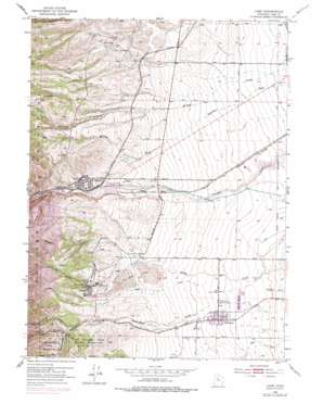
Lark Topo Map Utah
To zoom in, hover over the map of Lark
USGS Topo Quad 40112e1 - 1:24,000 scale
| Topo Map Name: | Lark |
| USGS Topo Quad ID: | 40112e1 |
| Print Size: | ca. 21 1/4" wide x 27" high |
| Southeast Coordinates: | 40.5° N latitude / 112° W longitude |
| Map Center Coordinates: | 40.5625° N latitude / 112.0625° W longitude |
| U.S. State: | UT |
| Filename: | o40112e1.jpg |
| Download Map JPG Image: | Lark topo map 1:24,000 scale |
| Map Type: | Topographic |
| Topo Series: | 7.5´ |
| Map Scale: | 1:24,000 |
| Source of Map Images: | United States Geological Survey (USGS) |
| Alternate Map Versions: |
Lark UT 1952, updated 1954 Download PDF Buy paper map Lark UT 1952, updated 1966 Download PDF Buy paper map Lark UT 1952, updated 1970 Download PDF Buy paper map Lark UT 1952, updated 1978 Download PDF Buy paper map Lark UT 1952, updated 1985 Download PDF Buy paper map Copperton UT 1999, updated 2001 Download PDF Buy paper map Copperton UT 2011 Download PDF Buy paper map Copperton UT 2014 Download PDF Buy paper map |
1:24,000 Topo Quads surrounding Lark
> Back to 40112e1 at 1:100,000 scale
> Back to 40112a1 at 1:250,000 scale
> Back to U.S. Topo Maps home
Lark topo map: Gazetteer
Lark: Airports
BP Minerals-Copperton Heliport elevation 1653m 5423′Lark: Basins
Clay Hollow elevation 1596m 5236′Lark: Canals
Cement Ditch elevation 1531m 5022′Mascotte Tunnel Ditch elevation 1592m 5223′
Lark: Dams
Bingham Creek Dam elevation 1617m 5305′Kennecott Eastside Leaching Dam elevation 1623m 5324′
Lark: Mines
Bingham Tunnel elevation 1683m 5521′Mascotte Tunnel elevation 1684m 5524′
Saint Joe Tunnel elevation 1854m 6082′
Lark: Parks
Fort Herriman Historical Marker elevation 1502m 4927′Lark: Populated Places
Copperton elevation 1665m 5462′Dalton elevation 1570m 5150′
Herriman elevation 1507m 4944′
Hi Country Estates elevation 1615m 5298′
Lark (historical) elevation 1689m 5541′
Robbe elevation 1577m 5173′
Snyder elevation 1610m 5282′
Lark: Reservoirs
Bingham Creek Reservoir elevation 1617m 5305′Kennecott Eastside Leaching Reservoir elevation 1623m 5324′
Lark: Springs
Bancroft Spring elevation 1787m 5862′Lark: Streams
Butterfield Creek elevation 1512m 4960′Copper Creek elevation 1518m 4980′
Lark: Summits
Twin Knolls elevation 1647m 5403′Lark: Valleys
Barneys Canyon elevation 1550m 5085′Bingham Canyon elevation 1672m 5485′
Butterfield Canyon elevation 1604m 5262′
Castro Gulch elevation 1764m 5787′
Copper Gulch elevation 1672m 5485′
Dry Canyon elevation 1632m 5354′
Keystone Gulch elevation 1630m 5347′
Midas Gulch elevation 1575m 5167′
Saints Rest Gulch elevation 1721m 5646′
Yosemite Gulch elevation 1707m 5600′
Lark digital topo map on disk
Buy this Lark topo map showing relief, roads, GPS coordinates and other geographical features, as a high-resolution digital map file on DVD:


