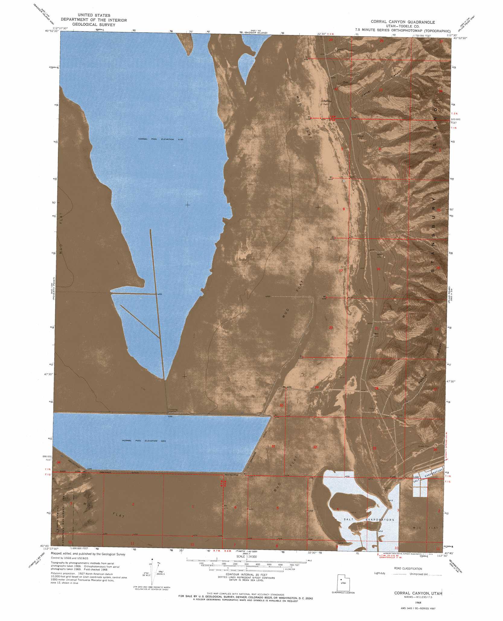
Corral Canyon Topo Map Utah
To zoom in, hover over the map of Corral Canyon
USGS Topo Quad 40112g5 - 1:24,000 scale
| Topo Map Name: | Corral Canyon |
| USGS Topo Quad ID: | 40112g5 |
| Print Size: | ca. 21 1/4" wide x 27" high |
| Southeast Coordinates: | 40.75° N latitude / 112.5° W longitude |
| Map Center Coordinates: | 40.8125° N latitude / 112.5625° W longitude |
| U.S. State: | UT |
| Filename: | p40112g5.jpg |
| Download Map JPG Image: | Corral Canyon topo map 1:24,000 scale |
| Map Type: | Orthophoto |
| Topo Series: | 7.5´ |
| Map Scale: | 1:24,000 |
| Source of Map Images: | United States Geological Survey (USGS) |
| Alternate Map Versions: |
Corral Canyon UT 1968, updated 1973 Download PDF Buy paper map Corral Canyon UT 2011 Download PDF Buy paper map Corral Canyon UT 2014 Download PDF Buy paper map |
1:24,000 Topo Quads surrounding Corral Canyon
Deardens Knoll |
Carrington Island Sw |
Carrington Island |
Fremont Island Sw |
Buffalo Point |
Craner Peak |
Badger Island Nw |
Badger Island |
Plug Peak Nw |
Plug Peak Ne |
Delle |
Poverty Point |
Corral Canyon |
Plug Peak |
Plug Peak Se |
Hastings Pass Ne |
Timpie |
Flux |
Burmester |
Mills Junction |
Hastings Pass Se |
Salt Mountain |
North Willow Canyon |
Grantsville |
Tooele |
> Back to 40112e1 at 1:100,000 scale
> Back to 40112a1 at 1:250,000 scale
> Back to U.S. Topo Maps home
Corral Canyon topo map: Gazetteer
Corral Canyon: Bars
Stansbury Island Bar elevation 1285m 4215′Corral Canyon: Bays
Stansbury Bay elevation 1279m 4196′Corral Canyon: Islands
Stansbury Island elevation 1703m 5587′Corral Canyon: Summits
The Dome elevation 2010m 6594′Corral Canyon: Valleys
Corral Canyon elevation 1293m 4242′Stansbury Gulch elevation 1305m 4281′
Tabbys Canyon elevation 1306m 4284′
Corral Canyon digital topo map on disk
Buy this Corral Canyon topo map showing relief, roads, GPS coordinates and other geographical features, as a high-resolution digital map file on DVD: