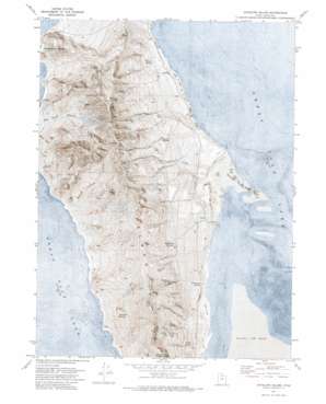
Antelope Island Topo Map Utah
To zoom in, hover over the map of Antelope Island
USGS Topo Quad 40112h2 - 1:24,000 scale
| Topo Map Name: | Antelope Island |
| USGS Topo Quad ID: | 40112h2 |
| Print Size: | ca. 21 1/4" wide x 27" high |
| Southeast Coordinates: | 40.875° N latitude / 112.125° W longitude |
| Map Center Coordinates: | 40.9375° N latitude / 112.1875° W longitude |
| U.S. State: | UT |
| Filename: | p40112h2.jpg |
| Download Map JPG Image: | Antelope Island topo map 1:24,000 scale |
| Map Type: | Orthophoto |
| Topo Series: | 7.5´ |
| Map Scale: | 1:24,000 |
| Source of Map Images: | United States Geological Survey (USGS) |
| Alternate Map Versions: |
Antelope Island UT 1954, updated 1956 Download PDF Buy paper map Antelope Island UT 1972, updated 1974 Download PDF Buy paper map Antelope Island UT 2011 Download PDF Buy paper map Antelope Island UT 2014 Download PDF Buy paper map |
1:24,000 Topo Quads surrounding Antelope Island
> Back to 40112e1 at 1:100,000 scale
> Back to 40112a1 at 1:250,000 scale
> Back to U.S. Topo Maps home
Antelope Island topo map: Gazetteer
Antelope Island: Bays
Split Rock Bay elevation 1279m 4196′Antelope Island: Capes
Sea Gull Point elevation 1283m 4209′Antelope Island: Islands
Antelope Island elevation 1618m 5308′Antelope Island: Ridges
Daddy Stump Ridge elevation 1646m 5400′Red Rocks elevation 1803m 5915′
Timely Gull Ridge elevation 1427m 4681′
Antelope Island: Springs
Blackburn Spring elevation 1433m 4701′Cedar Spring elevation 1467m 4812′
Dairy Springs elevation 1342m 4402′
Dooly Spring elevation 1401m 4596′
Freds Spring elevation 1321m 4333′
Mushroom Springs elevation 1411m 4629′
Porcupine Spring elevation 1288m 4225′
Westside Spring elevation 1328m 4356′
Antelope Island: Streams
Garden Creek elevation 1298m 4258′Antelope Island: Summits
Bamberger Hill elevation 1795m 5889′Dooly Knob elevation 1582m 5190′
Elephant Head elevation 1551m 5088′
Frary Peak elevation 2006m 6581′
Mormon Rocks elevation 1507m 4944′
Picture Rock elevation 1300m 4265′
Stringham Peak elevation 1934m 6345′
The Sentry elevation 1642m 5387′
Antelope Island: Valleys
Buffalo Scaffold Canyon elevation 1304m 4278′Dry Canyon elevation 1314m 4311′
Antelope Island digital topo map on disk
Buy this Antelope Island topo map showing relief, roads, GPS coordinates and other geographical features, as a high-resolution digital map file on DVD:


