Badger Island Topo Map Utah
To zoom in, hover over the map of Badger Island
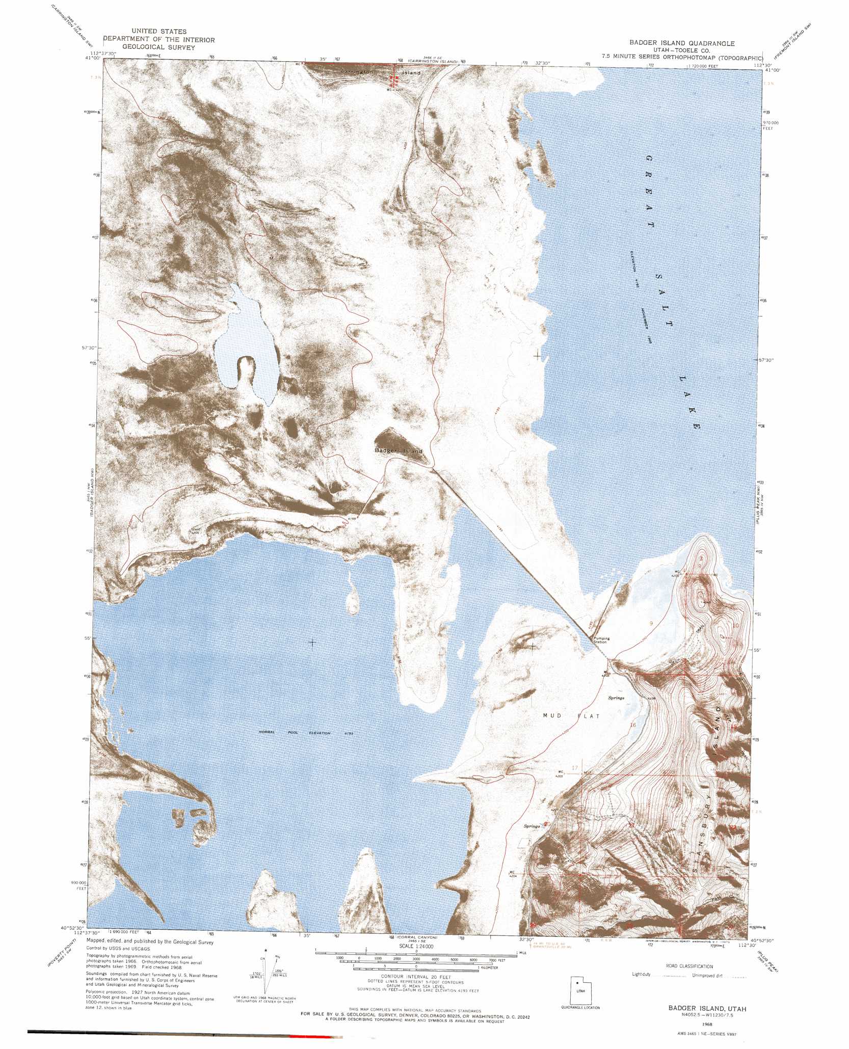
USGS Topo Quad 40112h5 - 1:24,000 scale
| Topo Map Name: | Badger Island |
| USGS Topo Quad ID: | 40112h5 |
| Print Size: | ca. 21 1/4" wide x 27" high |
| Southeast Coordinates: | 40.875° N latitude / 112.5° W longitude |
| Map Center Coordinates: | 40.9375° N latitude / 112.5625° W longitude |
| U.S. State: | UT |
| Filename: | p40112h5.jpg |
| Download Map JPG Image: | Badger Island topo map 1:24,000 scale |
| Map Type: | Orthophoto |
| Topo Series: | 7.5´ |
| Map Scale: | 1:24,000 |
| Source of Map Images: | United States Geological Survey (USGS) |
| Alternate Map Versions: |
Badger Island UT 1968, updated 1973 Download PDF Buy paper map Badger Island UT 2011 Download PDF Buy paper map Badger Island UT 2014 Download PDF Buy paper map |
1:24,000 Topo Quads surrounding Badger Island
Lakeside |
Carrington Island Nw |
Carrington Island Ne |
Promontory Point |
Fremont Island |
Deardens Knoll |
Carrington Island Sw |
Carrington Island |
Fremont Island Sw |
Buffalo Point |
Craner Peak |
Badger Island Nw |
Badger Island |
Plug Peak Nw |
Plug Peak Ne |
Delle |
Poverty Point |
Corral Canyon |
Plug Peak |
Plug Peak Se |
Hastings Pass Ne |
Timpie |
Flux |
Burmester |
Mills Junction |
> Back to 40112e1 at 1:100,000 scale
> Back to 40112a1 at 1:250,000 scale
> Back to U.S. Topo Maps home
Badger Island topo map: Gazetteer
Badger Island: Bays
Crystal Bay elevation 1279m 4196′Gilbert Bay elevation 1280m 4199′
SAC Bay elevation 1279m 4196′
Sandy Beach Bay elevation 1279m 4196′
Badger Island: Capes
Boulder Point elevation 1282m 4206′Badger Island: Islands
Badger Island elevation 1283m 4209′Badger Island: Summits
Adams Peak elevation 1839m 6033′Badger Island digital topo map on disk
Buy this Badger Island topo map showing relief, roads, GPS coordinates and other geographical features, as a high-resolution digital map file on DVD: