Ibapah Topo Map Utah
To zoom in, hover over the map of Ibapah
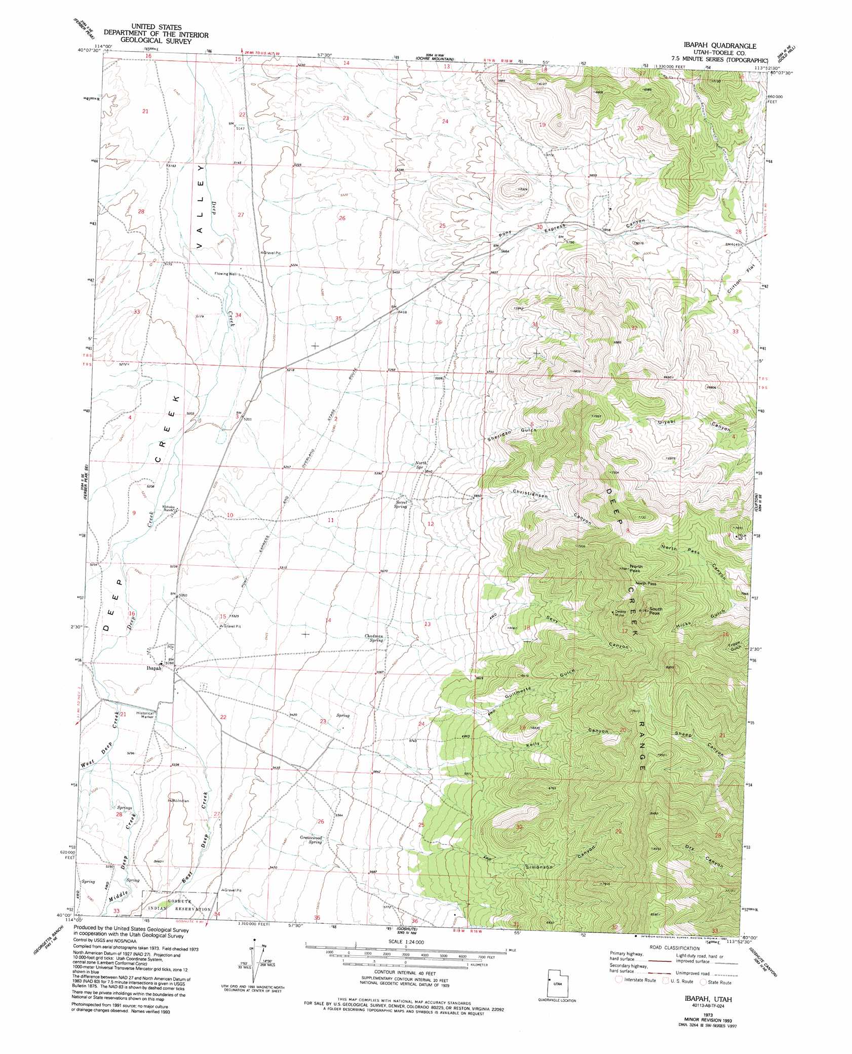
USGS Topo Quad 40113a8 - 1:24,000 scale
| Topo Map Name: | Ibapah |
| USGS Topo Quad ID: | 40113a8 |
| Print Size: | ca. 21 1/4" wide x 27" high |
| Southeast Coordinates: | 40° N latitude / 113.875° W longitude |
| Map Center Coordinates: | 40.0625° N latitude / 113.9375° W longitude |
| U.S. State: | UT |
| Filename: | o40113a8.jpg |
| Download Map JPG Image: | Ibapah topo map 1:24,000 scale |
| Map Type: | Topographic |
| Topo Series: | 7.5´ |
| Map Scale: | 1:24,000 |
| Source of Map Images: | United States Geological Survey (USGS) |
| Alternate Map Versions: |
Ibapah UT 1973, updated 1977 Download PDF Buy paper map Ibapah UT 1973, updated 1987 Download PDF Buy paper map Ibapah UT 1973, updated 1993 Download PDF Buy paper map Ibapah UT 2010 Download PDF Buy paper map Ibapah UT 2014 Download PDF Buy paper map |
1:24,000 Topo Quads surrounding Ibapah
White Horse Pass |
Utah Peak |
Elephant Knoll |
Elephant Knoll Se |
Gold Hill 1 Sw |
Ferber Peak Nw |
Ferber Peak |
Ochre Mountain |
Gold Hill |
Gold Hill 4 Nw |
Ayarbe Spring |
Ferber Peak Se |
Ibapah |
Clifton |
Gold Hill 4 Sw |
Spring Creek Flat Nw |
Georgetta Ranch |
Goshute |
Goshute Canyon |
Callao |
Tippett Canyon |
Weaver Canyon |
Ibapah Peak |
Indian Farm Creek |
Mud Lake Reservoir |
> Back to 40113a1 at 1:100,000 scale
> Back to 40112a1 at 1:250,000 scale
> Back to U.S. Topo Maps home
Ibapah topo map: Gazetteer
Ibapah: Gaps
North Pass elevation 2309m 7575′Ibapah: Mines
Dewey Mine elevation 2173m 7129′Ibapah: Pillars
Deep Creek Pony Express Monument elevation 1614m 5295′Ibapah: Populated Places
Ibapah elevation 1610m 5282′Ibapah: Springs
Chadman Spring elevation 1683m 5521′Greasewood Spring elevation 1694m 5557′
North Spring elevation 1672m 5485′
Secret Spring elevation 1684m 5524′
Ibapah: Streams
East Deep Creek elevation 1610m 5282′Middle Deep Creek elevation 1615m 5298′
West Deep Creek elevation 1610m 5282′
Ibapah: Summits
Ibapah Peak elevation 2488m 8162′North Peak elevation 2325m 7627′
South Peak elevation 2452m 8044′
Ibapah: Valleys
Christiansen Canyon elevation 1701m 5580′Guilmette Gulch elevation 1828m 5997′
Hicks Gulch elevation 2086m 6843′
Kelly Canyon elevation 1719m 5639′
Open A Canyon elevation 1695m 5561′
Pony Express Canyon elevation 1597m 5239′
Sevy Canyon elevation 1767m 5797′
Sheridan Gulch elevation 1706m 5597′
Simonson Canyon elevation 1829m 6000′
Ibapah digital topo map on disk
Buy this Ibapah topo map showing relief, roads, GPS coordinates and other geographical features, as a high-resolution digital map file on DVD: