Lages Station Topo Map Nevada
To zoom in, hover over the map of Lages Station
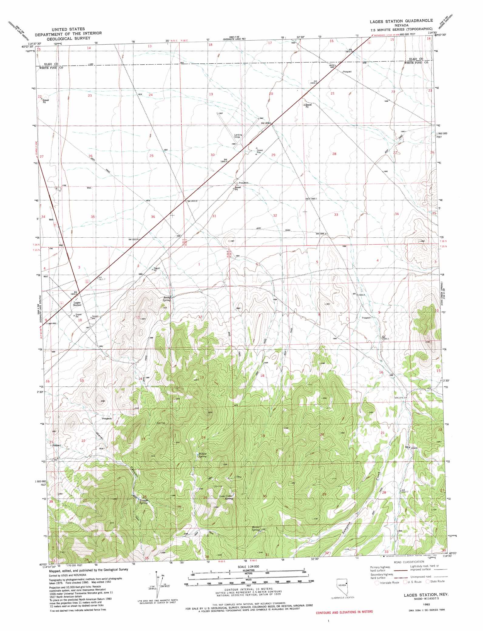
USGS Topo Quad 40114a5 - 1:24,000 scale
| Topo Map Name: | Lages Station |
| USGS Topo Quad ID: | 40114a5 |
| Print Size: | ca. 21 1/4" wide x 27" high |
| Southeast Coordinates: | 40° N latitude / 114.5° W longitude |
| Map Center Coordinates: | 40.0625° N latitude / 114.5625° W longitude |
| U.S. State: | NV |
| Filename: | o40114a5.jpg |
| Download Map JPG Image: | Lages Station topo map 1:24,000 scale |
| Map Type: | Topographic |
| Topo Series: | 7.5´ |
| Map Scale: | 1:24,000 |
| Source of Map Images: | United States Geological Survey (USGS) |
| Alternate Map Versions: |
Lages Station NV 1982, updated 1982 Download PDF Buy paper map Lages Station NV 2012 Download PDF Buy paper map Lages Station NV 2015 Download PDF Buy paper map |
1:24,000 Topo Quads surrounding Lages Station
Currie Gardens |
Currie |
Sharp Peak |
Dolly Varden Spring |
White Horse Mountain |
Mcdermid Ranch |
Goshute Lake North |
Goshute Lake Ne |
Boone Canyon |
Kinsley Mountain |
Goshute Creek |
Goshute Lake South |
Lages Station |
Chin Creek Spring |
Chin Creek Reservoir |
Cherry Creek Station |
Cherry Spring |
Becky Peak |
Baldy Peak |
Sunset Reservoir |
Borchert Spring |
Schellbourne |
Stonehouse |
Rock Springs Pass |
Tippett |
> Back to 40114a1 at 1:100,000 scale
> Back to 40114a1 at 1:250,000 scale
> Back to U.S. Topo Maps home
Lages Station topo map: Gazetteer
Lages Station: Reservoirs
Willow Spring Reservoir elevation 2179m 7148′Lages Station: Springs
Barrel Spring elevation 2195m 7201′Becky Springs elevation 1907m 6256′
Lone Cedar Spring elevation 2257m 7404′
Moonshine Spring elevation 2094m 6870′
Rock Spring elevation 2343m 7687′
Trough Spring elevation 2133m 6998′
Willow Spring elevation 2170m 7119′
Lages Station: Streams
North Creek elevation 1866m 6122′Sampson Creek elevation 1796m 5892′
Lages Station digital topo map on disk
Buy this Lages Station topo map showing relief, roads, GPS coordinates and other geographical features, as a high-resolution digital map file on DVD: