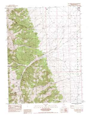
Mcdermid Ranch Topo Map Nevada
To zoom in, hover over the map of Mcdermid Ranch
USGS Topo Quad 40114b7 - 1:24,000 scale
| Topo Map Name: | Mcdermid Ranch |
| USGS Topo Quad ID: | 40114b7 |
| Print Size: | ca. 21 1/4" wide x 27" high |
| Southeast Coordinates: | 40.125° N latitude / 114.75° W longitude |
| Map Center Coordinates: | 40.1875° N latitude / 114.8125° W longitude |
| U.S. State: | NV |
| Filename: | o40114b7.jpg |
| Download Map JPG Image: | Mcdermid Ranch topo map 1:24,000 scale |
| Map Type: | Topographic |
| Topo Series: | 7.5´ |
| Map Scale: | 1:24,000 |
| Source of Map Images: | United States Geological Survey (USGS) |
| Alternate Map Versions: |
McDermid Ranch NV 1984, updated 1984 Download PDF Buy paper map McDermid Ranch NV 2012 Download PDF Buy paper map McDermid Ranch NV 2014 Download PDF Buy paper map |
1:24,000 Topo Quads surrounding Mcdermid Ranch
> Back to 40114a1 at 1:100,000 scale
> Back to 40114a1 at 1:250,000 scale
> Back to U.S. Topo Maps home
Mcdermid Ranch topo map: Gazetteer
Mcdermid Ranch: Reservoirs
Currie Ponds elevation 1780m 5839′Mcdermid Ranch: Springs
Big Spring elevation 2203m 7227′Cheat Grass Spring elevation 2133m 6998′
Julians Hole elevation 2138m 7014′
Mountain Lion Spring elevation 2166m 7106′
Quaker Spring elevation 2190m 7185′
Willow Spring elevation 1829m 6000′
Mcdermid Ranch: Streams
North Fork Williams Creek elevation 1991m 6532′Mcdermid Ranch: Valleys
Calf Canyon elevation 2013m 6604′Corral Canyon elevation 1998m 6555′
Deep Canyon elevation 1945m 6381′
Dry Canyon elevation 1978m 6489′
East Taylor Canyon elevation 1935m 6348′
Mountain Lion Canyon elevation 2046m 6712′
Wood Canyon elevation 1943m 6374′
Mcdermid Ranch: Wells
Phalen Well elevation 1886m 6187′Mcdermid Ranch digital topo map on disk
Buy this Mcdermid Ranch topo map showing relief, roads, GPS coordinates and other geographical features, as a high-resolution digital map file on DVD:


