Ola Topo Map Nevada
To zoom in, hover over the map of Ola
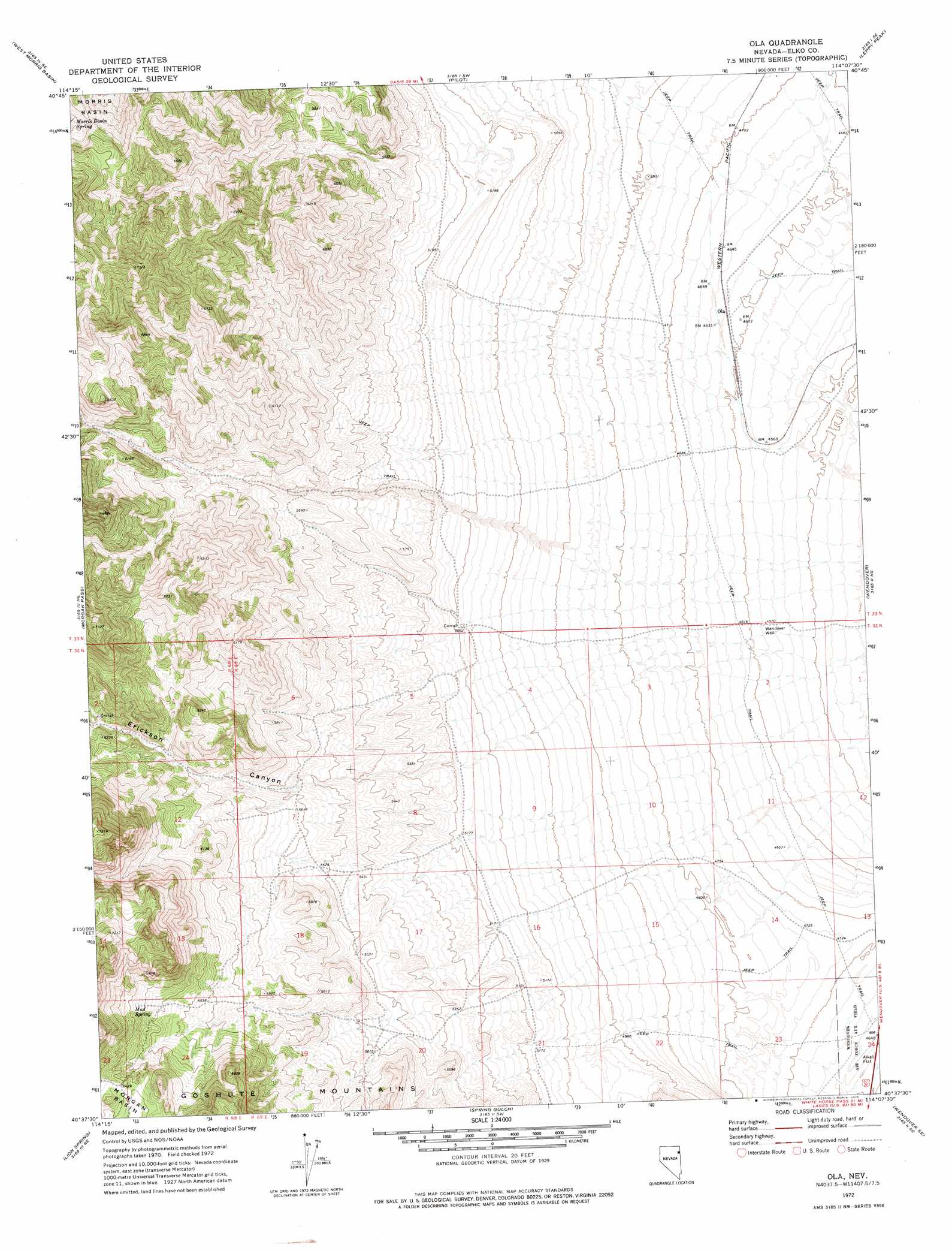
USGS Topo Quad 40114f2 - 1:24,000 scale
| Topo Map Name: | Ola |
| USGS Topo Quad ID: | 40114f2 |
| Print Size: | ca. 21 1/4" wide x 27" high |
| Southeast Coordinates: | 40.625° N latitude / 114.125° W longitude |
| Map Center Coordinates: | 40.6875° N latitude / 114.1875° W longitude |
| U.S. State: | NV |
| Filename: | o40114f2.jpg |
| Download Map JPG Image: | Ola topo map 1:24,000 scale |
| Map Type: | Topographic |
| Topo Series: | 7.5´ |
| Map Scale: | 1:24,000 |
| Source of Map Images: | United States Geological Survey (USGS) |
| Alternate Map Versions: |
Ola NV 1972, updated 1975 Download PDF Buy paper map Ola NV 2012 Download PDF Buy paper map Ola NV 2015 Download PDF Buy paper map |
1:24,000 Topo Quads surrounding Ola
Hardy Creek |
Silver Zone Pass |
Leppy Peak Nw |
Miners Canyon |
Silver Island Pass |
Shafter |
West Morris Basin |
Pilot |
Leppy Peak |
Tetzlaff Peak |
Decoy |
Morgan Pass |
Ola |
Wendover |
Silsbee |
Decoy Sw |
Lion Spring |
Spring Gulch |
Wendover Se |
Salduro Sw |
White Horse Mountain Nw |
Goshute Peak |
Ferguson Mountain |
Ferguson Flat |
Elephant Knoll Nw |
> Back to 40114e1 at 1:100,000 scale
> Back to 40114a1 at 1:250,000 scale
> Back to U.S. Topo Maps home
Ola topo map: Gazetteer
Ola: Populated Places
Ola elevation 1410m 4625′Ola: Springs
Blue Bell Spring elevation 1944m 6377′Elizabeth Spring elevation 1647m 5403′
Hillside Spring elevation 1663m 5456′
Mud Spring elevation 1939m 6361′
Ola: Valleys
Erickson Canyon elevation 1589m 5213′Ola: Wells
Wendover Well elevation 1396m 4580′Ola digital topo map on disk
Buy this Ola topo map showing relief, roads, GPS coordinates and other geographical features, as a high-resolution digital map file on DVD: