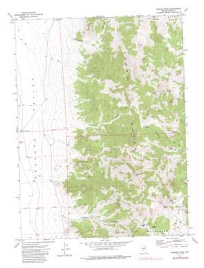
Morgan Pass Topo Map Nevada
To zoom in, hover over the map of Morgan Pass
USGS Topo Quad 40114f3 - 1:24,000 scale
| Topo Map Name: | Morgan Pass |
| USGS Topo Quad ID: | 40114f3 |
| Print Size: | ca. 21 1/4" wide x 27" high |
| Southeast Coordinates: | 40.625° N latitude / 114.25° W longitude |
| Map Center Coordinates: | 40.6875° N latitude / 114.3125° W longitude |
| U.S. State: | NV |
| Filename: | o40114f3.jpg |
| Download Map JPG Image: | Morgan Pass topo map 1:24,000 scale |
| Map Type: | Topographic |
| Topo Series: | 7.5´ |
| Map Scale: | 1:24,000 |
| Source of Map Images: | United States Geological Survey (USGS) |
| Alternate Map Versions: |
Morgan Pass NV 1972, updated 1975 Download PDF Buy paper map Morgan Pass NV 1972, updated 1986 Download PDF Buy paper map Morgan Pass NV 2012 Download PDF Buy paper map Morgan Pass NV 2014 Download PDF Buy paper map |
1:24,000 Topo Quads surrounding Morgan Pass
> Back to 40114e1 at 1:100,000 scale
> Back to 40114a1 at 1:250,000 scale
> Back to U.S. Topo Maps home
Morgan Pass topo map: Gazetteer
Morgan Pass: Gaps
Morgan Pass elevation 2229m 7312′Morgan Pass: Mines
Darky Mine elevation 1820m 5971′Morgan Pass: Springs
Erickson Spring elevation 2035m 6676′Isabel Spring elevation 2198m 7211′
Morgan Spring elevation 2182m 7158′
Morris Basin Spring elevation 1957m 6420′
Rock Spring elevation 2095m 6873′
Rosebud Spring elevation 2038m 6686′
Sidehill Spring elevation 2173m 7129′
Summit Spring elevation 2138m 7014′
Morgan Pass: Valleys
Johnson Canyon elevation 1827m 5994′Morgan Canyon elevation 1768m 5800′
Thirtymile Canyon elevation 1819m 5967′
Morgan Pass: Wells
Acorda Well elevation 1719m 5639′Acorda Well Number Three elevation 1724m 5656′
Shafter Well elevation 1770m 5807′
Shafter Well Number Two elevation 1709m 5606′
Morgan Pass digital topo map on disk
Buy this Morgan Pass topo map showing relief, roads, GPS coordinates and other geographical features, as a high-resolution digital map file on DVD:


