Miners Canyon Topo Map Nevada
To zoom in, hover over the map of Miners Canyon
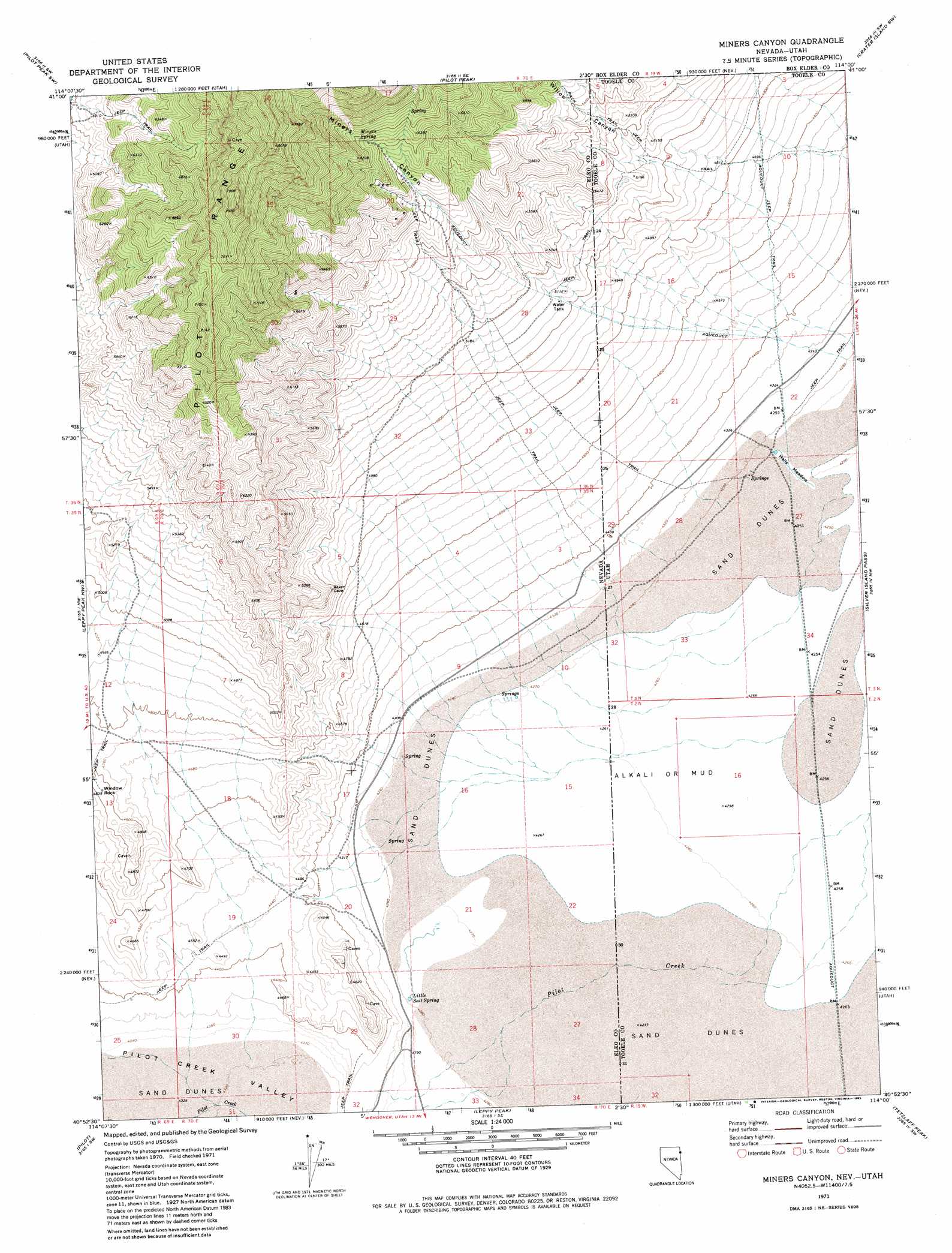
USGS Topo Quad 40114h1 - 1:24,000 scale
| Topo Map Name: | Miners Canyon |
| USGS Topo Quad ID: | 40114h1 |
| Print Size: | ca. 21 1/4" wide x 27" high |
| Southeast Coordinates: | 40.875° N latitude / 114° W longitude |
| Map Center Coordinates: | 40.9375° N latitude / 114.0625° W longitude |
| U.S. States: | NV, UT |
| Filename: | o40114h1.jpg |
| Download Map JPG Image: | Miners Canyon topo map 1:24,000 scale |
| Map Type: | Topographic |
| Topo Series: | 7.5´ |
| Map Scale: | 1:24,000 |
| Source of Map Images: | United States Geological Survey (USGS) |
| Alternate Map Versions: |
Miners Canyon NV 1971, updated 1974 Download PDF Buy paper map Miners Canyon NV 1971, updated 1985 Download PDF Buy paper map Miners Canyon NV 2011 Download PDF Buy paper map Miners Canyon NV 2012 Download PDF Buy paper map Miners Canyon NV 2014 Download PDF Buy paper map |
1:24,000 Topo Quads surrounding Miners Canyon
Loray |
Pilot Peak Nw |
Patterson Pass |
Crater Island Nw |
Lemay Island |
Cobre Se |
Pilot Peak Sw |
Pilot Peak |
Crater Island Sw |
Crater Island |
Silver Zone Pass |
Leppy Peak Nw |
Miners Canyon |
Silver Island Pass |
Graham Peak |
West Morris Basin |
Pilot |
Leppy Peak |
Tetzlaff Peak |
Bonneville Racetrack |
Morgan Pass |
Ola |
Wendover |
Silsbee |
Salduro |
> Back to 40114e1 at 1:100,000 scale
> Back to 40114a1 at 1:250,000 scale
> Back to U.S. Topo Maps home
Miners Canyon topo map: Gazetteer
Miners Canyon: Flats
Halls Meadow elevation 1299m 4261′Miners Canyon: Pillars
Window Rock elevation 1467m 4812′Miners Canyon: Springs
Little Salt Spring elevation 1305m 4281′Miners Spring elevation 1953m 6407′
Salt Spring elevation 1304m 4278′
Miners Canyon: Valleys
Miners Canyon elevation 1588m 5209′Pilot Creek Valley elevation 1308m 4291′
Willow Canyon elevation 1537m 5042′
Willow Canyon elevation 1576m 5170′
Miners Canyon digital topo map on disk
Buy this Miners Canyon topo map showing relief, roads, GPS coordinates and other geographical features, as a high-resolution digital map file on DVD: