Tobar Topo Map Nevada
To zoom in, hover over the map of Tobar
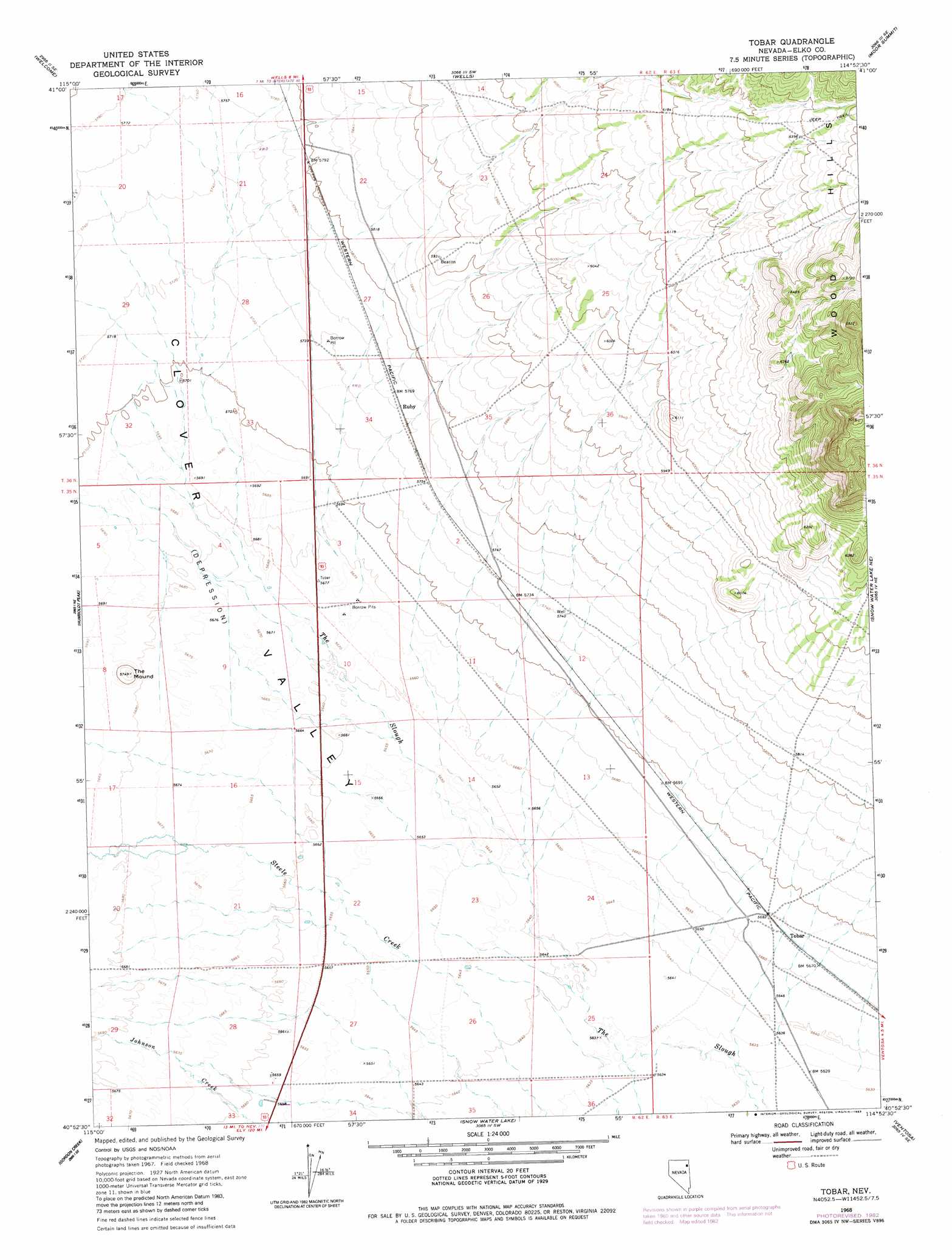
USGS Topo Quad 40114h8 - 1:24,000 scale
| Topo Map Name: | Tobar |
| USGS Topo Quad ID: | 40114h8 |
| Print Size: | ca. 21 1/4" wide x 27" high |
| Southeast Coordinates: | 40.875° N latitude / 114.875° W longitude |
| Map Center Coordinates: | 40.9375° N latitude / 114.9375° W longitude |
| U.S. State: | NV |
| Filename: | o40114h8.jpg |
| Download Map JPG Image: | Tobar topo map 1:24,000 scale |
| Map Type: | Topographic |
| Topo Series: | 7.5´ |
| Map Scale: | 1:24,000 |
| Source of Map Images: | United States Geological Survey (USGS) |
| Alternate Map Versions: |
Tobar NV 1968, updated 1971 Download PDF Buy paper map Tobar NV 1968, updated 1983 Download PDF Buy paper map Tobar NV 2012 Download PDF Buy paper map Tobar NV 2014 Download PDF Buy paper map |
1:24,000 Topo Quads surrounding Tobar
Tabor Flats |
Metropolis |
Oxley Peak |
Wells Peak |
Holborn |
Herder Creek |
Welcome |
Wells |
Moor Summit |
Pequop Summit Sw |
Tent Mountain |
Humboldt Peak |
Tobar |
Snow Water Lake Ne |
Independence Valley Nw |
Secret Valley |
Gordon Creek |
Snow Water Lake |
Ventosa |
Independence Valley Sw |
Ruby City Creek |
Arizona Spring |
Spruce Mountain Nw |
Chase Spring |
Ninemile Canyon |
> Back to 40114e1 at 1:100,000 scale
> Back to 40114a1 at 1:250,000 scale
> Back to U.S. Topo Maps home
Tobar topo map: Gazetteer
Tobar: Flats
Tobar Flat elevation 1731m 5679′Tobar: Populated Places
Tobar (historical) elevation 1731m 5679′Tobar: Post Offices
Tobar Post Office elevation 1731m 5679′Tobar: Summits
The Mound elevation 1753m 5751′Tobar digital topo map on disk
Buy this Tobar topo map showing relief, roads, GPS coordinates and other geographical features, as a high-resolution digital map file on DVD: