Odgers Ranch Topo Map Nevada
To zoom in, hover over the map of Odgers Ranch
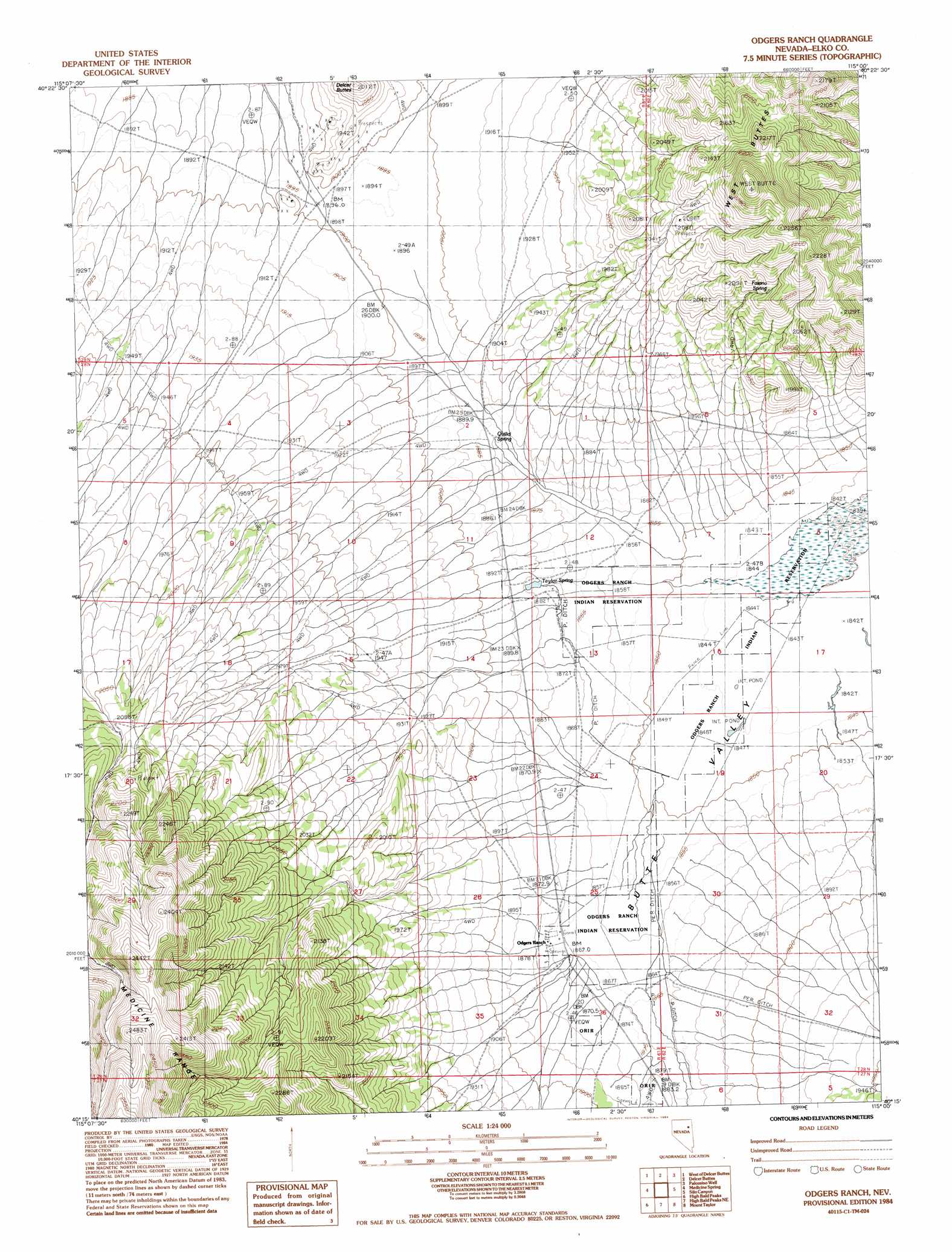
USGS Topo Quad 40115c1 - 1:24,000 scale
| Topo Map Name: | Odgers Ranch |
| USGS Topo Quad ID: | 40115c1 |
| Print Size: | ca. 21 1/4" wide x 27" high |
| Southeast Coordinates: | 40.25° N latitude / 115° W longitude |
| Map Center Coordinates: | 40.3125° N latitude / 115.0625° W longitude |
| U.S. State: | NV |
| Filename: | o40115c1.jpg |
| Download Map JPG Image: | Odgers Ranch topo map 1:24,000 scale |
| Map Type: | Topographic |
| Topo Series: | 7.5´ |
| Map Scale: | 1:24,000 |
| Source of Map Images: | United States Geological Survey (USGS) |
| Alternate Map Versions: |
Odgers Ranch NV 1984, updated 1984 Download PDF Buy paper map Odgers Ranch NV 2012 Download PDF Buy paper map Odgers Ranch NV 2015 Download PDF Buy paper map |
1:24,000 Topo Quads surrounding Odgers Ranch
Ruby Valley School |
Smith Well |
Valley Mountain |
Spruce Well |
Spruce Mountain |
Franklin Lake Ne |
West Of Delcer Buttes |
Delcer Buttes |
Palomino Well |
Palomino Ridge |
Franklin Lake Se |
Medicine Spring |
Odgers Ranch |
Silo Canyon |
Currie Gardens |
Ruby Lake Ne |
High Bald Peaks |
High Bald Peaks Ne |
Mount Taylor |
Mcdermid Ranch |
Ruby Lake Se |
Pot Spring |
High Bald Peaks Se |
Paris Creek |
Goshute Creek |
> Back to 40115a1 at 1:100,000 scale
> Back to 40114a1 at 1:250,000 scale
> Back to U.S. Topo Maps home
Odgers Ranch topo map: Gazetteer
Odgers Ranch: Springs
Fasano Spring elevation 2076m 6811′Quilici Spring elevation 1882m 6174′
Taylor Spring elevation 1882m 6174′
Odgers Ranch: Streams
Butte Creek elevation 1866m 6122′Odgers Ranch: Summits
West Buttes elevation 2252m 7388′Odgers Ranch digital topo map on disk
Buy this Odgers Ranch topo map showing relief, roads, GPS coordinates and other geographical features, as a high-resolution digital map file on DVD: