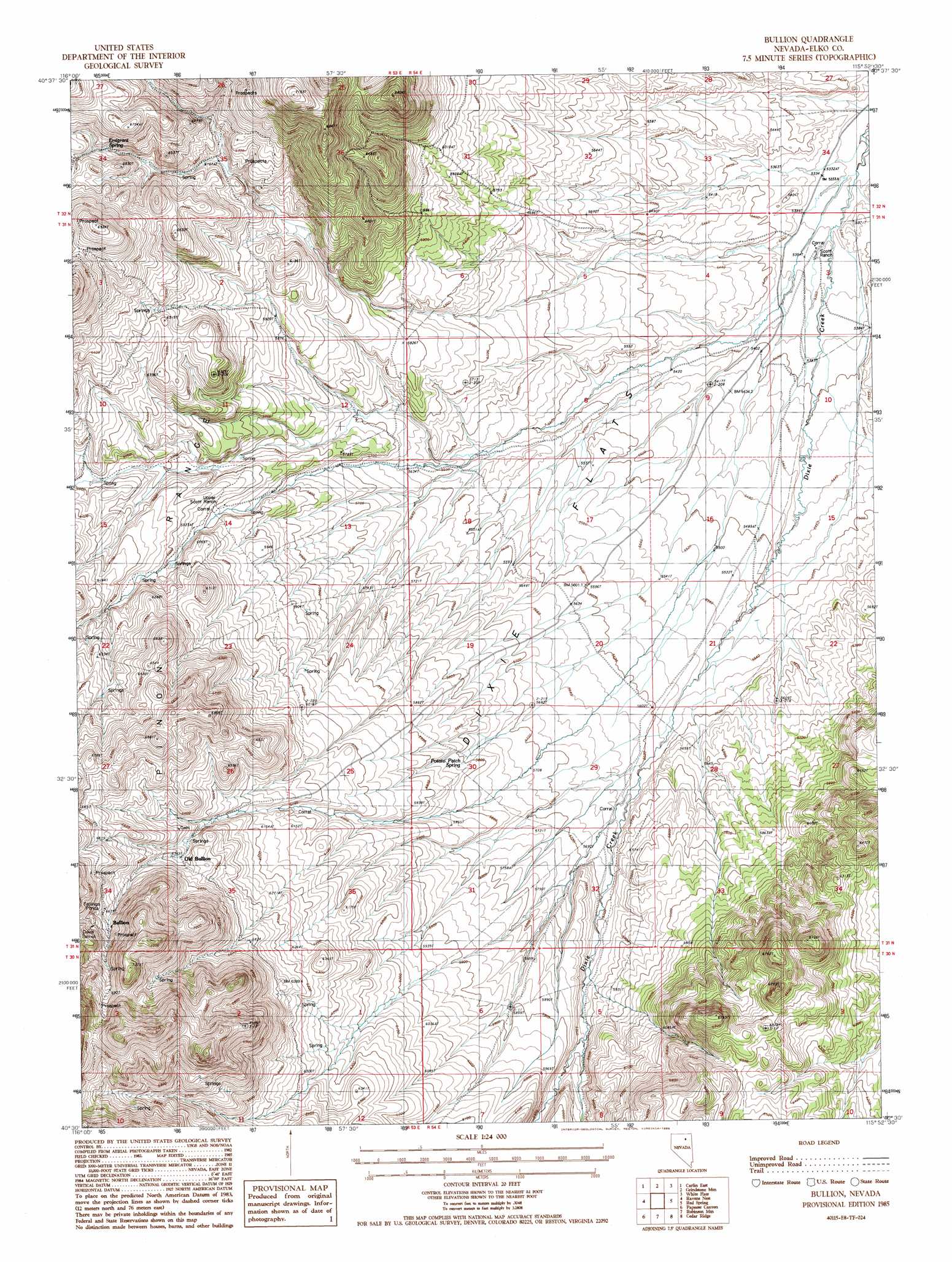
Bullion Topo Map Nevada
To zoom in, hover over the map of Bullion
USGS Topo Quad 40115e8 - 1:24,000 scale
| Topo Map Name: | Bullion |
| USGS Topo Quad ID: | 40115e8 |
| Print Size: | ca. 21 1/4" wide x 27" high |
| Southeast Coordinates: | 40.5° N latitude / 115.875° W longitude |
| Map Center Coordinates: | 40.5625° N latitude / 115.9375° W longitude |
| U.S. State: | NV |
| Filename: | o40115e8.jpg |
| Download Map JPG Image: | Bullion topo map 1:24,000 scale |
| Map Type: | Topographic |
| Topo Series: | 7.5´ |
| Map Scale: | 1:24,000 |
| Source of Map Images: | United States Geological Survey (USGS) |
| Alternate Map Versions: |
Bullion NV 1985, updated 1986 Download PDF Buy paper map Bullion NV 2012 Download PDF Buy paper map Bullion NV 2014 Download PDF Buy paper map |
1:24,000 Topo Quads surrounding Bullion
Schroeder Mountain |
Huntsman Ranch |
Hunter |
Elko West |
Elko East |
Carlin West |
Carlin East |
Grindstone Mountain |
White Flats |
Te-Moak Well |
Palisade |
Ravens Nest |
Bullion |
Red Spring |
West Of Lee |
Mccormack Spring |
Papoose Canyon |
Robinson Mountain |
Cedar Ridge |
Jiggs |
West Of Coffin Mountain |
Coffin Mountain |
Bailey Mountain |
East Of Bailey Mountain |
Frost Creek |
> Back to 40115e1 at 1:100,000 scale
> Back to 40114a1 at 1:250,000 scale
> Back to U.S. Topo Maps home
Bullion topo map: Gazetteer
Bullion: Flats
Dixie Flats elevation 1684m 5524′Bullion: Mines
Davis Tunnel elevation 2099m 6886′Bullion: Populated Places
Bullion elevation 2033m 6669′Highland (historical) elevation 2146m 7040′
Old Bullion elevation 1939m 6361′
Bullion: Post Offices
Bullion Post Office (historical) elevation 1939m 6361′Bullion: Springs
Emigrant Spring elevation 1884m 6181′Potato Patch Spring elevation 1770m 5807′
Bullion: Valleys
Cissillini Canyon elevation 1766m 5793′Bullion digital topo map on disk
Buy this Bullion topo map showing relief, roads, GPS coordinates and other geographical features, as a high-resolution digital map file on DVD: