Te-Moak Well Topo Map Nevada
To zoom in, hover over the map of Te-Moak Well
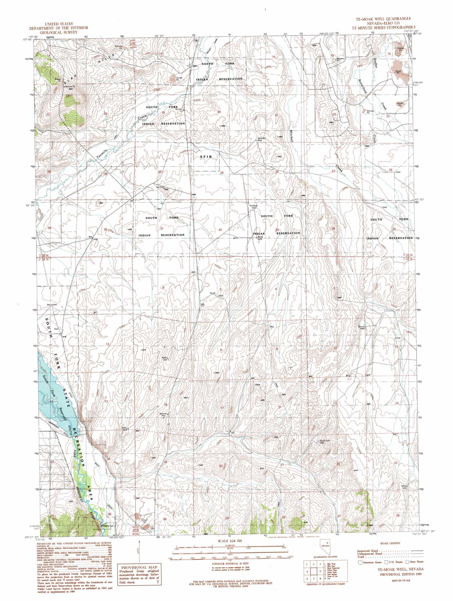
USGS Topo Quad 40115f6 - 1:24,000 scale
| Topo Map Name: | Te-Moak Well |
| USGS Topo Quad ID: | 40115f6 |
| Print Size: | ca. 21 1/4" wide x 27" high |
| Southeast Coordinates: | 40.625° N latitude / 115.625° W longitude |
| Map Center Coordinates: | 40.6875° N latitude / 115.6875° W longitude |
| U.S. State: | NV |
| Filename: | o40115f6.jpg |
| Download Map JPG Image: | Te-Moak Well topo map 1:24,000 scale |
| Map Type: | Topographic |
| Topo Series: | 7.5´ |
| Map Scale: | 1:24,000 |
| Source of Map Images: | United States Geological Survey (USGS) |
| Alternate Map Versions: |
Te-Moak Well NV 1990, updated 1991 Download PDF Buy paper map Te-Moak Well NV 2012 Download PDF Buy paper map Te-Moak Well NV 2014 Download PDF Buy paper map |
1:24,000 Topo Quads surrounding Te-Moak Well
Adobe Summit |
Kittridge Springs |
Osino |
Ryndon |
Halleck |
Hunter |
Elko West |
Elko East |
Boyd Reservoir |
Halleck Sw |
Grindstone Mountain |
White Flats |
Te-Moak Well |
Noon Rock |
Lamoille |
Bullion |
Red Spring |
West Of Lee |
Lee |
Ruby Dome |
Robinson Mountain |
Cedar Ridge |
Jiggs |
Green Mountain |
Franklin Lake Nw |
> Back to 40115e1 at 1:100,000 scale
> Back to 40114a1 at 1:250,000 scale
> Back to U.S. Topo Maps home
Te-Moak Well topo map: Gazetteer
Te-Moak Well: Basins
South Fork Valley elevation 1661m 5449′Te-Moak Well: Canals
Hilton Ditch elevation 1599m 5246′Te-Moak Well: Parks
South Fork Recreation Area elevation 1593m 5226′Te-Moak Well: Populated Places
Coral Hill (historical) elevation 1629m 5344′Te-Moak Well: Post Offices
Coral Hill Post Office (historical) elevation 1629m 5344′Te-Moak Well: Reservoirs
South Fork Reservoir elevation 1593m 5226′Te-Moak Well: Streams
Butterfield Creek elevation 1641m 5383′Huntington Creek elevation 1608m 5275′
Mitchell Creek elevation 1609m 5278′
Te-Moak Well: Wells
Secrist Well elevation 1686m 5531′South Fork Well elevation 1695m 5561′
Te-Moak Well elevation 1641m 5383′
Tenmile Well elevation 1641m 5383′
Te-Moak Well digital topo map on disk
Buy this Te-Moak Well topo map showing relief, roads, GPS coordinates and other geographical features, as a high-resolution digital map file on DVD: