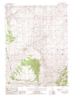
Ravens Nest Topo Map Nevada
To zoom in, hover over the map of Ravens Nest
USGS Topo Quad 40116e1 - 1:24,000 scale
| Topo Map Name: | Ravens Nest |
| USGS Topo Quad ID: | 40116e1 |
| Print Size: | ca. 21 1/4" wide x 27" high |
| Southeast Coordinates: | 40.5° N latitude / 116° W longitude |
| Map Center Coordinates: | 40.5625° N latitude / 116.0625° W longitude |
| U.S. State: | NV |
| Filename: | o40116e1.jpg |
| Download Map JPG Image: | Ravens Nest topo map 1:24,000 scale |
| Map Type: | Topographic |
| Topo Series: | 7.5´ |
| Map Scale: | 1:24,000 |
| Source of Map Images: | United States Geological Survey (USGS) |
| Alternate Map Versions: |
Ravens Nest NV 1985, updated 1986 Download PDF Buy paper map Ravens Nest NV 2012 Download PDF Buy paper map Ravens Nest NV 2014 Download PDF Buy paper map |
1:24,000 Topo Quads surrounding Ravens Nest
> Back to 40116e1 at 1:100,000 scale
> Back to 40116a1 at 1:250,000 scale
> Back to U.S. Topo Maps home
Ravens Nest topo map: Gazetteer
Ravens Nest: Mines
Brodine Mine elevation 2305m 7562′Bullion Mine elevation 2305m 7562′
Burke Mine elevation 2305m 7562′
Copper Bell Mine elevation 2184m 7165′
Delmas Mine elevation 2446m 8024′
Ennor Mine elevation 2253m 7391′
Grey Eagle Mine elevation 2282m 7486′
Helen M Mine elevation 2198m 7211′
Independence Mine elevation 2214m 7263′
Key Mine elevation 2305m 7562′
Mahogany Mine elevation 2305m 7562′
Mendota Mine elevation 2369m 7772′
Palisade Mine elevation 2305m 7562′
Red Bird Mine elevation 2170m 7119′
Silver King Mine elevation 2259m 7411′
Sky Blue Mine elevation 2305m 7562′
Standing Elk Mine elevation 2412m 7913′
Storm King Mine elevation 2305m 7562′
Sweepstake Mine elevation 2426m 7959′
Sylvania Mine elevation 2349m 7706′
Tripoli Mine elevation 2388m 7834′
Webfoot Mine elevation 2305m 7562′
Ravens Nest: Ranges
Piñon Range elevation 2021m 6630′Ravens Nest: Springs
Cherry Springs elevation 2016m 6614′Mill Creek Spring elevation 1856m 6089′
Murdock Spring elevation 1940m 6364′
Red Springs elevation 1618m 5308′
Stump Spring elevation 1950m 6397′
Ravens Nest: Streams
Webb Creek elevation 1676m 5498′Ravens Nest: Summits
Bunker Hill elevation 2636m 8648′Pine Mountain elevation 2524m 8280′
Ravens Nest elevation 2640m 8661′
Ravens Nest digital topo map on disk
Buy this Ravens Nest topo map showing relief, roads, GPS coordinates and other geographical features, as a high-resolution digital map file on DVD:


