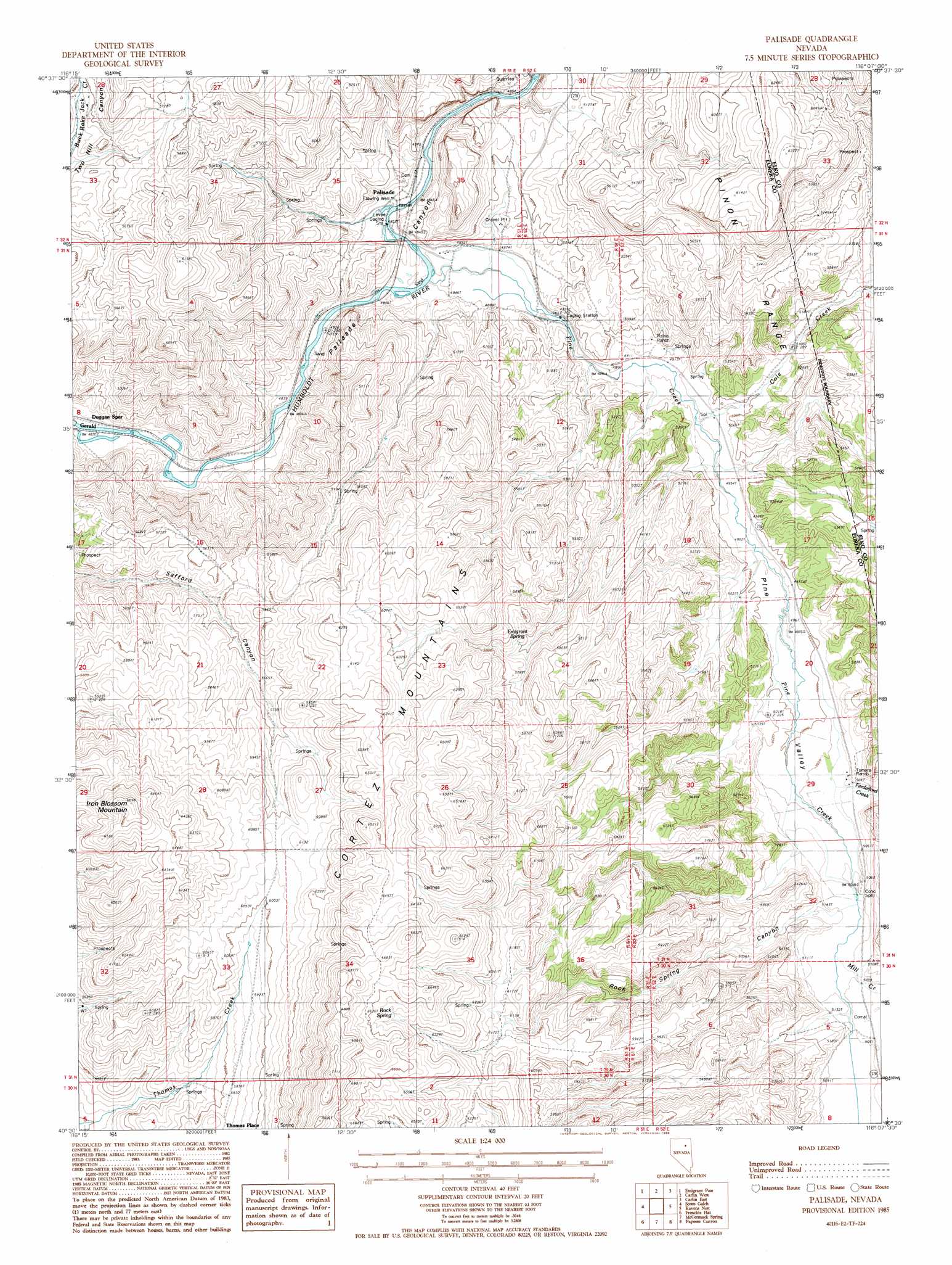
Palisade Topo Map Nevada
To zoom in, hover over the map of Palisade
USGS Topo Quad 40116e2 - 1:24,000 scale
| Topo Map Name: | Palisade |
| USGS Topo Quad ID: | 40116e2 |
| Print Size: | ca. 21 1/4" wide x 27" high |
| Southeast Coordinates: | 40.5° N latitude / 116.125° W longitude |
| Map Center Coordinates: | 40.5625° N latitude / 116.1875° W longitude |
| U.S. State: | NV |
| Filename: | o40116e2.jpg |
| Download Map JPG Image: | Palisade topo map 1:24,000 scale |
| Map Type: | Topographic |
| Topo Series: | 7.5´ |
| Map Scale: | 1:24,000 |
| Source of Map Images: | United States Geological Survey (USGS) |
| Alternate Map Versions: |
Palisade NV 1985, updated 1986 Download PDF Buy paper map Palisade NV 1985, updated 1986 Download PDF Buy paper map Palisade NV 2012 Download PDF Buy paper map Palisade NV 2014 Download PDF Buy paper map |
1:24,000 Topo Quads surrounding Palisade
Rodeo Creek Sw |
Welches Canyon |
Schroeder Mountain |
Huntsman Ranch |
Hunter |
Bobs Flat |
Emigrant Pass |
Carlin West |
Carlin East |
Grindstone Mountain |
Beowawe |
Scotts Gulch |
Palisade |
Ravens Nest |
Bullion |
Tumbleweed Flat |
Frenchie Flat |
Mccormack Spring |
Papoose Canyon |
Robinson Mountain |
Hand-Me-Down Creek |
Thatcher Spring |
West Of Coffin Mountain |
Coffin Mountain |
Bailey Mountain |
> Back to 40116e1 at 1:100,000 scale
> Back to 40116a1 at 1:250,000 scale
> Back to U.S. Topo Maps home
Palisade topo map: Gazetteer
Palisade: Dams
Palisades Four Dam elevation 1752m 5748′Palisades Three Dam elevation 1813m 5948′
Palisades Two Dam elevation 1619m 5311′
Palisade: Populated Places
Gerald (historical) elevation 1467m 4812′Palisade elevation 1479m 4852′
Thomas Place elevation 1786m 5859′
Palisade: Post Offices
Gerald Post Office (historical) elevation 1467m 4812′Palisade Post Office (historical) elevation 1479m 4852′
Palisade: Springs
Emigrant Spring elevation 1723m 5652′Raine Ranch Springs elevation 1509m 4950′
Rock Spring elevation 1978m 6489′
Palisade: Streams
Cole Creek elevation 1501m 4924′Ferdelford Creek elevation 1528m 5013′
Mill Creek elevation 1546m 5072′
Pine Creek elevation 1476m 4842′
Palisade: Summits
Iron Blossom Mountain elevation 2040m 6692′Palisade: Valleys
Pine Valley elevation 1489m 4885′Rock Spring Canyon elevation 1564m 5131′
Palisade digital topo map on disk
Buy this Palisade topo map showing relief, roads, GPS coordinates and other geographical features, as a high-resolution digital map file on DVD: