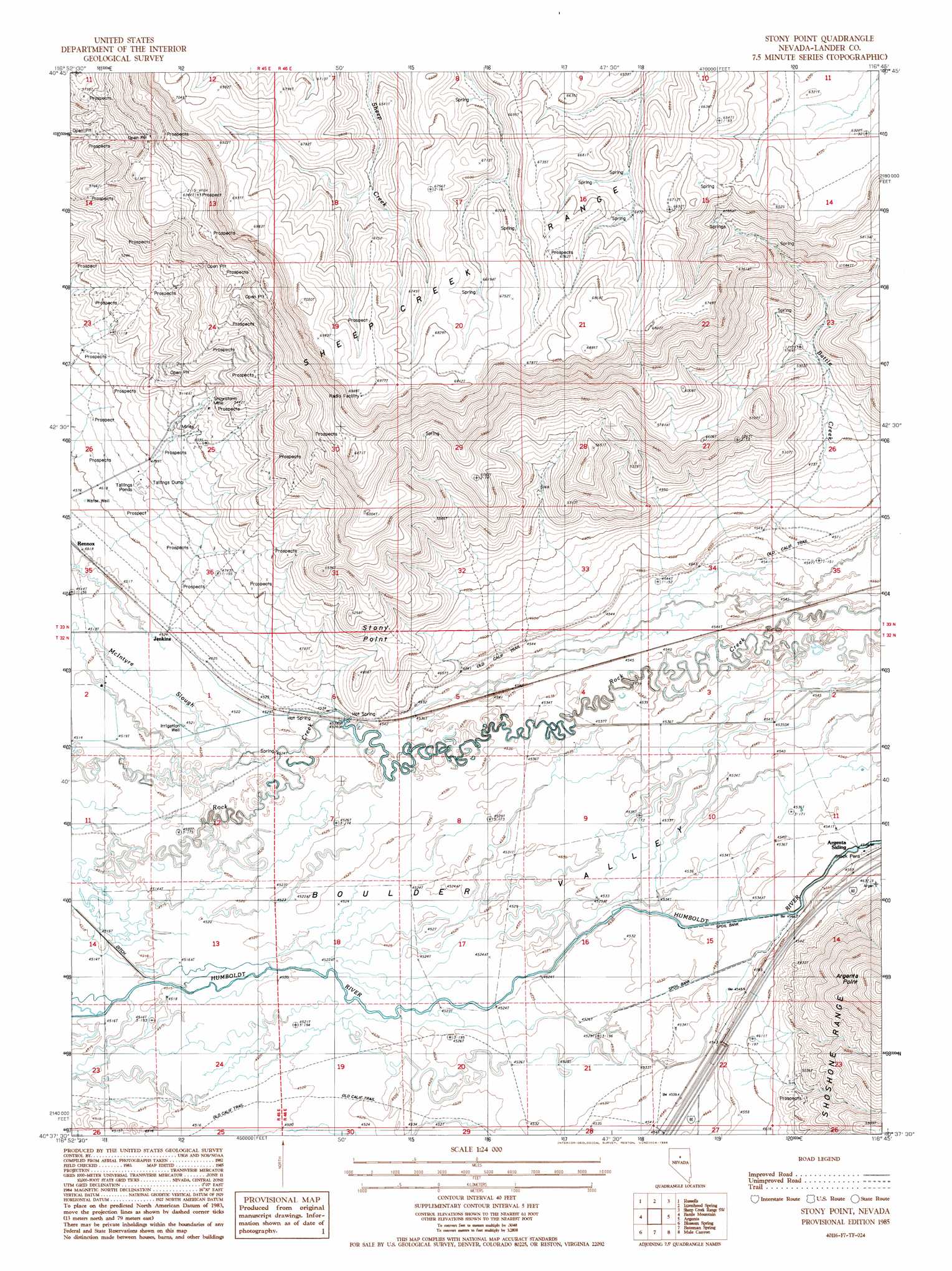
Stony Point Topo Map Nevada
To zoom in, hover over the map of Stony Point
USGS Topo Quad 40116f7 - 1:24,000 scale
| Topo Map Name: | Stony Point |
| USGS Topo Quad ID: | 40116f7 |
| Print Size: | ca. 21 1/4" wide x 27" high |
| Southeast Coordinates: | 40.625° N latitude / 116.75° W longitude |
| Map Center Coordinates: | 40.6875° N latitude / 116.8125° W longitude |
| U.S. State: | NV |
| Filename: | o40116f7.jpg |
| Download Map JPG Image: | Stony Point topo map 1:24,000 scale |
| Map Type: | Topographic |
| Topo Series: | 7.5´ |
| Map Scale: | 1:24,000 |
| Source of Map Images: | United States Geological Survey (USGS) |
| Alternate Map Versions: |
Stony Point NV 1985, updated 1986 Download PDF Buy paper map Stony Point NV 2012 Download PDF Buy paper map Stony Point NV 2014 Download PDF Buy paper map |
1:24,000 Topo Quads surrounding Stony Point
Hot Pot |
Izzenhood Ranch |
Izzenhood Gap |
Sheep Creek Range Nw |
Sheep Creek Range Ne |
Ellison |
Russells |
Izzenhood Spring |
Sheep Creek Range Sw |
Sheep Creek Range Se |
Snow Gulch |
Battle Mountain |
Stony Point |
Argenta |
Dunphy |
Galena |
Blossom Spring |
Bateman Spring |
Mule Canyon |
The Geysers |
Mccoy Ne |
Crippen Canyon |
Mount Lewis |
Mud Spring Gulch |
Crescent Valley |
> Back to 40116e1 at 1:100,000 scale
> Back to 40116a1 at 1:250,000 scale
> Back to U.S. Topo Maps home
Stony Point topo map: Gazetteer
Stony Point: Areas
North Battle Mountain Mining Area elevation 2018m 6620′Stony Point: Canals
T-S Ditch elevation 1383m 4537′Stony Point: Flats
Stony Point Meadow elevation 1381m 4530′Stony Point: Mines
Snowstorm Mine elevation 1549m 5082′Stony Point: Populated Places
Jenkins elevation 1383m 4537′Stony Point: Springs
Hot Springs elevation 1379m 4524′Stony Point: Streams
Battle Creek elevation 1392m 4566′Stony Point: Summits
Shoshone Mesa elevation 2149m 7050′Stony Point elevation 1585m 5200′
Stony Point: Valleys
Boulder Valley elevation 1377m 4517′Stony Point digital topo map on disk
Buy this Stony Point topo map showing relief, roads, GPS coordinates and other geographical features, as a high-resolution digital map file on DVD: