Rodeo Creek Sw Topo Map Nevada
To zoom in, hover over the map of Rodeo Creek Sw
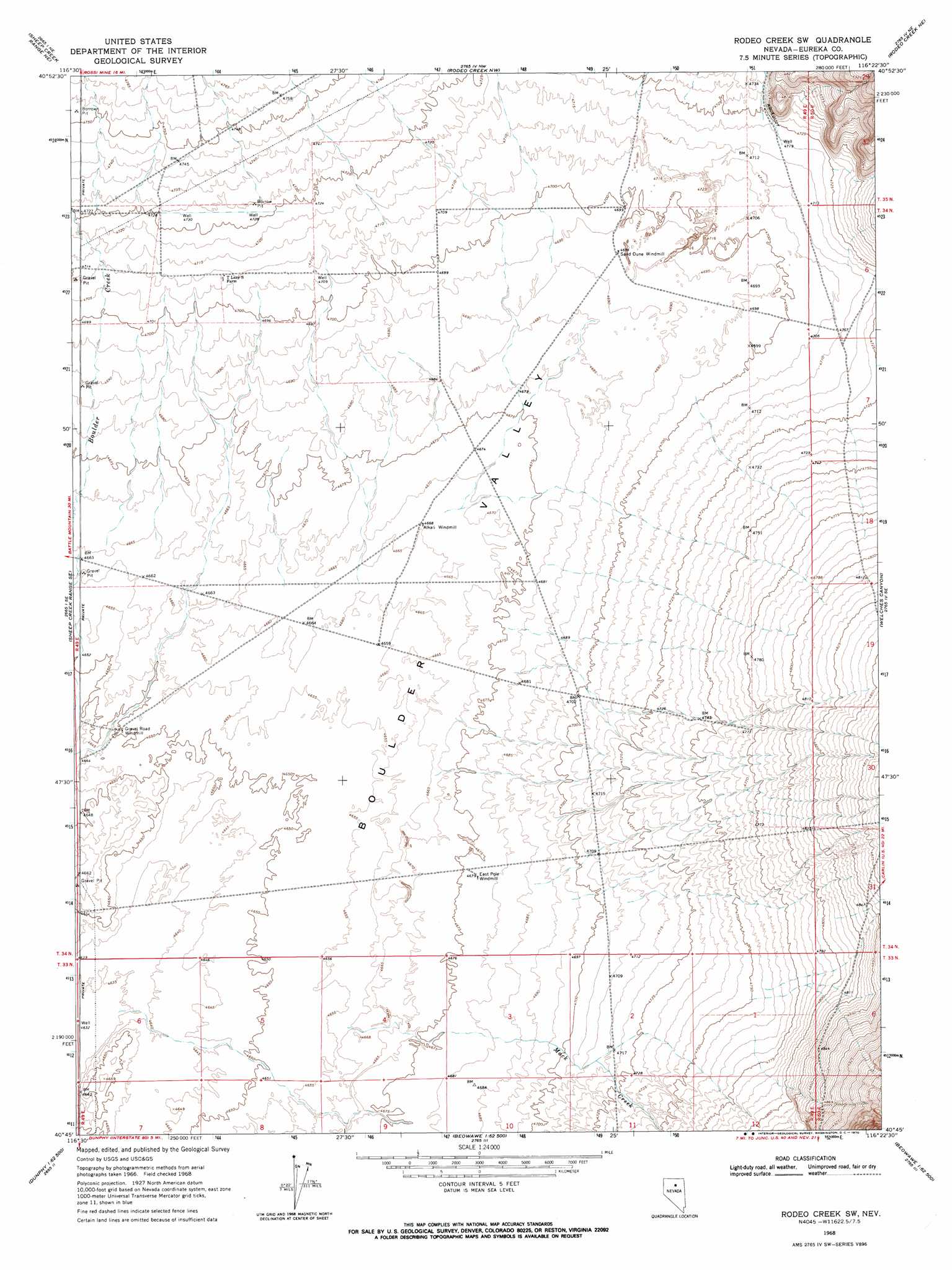
USGS Topo Quad 40116g4 - 1:24,000 scale
| Topo Map Name: | Rodeo Creek Sw |
| USGS Topo Quad ID: | 40116g4 |
| Print Size: | ca. 21 1/4" wide x 27" high |
| Southeast Coordinates: | 40.75° N latitude / 116.375° W longitude |
| Map Center Coordinates: | 40.8125° N latitude / 116.4375° W longitude |
| U.S. State: | NV |
| Filename: | o40116g4.jpg |
| Download Map JPG Image: | Rodeo Creek Sw topo map 1:24,000 scale |
| Map Type: | Topographic |
| Topo Series: | 7.5´ |
| Map Scale: | 1:24,000 |
| Source of Map Images: | United States Geological Survey (USGS) |
| Alternate Map Versions: |
Rodeo Creek SW NV 1968, updated 1970 Download PDF Buy paper map Rodeo Creek SW NV 1968, updated 1971 Download PDF Buy paper map Rodeo Creek SW NV 2012 Download PDF Buy paper map Rodeo Creek SW NV 2014 Download PDF Buy paper map |
1:24,000 Topo Quads surrounding Rodeo Creek Sw
Rock Creek Ranch |
Willow Cr Reservoir Se |
Santa Renia Fields |
Beaver Peak |
Beaver Creek |
Sheep Creek Range Nw |
Sheep Creek Range Ne |
Rodeo Creek Nw |
Rodeo Creek Ne |
Swales Mountain Nw |
Sheep Creek Range Sw |
Sheep Creek Range Se |
Rodeo Creek Sw |
Welches Canyon |
Schroeder Mountain |
Argenta |
Dunphy |
Bobs Flat |
Emigrant Pass |
Carlin West |
Mule Canyon |
The Geysers |
Beowawe |
Scotts Gulch |
Palisade |
> Back to 40116e1 at 1:100,000 scale
> Back to 40116a1 at 1:250,000 scale
> Back to U.S. Topo Maps home
Rodeo Creek Sw topo map: Gazetteer
Rodeo Creek Sw: Streams
Mack Creek elevation 1421m 4662′Welches Creek elevation 1444m 4737′
Rodeo Creek Sw digital topo map on disk
Buy this Rodeo Creek Sw topo map showing relief, roads, GPS coordinates and other geographical features, as a high-resolution digital map file on DVD: