Sheep Creek Range Sw Topo Map Nevada
To zoom in, hover over the map of Sheep Creek Range Sw
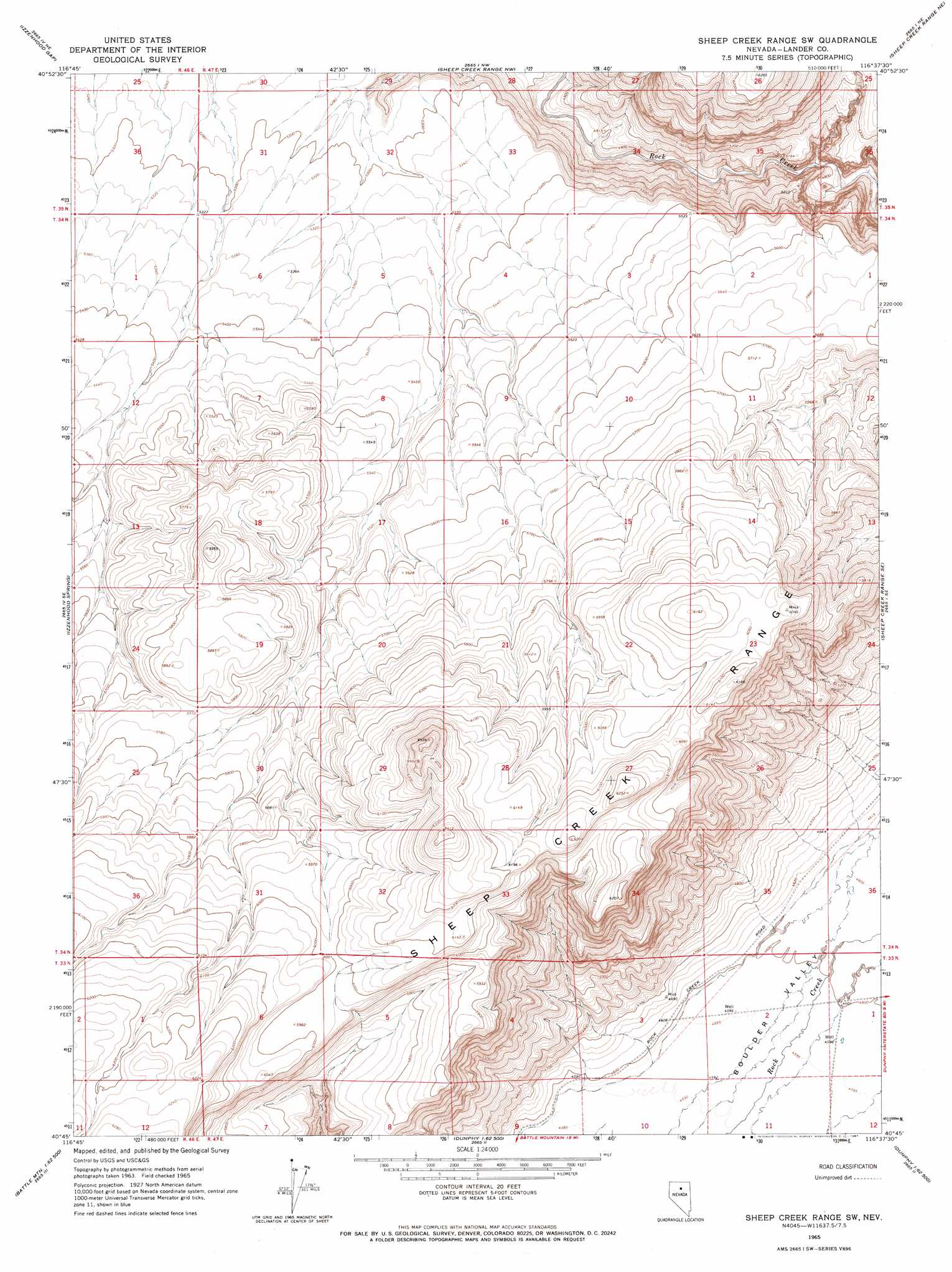
USGS Topo Quad 40116g6 - 1:24,000 scale
| Topo Map Name: | Sheep Creek Range Sw |
| USGS Topo Quad ID: | 40116g6 |
| Print Size: | ca. 21 1/4" wide x 27" high |
| Southeast Coordinates: | 40.75° N latitude / 116.625° W longitude |
| Map Center Coordinates: | 40.8125° N latitude / 116.6875° W longitude |
| U.S. State: | NV |
| Filename: | o40116g6.jpg |
| Download Map JPG Image: | Sheep Creek Range Sw topo map 1:24,000 scale |
| Map Type: | Topographic |
| Topo Series: | 7.5´ |
| Map Scale: | 1:24,000 |
| Source of Map Images: | United States Geological Survey (USGS) |
| Alternate Map Versions: |
Sheep Creek Range SW NV 1965, updated 1967 Download PDF Buy paper map Sheep Creek Range SW NV 2012 Download PDF Buy paper map Sheep Creek Range SW NV 2014 Download PDF Buy paper map |
1:24,000 Topo Quads surrounding Sheep Creek Range Sw
Midas Sw |
Sixmile Hill |
Rock Creek Ranch |
Willow Cr Reservoir Se |
Santa Renia Fields |
Izzenhood Ranch |
Izzenhood Gap |
Sheep Creek Range Nw |
Sheep Creek Range Ne |
Rodeo Creek Nw |
Russells |
Izzenhood Spring |
Sheep Creek Range Sw |
Sheep Creek Range Se |
Rodeo Creek Sw |
Battle Mountain |
Stony Point |
Argenta |
Dunphy |
Bobs Flat |
Blossom Spring |
Bateman Spring |
Mule Canyon |
The Geysers |
Beowawe |
> Back to 40116e1 at 1:100,000 scale
> Back to 40116a1 at 1:250,000 scale
> Back to U.S. Topo Maps home
Sheep Creek Range Sw topo map: Gazetteer
Sheep Creek Range Sw: Ranges
Sheep Creek Range elevation 1763m 5784′Sheep Creek Range Sw digital topo map on disk
Buy this Sheep Creek Range Sw topo map showing relief, roads, GPS coordinates and other geographical features, as a high-resolution digital map file on DVD: